With October, playoff baseball is in full swing and tonight Madison Bumgarner is scheduled to take the mound at home in AT&T Park in San Francisco, for the Giants’ first home playoff game of the year after three games on the road in New York and Chicago.
The unique ballparks in every city are part of baseball’s special charm. Each stadium’s distinctive dimensions, angles, and weather patterns play a role in the outcome of the game. For the San Francisco Giants, AT&T Park is a welcoming home, sheltered from the cold, swirling winds and fog for which Candlestick Park, located a few miles south, was notorious, and long fly balls that might have once died in the Candlestick winds now can fly over the high right field wall, out of the park, and splash into the San Francisco Bay. Such home runs, less common now than in the pumped days of the early 2000s, are one of the special treats at AT&T.
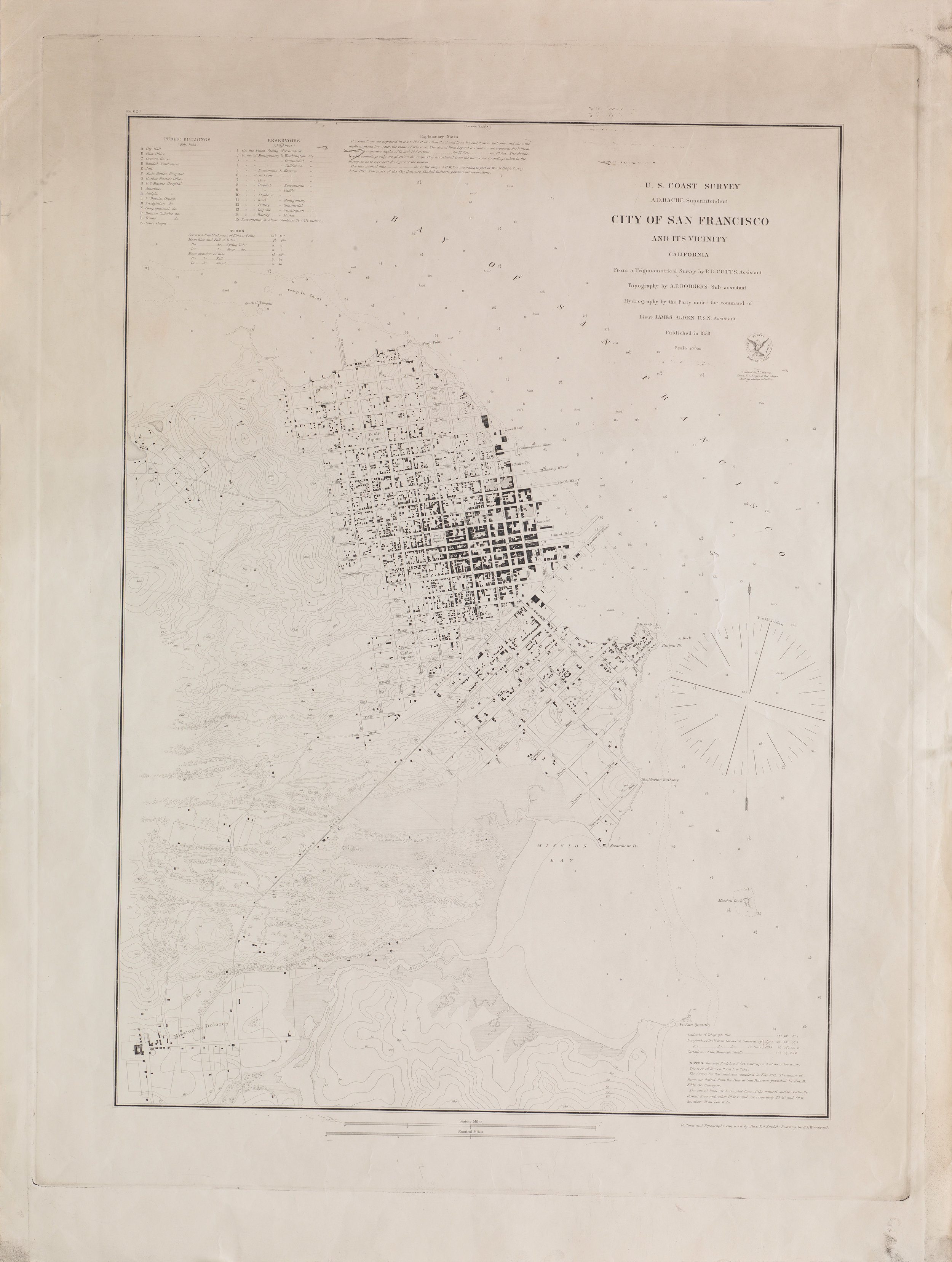
1853 United States Coast Survey – City of San Francisco and Its Vicinity [Master sheet!]
In the second half of the 19th century, as professional baseball matured and expanded in popularity, San Francisco was growing into the leading city of the West Coast. In the early years of the 20th century, the San Francisco Seals baseball team had a proud history, producing some of the game’s all-time greats, like Joe DiMaggio and his brothers, and Hall of Famer Earl Averill. In 1958, the Giants moved to San Francisco, making their home at Candlestick for four decades before moving to their current home in AT&T Park (then Pacific Bell Park) in the year 2000.
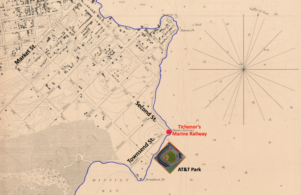
Of course, for a San Franciscan around the time of the Gold Rush, all hits at AT&T Park, even bunts, would have been splash hits because the stadium occupies a location that was once the deep waters off Steamboat Point, the northern corner of Mission Bay. The San Francisco shown in this intricate 1853 United States Coast Survey map still has the original shoreline, which ran along Townsend Street, where a 100’-high sand hill rose in the area of Townsend and Second Street. Superimposing an image of AT&T Park in its current location shows it deep in the bay.
The Gold Rush brought an influx of thousands of people from the East Coast and Europe via ship to San Francisco. “There were suddenly hundreds of vessels of all sizes and types operating in and out of San Francisco,” writes Nancy Olmsted in her study of the history of Mission Bay. But the port had a problem: “the city had no facility for hauling or dry-docking vessels for bottom-cleaning, caulking, coppering, or other repairs below the waterline” (1). To meet this need, the enterprising Henry B. Tichenor built a marine railway at the base of Second Street to convey ships up and out of the water, which can be seen on the 1853 map just above the overlay of AT&T Park.

1853 USCS map zoom with overlay of AT&T Park and original shoreline in blue.
Other boatyards followed, and Steamboat Point became an increasingly important site of the city’s infrastructure for maritime commerce. Photographs of the area in the archives of the California Historical Society show that already by the early 1870s, the shoreline was markedly filled-in and new wharves reached out into the bay (2).
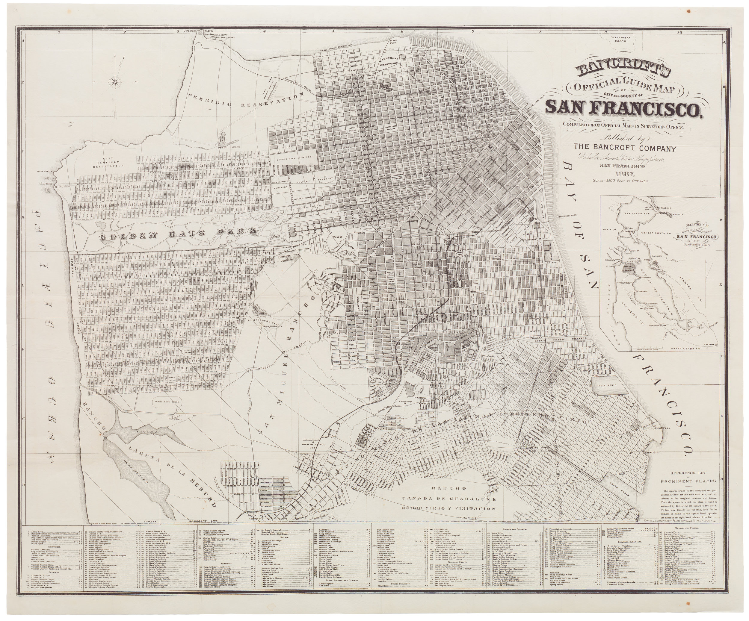
In this elegant 1887 map of San Francisco published by the Bancroft Company, which produced some of the finest maps of the time, we see a shorefront resembling the embarcadero today.
So, next time a Giants’ home run splashes into the Bay, celebrated with a sounding fog horn and mist sprayed into the air, think of Steamboat Point and how the Bay gave a part of herself for the home team.
——————————————————————————————————————————————————————————————-
(1) Olmsted, Nancy. Vanished Waters: A History of San Francisco’s Mission Bay. San Francisco, CA: Mission Creek Conservancy, 1986, p. 38.
(2) Olmsted, p. 42.