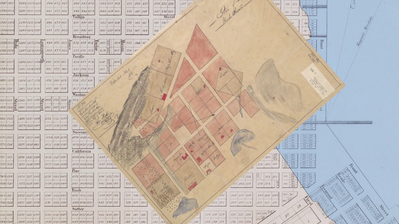
1840 Brue map of Mexico and Texas

An examination of a French map of Mexico and Texas from the year 1840. Topics include the 1819 Adams-Onis Treaty, the Republic of Texas, and Franco-Mexican relations, including the Pastry War. Featured map: SOLD: 1840 Brué – Carte Nouvelle du Mexique du Texas et d’une Partie des Etats Limitrophes

1541 world map by L. Fries

Topics include: the Mountains of the Moon, Greenland as a peninsula, and the ‘Dragon Tail’ model of the Malay Peninsula. Featured map: SOLD: 1541 Fries – Diefert Situs Orbis Hydrographorum Ab Eo Quem Ptolomeus Posuit…

Faden/Roberts

The “Legendary lost chart of Captain Cook.” Featured map: 1784 Roberts/Faden – Chart of the N. W. Coast of America and the N. E. Coast of Asia, Explored in the Years 1778 and 1779

Wackenreuder

A quick look at an 1861 first-edition of Wackenreuder’s seminal map of San Francisco. Featured map: SOLD: 1861 Wackenreuder – City and County of San Francisco…[rare first edition!]

Ortelius Japan

A quick look at Ortelius’s map of Japan and the myth of Korea as an Island. Featured maps: SOLD: 1630 Mercator & Cloppenburgh – Iaponia [Korea as island] 1631 H. Hondius – Asia recens summa cura delineata [misshapen Korea]