A particularly conspicuous feature of the cultural landscape of the first and second century CE Mediterranean was a network of roads connecting Rome and its provinces. The Romans invested great energy and resources in the planning of road systems. They cleared and leveled rocky terrain, constructed embankments, retaining walls, and bridges where necessary, and placed milestones at intervals of one Roman mile, approximately 1.5 kilometers.
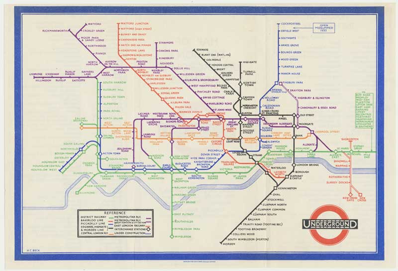
The most famous graphic representation of a transportation system is surely Henry C. Beck’s ‘electrical circuit’ map of the London Underground, which dispensed with scale, left only the Thames as a surface feature, plotted equidistant stations, and set angles at either 45 or 90 degrees.

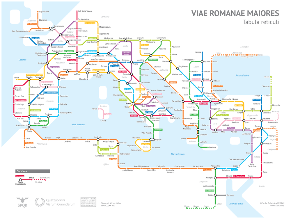
Fortunately for us, Sasha Trubetskoy, an undergraduate economics student at the University of Chicago, had the brilliant idea of visualizing the ancient Roman road network on Beck’s model:
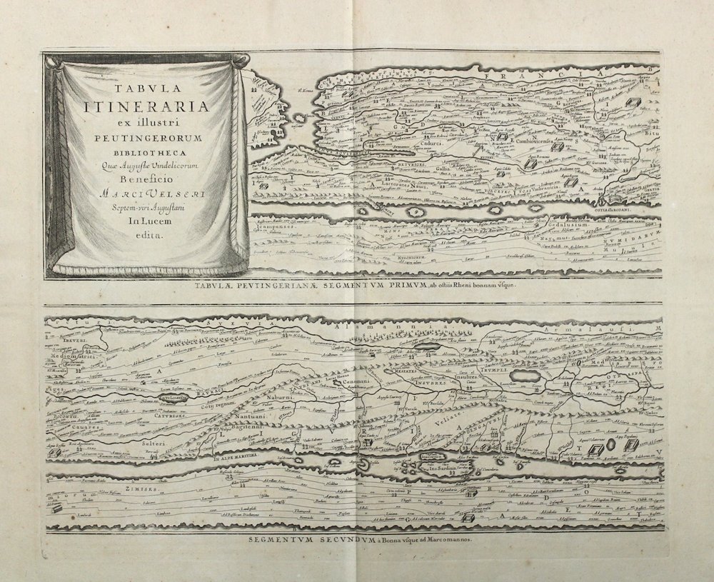
As for contemporary ancient Roman maps, the only map of Roman roads that has survived from Antiquity is the Tabula Peutingeriana, the surviving copy of which actually dates from the 12th or 13th century, and takes its name from Konrad Peutinger, a collector of antiquities who was willed the map in the early 16th century.
During the Renaissance, there was widespread public interest in ancient Greece and Rome. In this interest Abraham Ortelius saw an opportunity and in 1598 published the Parergon, considered the first historical atlas. The Parergon consisted of 38 maps and views of the classical world, including a 4-sheet map of the Peutinger Table.
Other cartographers published versions of the Peutinger Table as well, including Johannes Janssonius, who prepared a new plate and inserted it into the ancient world volume (VI) of his Atlas Maior and then into Accuratissimia Orbis Antiqui Delineatio, with G. Hornius’s text printed as a single volume.