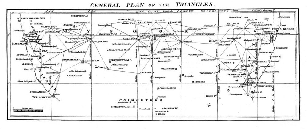
Before orbital satellites, mapping large areas was a difficult task. At sea, after the problem of calculating longitude had been solved in the 18th century, it was possible to accurately map positions. On land, where the horizon is uneven, astronomical observations are more difficult, but territories can be accurately measured using trigonometry and other mathematics in combination with a carefully measured baseline and a combination of observations of distant land marks to define a triangle of known size. This method was the fundamental method used by The Great Trigonometrical Survey, which was the official name of a project initiated in 1802 by the British East India Company to map and measure their domains in India.
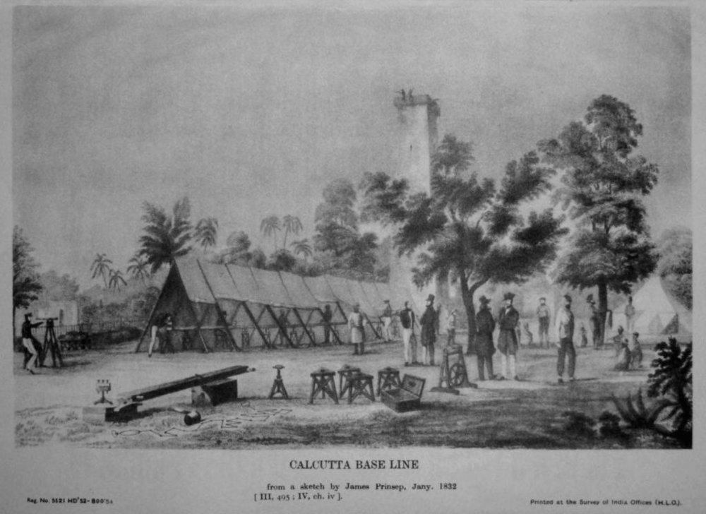
It was a massive undertaking. Its first leader, William Lambton, had, among the instruments, a 100-foot chain to measure baselines, and supporting gear to ensure that it was kept horizontal, at the proper tension, and, as much as possible out of the sun to avoid changes in the length of the metal due to temperature changes; a “zenith sector,” which was a tool for astronomical observations so large it required over a dozen men to carry it; and “The Great Theodolite,” a thousand-pound tool to measure horizontal and vertical angles.

They started on the west coast, measuring two baselines at Bangalore (Bengaluru) and Madras (Chennai), and headed east. It was a long, slow process, and when Lambton died in 1823, the project was taken over by George Everest (of Mt. Everest fame in the English-speaking world). Everest, too, died before the project was brought to an end in 1875, when the survey was integrated into the British topographical and revenue surveys.