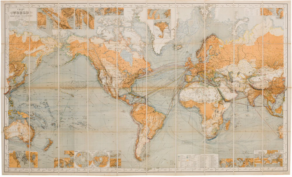
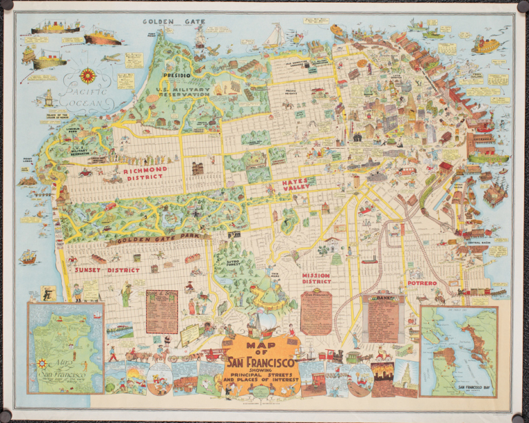
World maps display the surface of a sphere on a flat surface, necessarily introducing distortion. In the Mercator projection, named for 16th century Flemish cartographer Gerardus Mercator, the lines of longitude are represented as parallel vertical lines, even though on the surface of the earth, the lines of longitude approach each other, until they meet at the poles. Objects near the poles are expanded relative to objects near the equator. Greenland appears as large as, or larger than, Africa; Africa, which straddles the equator, appears deceptively small.

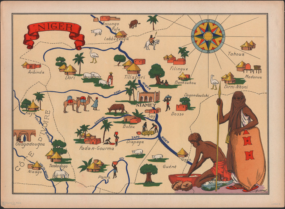
The Niger River, with a drainage basin about two-thirds that of the Mississippi, is tucked into the bulge of Africa, arising in the Guinea Highlands, only about 150 miles (240 km) from the Atlantic— quite close to an ocean for a river that is over 2,500 miles (about 4,000km) long. From its source, the Niger flows east-northeast, away from the ocean, towards the Sahara, before turning southeast and then south, to flow into the Gulf of Benin.
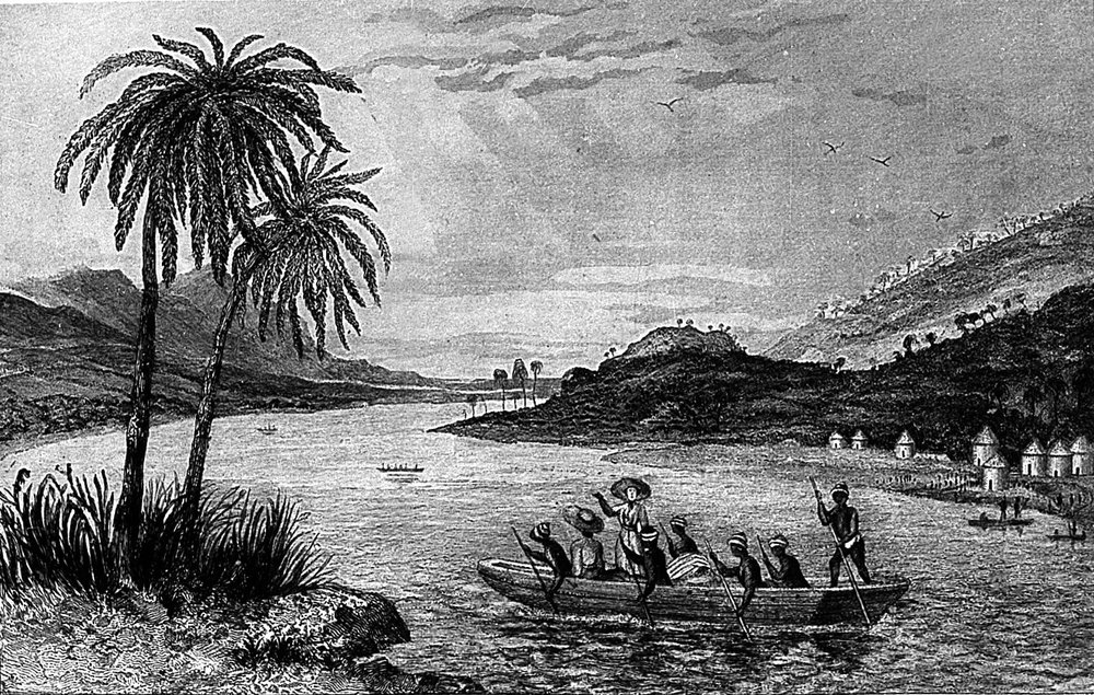
As the 19th century dawned, even though European ships had been sailing down the west coast of Africa for centuries, the Niger’s actual course was unknown to Europeans. Europeans had knowledge of the river from ancient times — its existence had been reported by the Greeks, Phoenicians, and others — but its route was a mystery. Some Europeans speculated that it was linked to the Nile, others to the Congo, and others offered other alternatives.
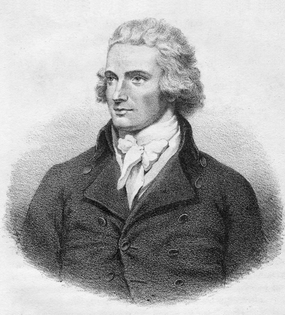
This lack of European knowledge was at least partly due to the many who did know the Niger: it passed through lands populated by a variety of peoples, many of whom were hostile to outsiders. In 1795, the explorer Mungo Park found the Niger, but did not follow it. He returned in 1805, leading an expedition that included a troop of 44 redcoats. They never returned, reportedly killed by locals. Disease, too, preyed upon explorers.
In the early decades of the 19th century, the British Lords of the Admiralty sent several expeditions to map the Niger. Most failed, with many casualties, but by 1831, the last portions of the river were mapped by an Englishman named Richard Lander, setting the stage for the expansion of European imperial control in the 1870s and 1880s.