On November 1, 1520, All-Saints’ Day — in the South American spring — Ferdinand Magellan entered the strait that he named for the day: Estrecho de Todos los Santos (Strait of All Saints), but which now bears his name. The channel was relatively narrow and currents and wind were strong and treacherous, but Magellan and most of his fleet were able to navigate it successfully, on their way to circumnavigating the earth.
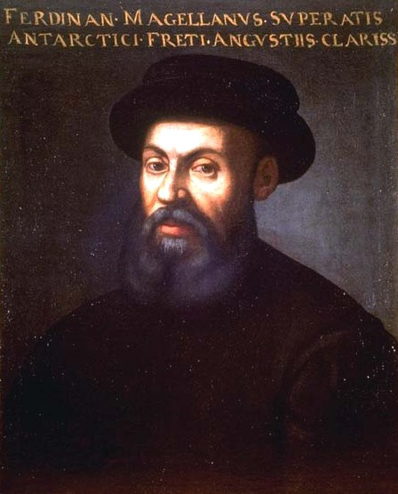
One of Magellan’s captains, Estêvão Gomes, mutinied in the straits, and turned his ship, the San Antonio, back, returning to Spain across the Atlantic. Magellan had already faced and suppressed a previous attempt at mutiny, and if the strait had not reached the Pacific Ocean, Magellan’s expedition might never have completed its circumnavigation.
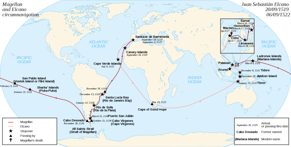
On maps of South America, the Strait of Magellan is hardly visible because it is so narrow. The sweep of the South American continent appears unbroken down to the tip of the island of Tierra del Fuego. The east coast of Tierra del Fuego runs southeast and then east in a curve over 150 miles in length—a great barrier to the small sailing ships of Magellan’s fleet. South of Tierra del Fuego are the narrow Beagle Passage and the perilous Drake’s Passage. The clipper ships of the 19th century would choose the wide and stormy Drake’s Passage, but for a long time, the Strait of Magellan was the best passage from the Atlantic to the Pacific.
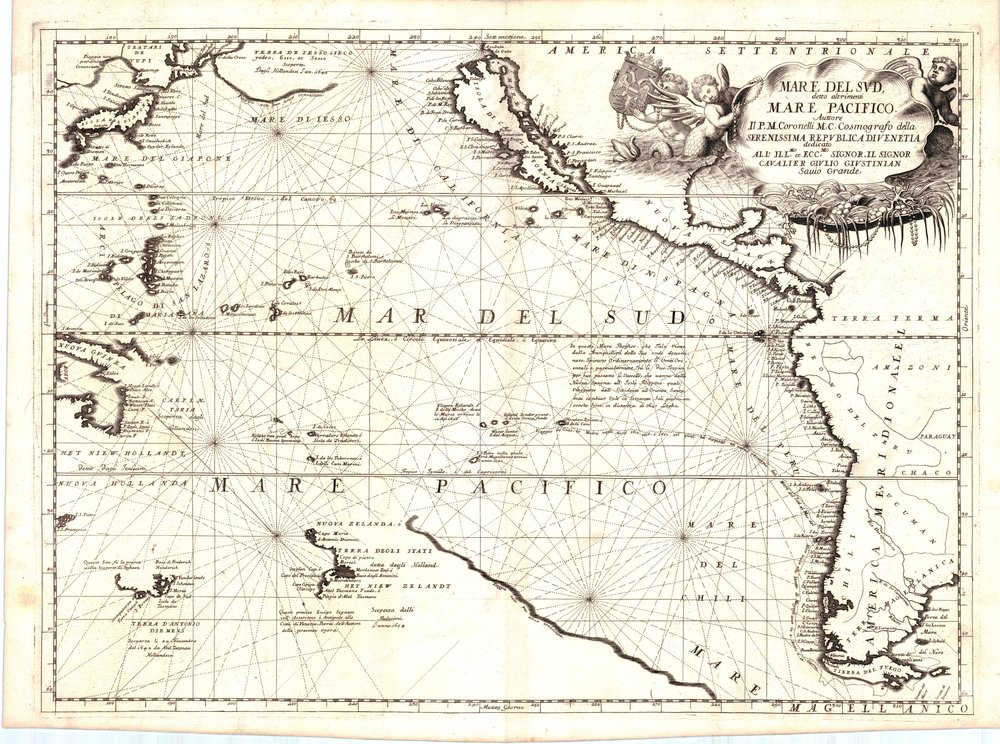
“Pacific,” incidentally, was the name that Magellan gave the ocean for the calm waters into which the ships sailed after passing through the Strait. The first European to sight the Pacific was Vasco Núñez de Balboa, who on crossing the Isthmus of Panama, saw the ocean to the south and named it “Mar del Sur” or South Sea.
On antique maps, the two names are used interchangeably, or together, well into the 18th century; a classic example being this 1691 map by Vincenzo Coronelli, Mare Del Sud detto altrimenti Mare Pacifico (“South Sea also called the Pacific Sea”):
