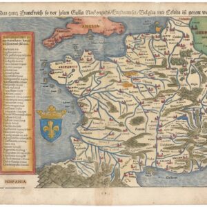
The famous Ortelius/Vrients map of Greater France.
Gallia Geographica Galliae descriptio, de integro plurimis in locis emendata ac Regionum limitibus distincta; auctore Petro Plancio…
Out of stock
Description
This gorgeous map of greater France is one of the most decorative charts of the country produced in the early 17th century. It was published as part of Abraham Ortelius’ famous atlas, the Theatrum Orbis Terrarum, to which it was added after Ortelius’ death in 1598. It has become known as one of the ‘Vrients maps’, which were was compiled and added posthumously to the Theatrum by Ortelius’ collaborator, Johannes Baptiste Vrients.
As the Latin title of the map informs us, this is essentially an up-to-date geographical depiction of France as defined both by its recognized borders and by natural or topographical boundaries, such as the Alps, the Pyrenees, and the Rhine. The map also depicts the many regions falling under the French Crown, including Burgundy, Helvetia (Switzerland), Alsatia, Lotharingia, Lower Germany, as well as other more distant areas like Italia Gallica and Gallicia Alpinis.
The current chart of France appeared in two posthumous editions of the Theatrum: the first appeared in 1606, followed by a second edition in 1609. Neatline’s gorgeous example comes from the 1609 edition, which Vrients published only three years before his death. Dr. Marcel van den Broecke, a specialist in the maps and atlases of Abraham Ortelius, has built a comprehensive website for identifying the exact editions and states of all Ortelius maps (https://orteliusmaps.com/index.html). From this, we can ascertain that the Gallia map occurred in four versions of the Theatrum published by Vrients. The original 1606 edition was printed in 300 copies, and an Italian translation soon followed this in 1608, also in 300 copies. The second edition of the Vrients Theatrum was formally published in 1609, being issued in both a Spanish version (325 copies) and in a Latin version (300 copies). Following these editions, the Gallia map was no longer included, bringing the total number of copies of this map to about 1225.
Among the many innovations that Ortelius introduced in the Theatrum was the Catalogus Auctorum; a comprehensive bibliography of the sources Ortelius used for compiling his atlas. Ortelius’ practice of referencing ensured that later editors and publishers had to commit to a similar naming of sources. This particular map is recognized – both in the title and from the catalogus auctorum – as having been based on a separately compiled map by Peter Plancius (1552-1622), one of the greatest mapmakers in the Golden Age of Dutch cartography. It was printed by the Dutch master engraver, Joannes van Deutecum (who, among others, worked for Breughel the Elder) and was first published by Vrients in 1592, elucidating how, and how effortlessly, the knowledge of one mapmaker could be transferred to another.
Cartographer(s):
Abraham Ortelius (1527-1598) was born in Antwerp to Flemish parents in 1527. After studying Greek, Latin, and mathematics, he and his sister set up shop as book dealers and a ‘painter of maps.’ In his heart, Ortelius was, nevertheless, first and foremost a historian. He believed geography was the ‘eye of history,’ which explains why he collected maps and historical documents with such passion. Ortelius traveled widely in pursuit of his interests, building contacts with mapmakers and literati all over the European continent.
Ortelius reached a turning point in his career in 1564 with the publication of a World Map in eight sheets, of which only a single copy survives. In 1570, he published a comprehensive collection of maps titled Theatrum orbis terrarum (Theatre of the World). The Theatrum is conventionally considered the first modern-style atlas. It was compiled by collecting maps and charts from colleagues across the continent, which Ortelius then had engraved in a uniform size and style. The engraver for most of the maps in Theatrum was none other than the famous Frans Hogenberg, who also served as the main engraver for the 16th-century urban atlas Civitates Orbis Terrarum, published with Georg Braun in 1572.
Hogenberg’s re-drawn and standardized maps formed the basis of the first atlas in history (even though it was Mercator who was the first to use the term a few decades later). Unlike many of his contemporaries, Ortelius noted his sources openly and in the first edition, acknowledged no less than eighty-seven different European cartographers. This ‘catalogus auctorum tabularum geographicum‘ is one of the major innovations of his atlas. The list of contributing mapmakers was kept up-to-date for decades after Ortelius’ death. In the first edition of 1570, this list included 87 names, whereas the posthumous edition of 1603 contained no less than 183 names.
While compiled by Abraham Ortelius in the manner described above, the Theatrum was first printed by Gielis Coppens van Diest, an Antwerp printer experienced with cosmographical books. Van Diest was succeeded by his son Anthonis in 1573, who in turn was followed by Gillis van den Rade, who printed the 1575 edition of Ortelius’ atlas. From 1579, Christoffel Plantin took over, and his successors continued to print Theatrum until Ortelius’ heirs sold the copperplates and the publication rights to Jan Baptist Vrients in 1601. In 1612, shortly after Vrients’s death, the copperplates passed to the Moretus brothers.
Johannes Baptiste VrientsJohannes Baptiste Vrients (1552-1612) worked with Abraham Ortelius and purchased a manuscript translation of Oretlius’ landmark atlas Theatrum Orbis Terrarum in Italian from Ortelius’ estate after his death. He made the acquisition intending to publish an Italian version of the atlas in his own name. Between Ortelius’ death in 1598 and Vrients’ death in 1612, he published several new and updated editions of Ortelius.
Among the additions introduced by Vrients were eight new maps for the Theatrum, bringing the total number of maps in his posthumous editions of the atlas to 128. Moreover, Vrients expanded the scope of the atlas by adding an Introduction to Cosmography written by Michel Coignet.
Condition Description
Scattered foxing throughout. Two minor repairs in the margins. Image quality is superb.
References
Van der Krogt 3, 4000: 31C; Van den Broecke, 36.
