-
-
Add to cart
 Quick View
 - Europe, Iceland & Scandinavia
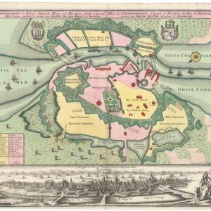
Coppenhagen die Königl. Dänische Haupt und Residentz Stadt in Grund Riss.
- $1,600
- 1740 Seutter Ground Plan of Copenhagen with Panoramic View.
-
-
-
-
Add to cart
 Quick View
 - Curiosities - Miscellanea, World
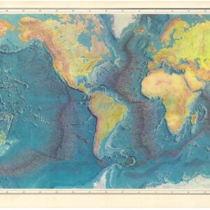
World Ocean Floor.
- $1,800
- 1977 Heezen & Tharp World Ocean Floor Map.
-
-
-
-
Add to cart
 Quick View
 - Asia, Southeast Asia & Australia
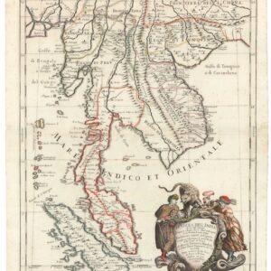
Penisola Dell India di la dal Gange Diusa ne i Regni…
- $2,200
- Stunning 1683 Cantelli-Rossi Map of Southeast Asia.
-
-
-
-
Add to cart
 Quick View
 - Asia, India
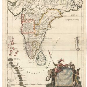
Penisola dell’India di qua dal Gange et Isole intorno ad essa adiacenti.
- $1,600
- Gorgeous 1683 Cantelli-Rossi Map of India, Ceylon, and the Maldive Islands.
-
-
-
-
Add to cart
 Quick View
 - Bay Area & Silicon Valley, California
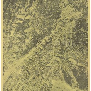
Beautiful Mill Valley “My Home Town”.
- $375
- 1962 circa Aerial Photograph of Mill Valley, Marin County, California.
-
-
-
-
Add to cart
 Quick View
 - San Francisco
U.S. Coast Survey A.D. Bache, Superintendent, City Of San Francisco And Its Vicinity California. From a Trigonometrical Survey by R.D. Cutts, Assistant…
- $1,900
- Hand-colored 1853 United States Coast Survey master sheet map of the San Francisco Peninsula.
-
-
-
-
Add to cart
 Quick View
 - Asia, Southeast Asia & Australia
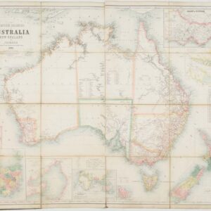
The British Colonies of Australia, New Zealand and Tasmania Shewing the Latest Discoveries and Travellers Routes.
- $2,200
- Large 1861 Case Map of Australia, New Zealand, and Tasmania Showing Early Exploration Routes.
-
-
-
-
Add to cart
 Quick View
 - East & Midwest United States, United States
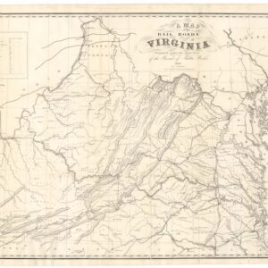
A Map of the Rail Roads of Virginia Prepared Under the Direction of the Board of Public Works.
- $4,800
- Rare Pre-Civil War Virginia Railroad Map Printed in Richmond, 1858.
-
-
-
-
Add to cart

 Quick View
 - Asia, Featured Maps & Views, Southeast Asia & Australia
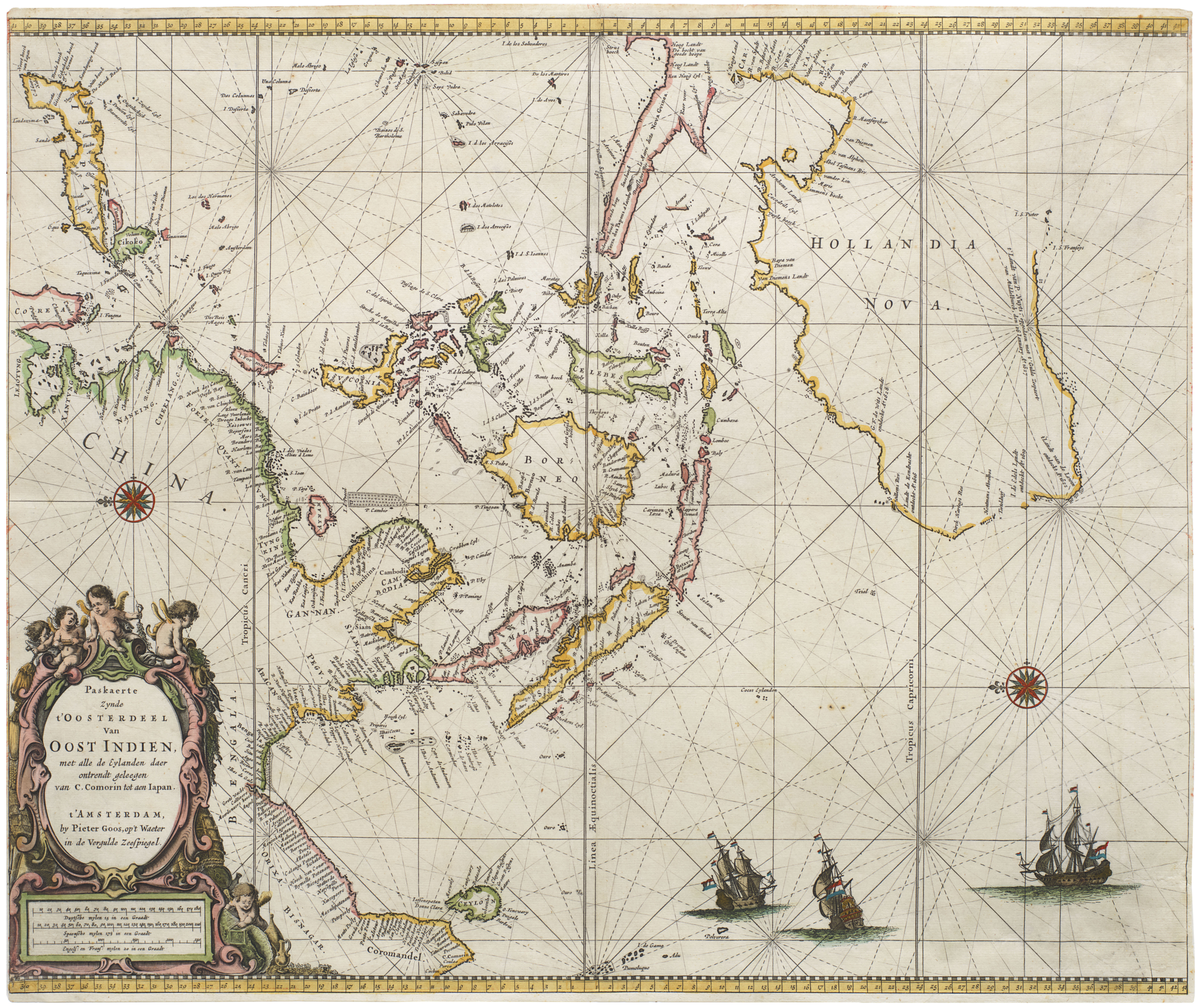
Paskaerte Zynde t’Oosterdeel van Oost Indien, met Alle de Eylanden daer Ontrendt Geleegen van C. Comorin tot aen Japan
- $6,500
- [Early color] Pieter Goos’ Striking Sea Chart of Southeast Asia, Australia, and the Indian Ocean.
-
-

-
-
-
Add to cart

 Quick View
 - California
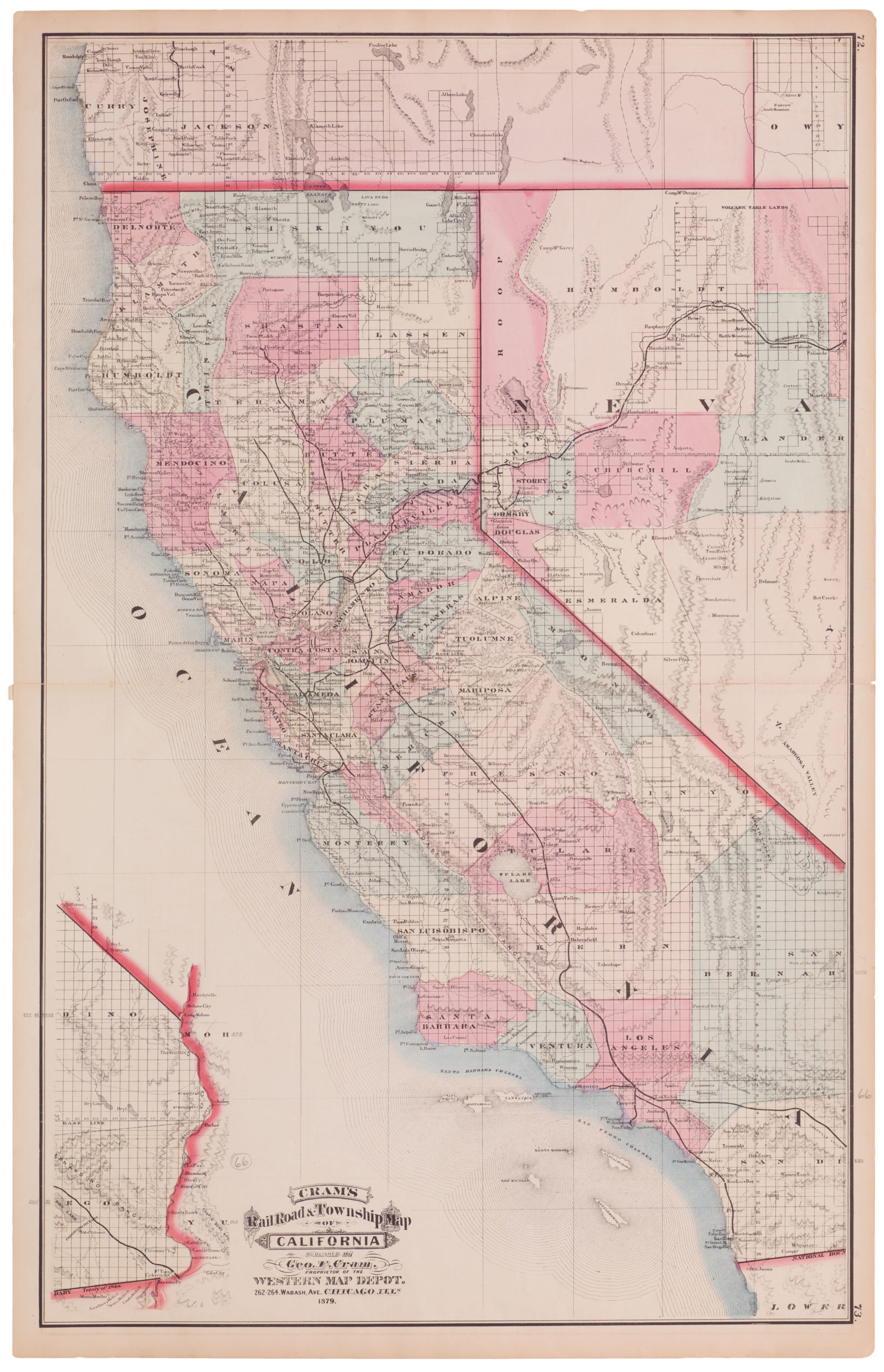
Cram’s Railroad & Township Map of California
- $575
- Excellent 1879 large-format edition railroad map of California.
-
-

-
-
-
Add to cart

 Quick View
 - Southeast Asia & Australia, Asia
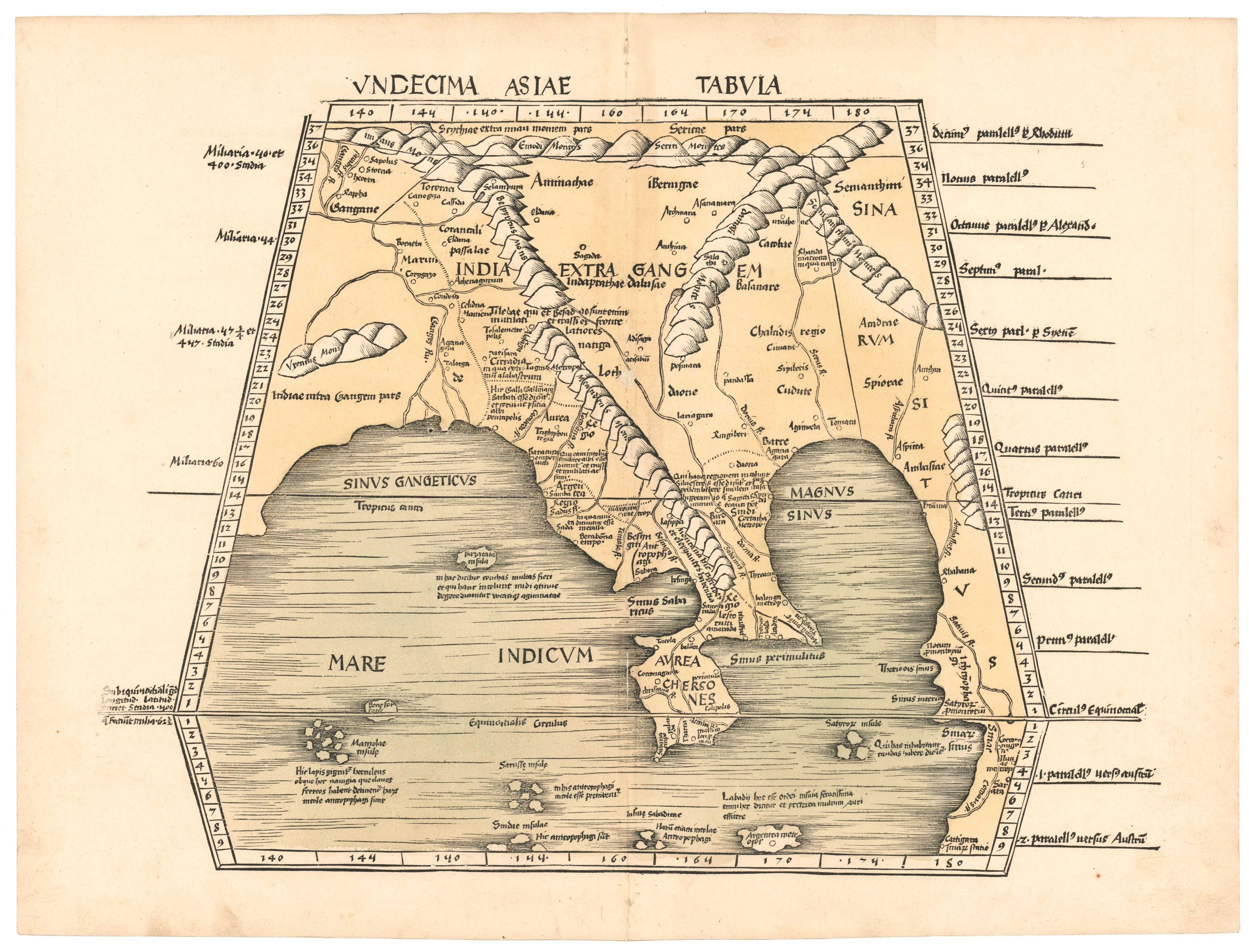
Undecima Asiae Tabula.
- $4,800
- An early printed map of Southeast Asia from the first modern atlas.
-
-

-
-
-
Add to cart
 Quick View
 - Bay Area & Silicon Valley
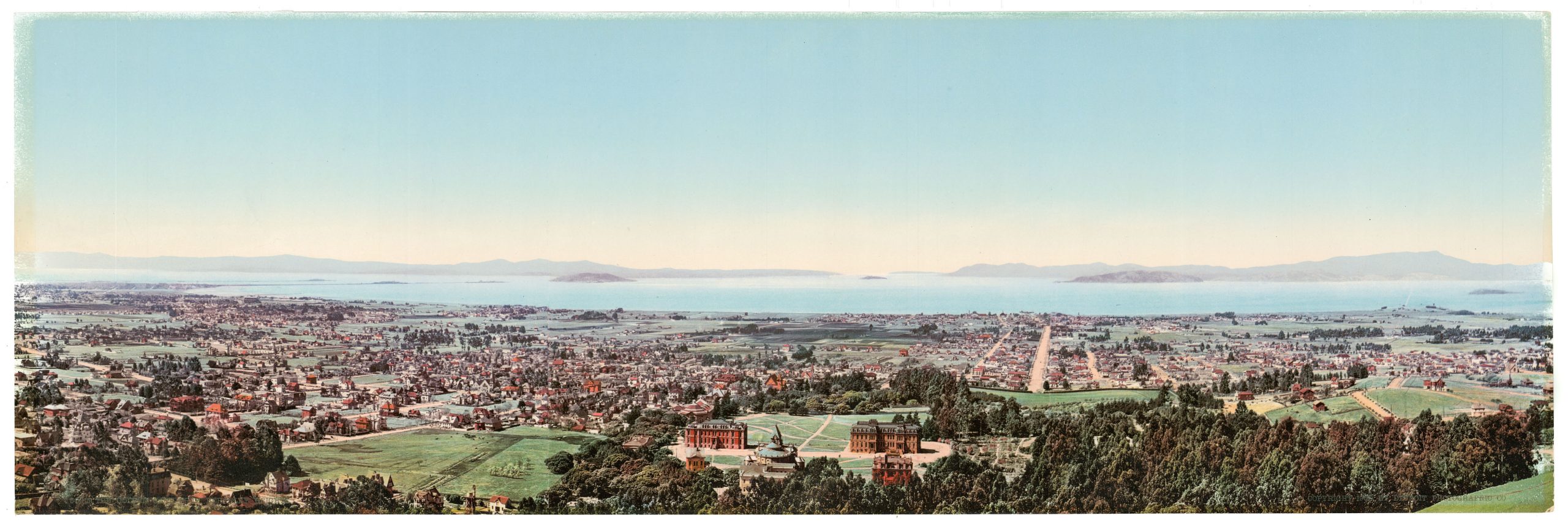
The Golden Gate from Berkeley Heights.
- $975
- William Henry Jackson’s panoramic photochrom of Berkeley and the Bay Area at the dawn of the 20th century.
-
-
-