-
-
Add to cart
 Quick View
 - Curiosities - Miscellanea, Pictorial maps, World
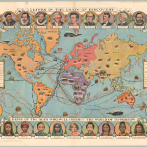
Cassell’s Children’s Book of Knowledge Wonder Map of the World.
- $450
- Thematic mapping for children: a fabulous circa 1930 world map depicting the history of exploration.
-
-
-
-
-
Add to cart
 Quick View
 - Curiosities - Miscellanea, World
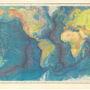
World Ocean Floor.
- $1,800
- 1977 Heezen & Tharp World Ocean Floor Map.
-
-
-
-
Add to cart
 Quick View
 - Curiosities - Miscellanea, World
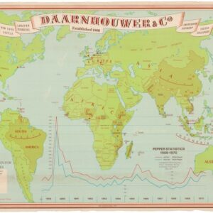
Daarnhouwer & Co — Established 1908 — Countries of Origin for the Major Spices.
- $375
- 1971 Thematic World Map of the Global Spice Trade.
-
-
-
-
Add to cart
![[Propaganda map] Deutsches Volkstum in aller Welt. Bearbeitet von Dr. Friedrich Lange.](https://neatlinemaps.com/wp-content/uploads/2026/03/NL-02488_thumbnail-300x300.jpg) Quick View
Quick View - World, World War I and World War II
[Propaganda map] Deutsches Volkstum in aller Welt. Bearbeitet von Dr. Friedrich Lange.
- $1,400
- Propaganda cartography from Europe’s darkest hour.
-
-
-
-
Add to cart
 Quick View
 - Curiosities - Miscellanea, World
Le Microscope moderne.
- $4,000
- Anticipating Flat-Earth Thought.
-
-
-
-
Add to cart
![[Large French Manuscript World Map].](https://neatlinemaps.com/wp-content/uploads/2025/12/NL-02491_thumbnail-300x300.jpg) Quick View
Quick View - World, Curiosities - Miscellanea
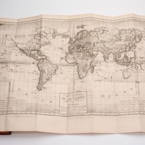
[Large French Manuscript World Map].
- $1,200
- Elegant Hand-Drawn French Map of the World.
-
-
-
-
Add to cart
 Quick View
 - Curiosities - Miscellanea, World
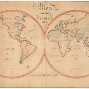
Map of the World. 1812.
- $1,800
- Drawing the world in 1812: a Quaker manuscript map blending myth and geography.
-
-
-
-
Add to cart
 Quick View
 - World
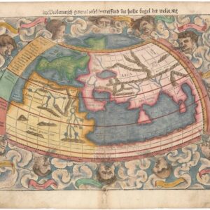
Ptolemaisch general Tafel begreifend die halbe kugel der Weldt.
- $1,200
- Sebastian Münster’s World Map According to Ptolemy.
-
-
-
-
Add to cart
 Quick View
 - Featured Maps & Views, Polar - Arctic, World
Hemispheriu Ab Aequinoctli Linea, Ad Circulu Poli Arctici/ Hemispheriu Ad Circulu Poli Atarctici.
- $57,500
- A superb example of De Jode’s seminal polar projection of the world.
-
-
-
-
Add to cart
 Quick View
 - World
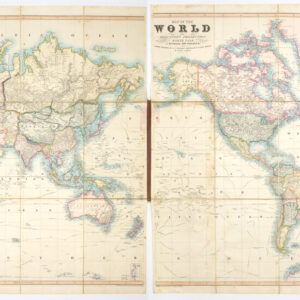
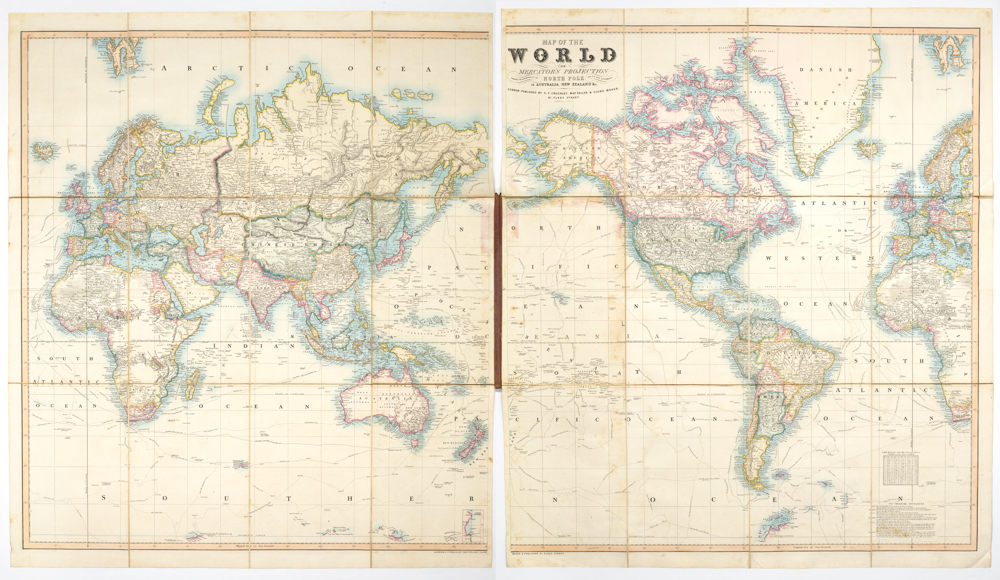
Map of the World on Mercator’s Projection showing the Discoveries at the North Pole and the New Settlements in Australia and New Zealand &c. additions to 1855
- $3,800
- Cruchley's 1855 map of the world in original boards and marbled backing -- a distinctive addition to any world map collection.
-
-
-
-
-
Add to cart
 Quick View
 - World
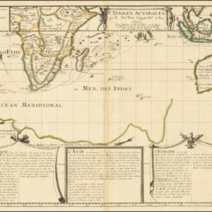
Terres Australes par P. Du Val.
- $4,800
- Gonneville Land and Terre de Perroquets: Du Val’s early map of Australia and the southern Indian Ocean.
-
-
-
-
Add to cart
 Quick View
 - World
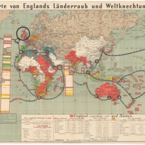
Karte von Englands Länderraub und Weltknechtung.
- $2,400
- [Persuasive Cartography] German WWI propaganda map showing ‘England’s subjugation of the world.’
-
-