-
-
Add to cart
 Quick View
 - Americas, Mexico - Central & South America
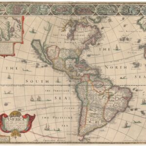
Brasilia et Peruvia.
- $10,500
- De Jode's 1593 South America in Exceptional Original Color.
-
-
-
-
Add to cart
 Quick View
 - Americas, Cuba, West Indies, Caribbean
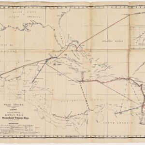
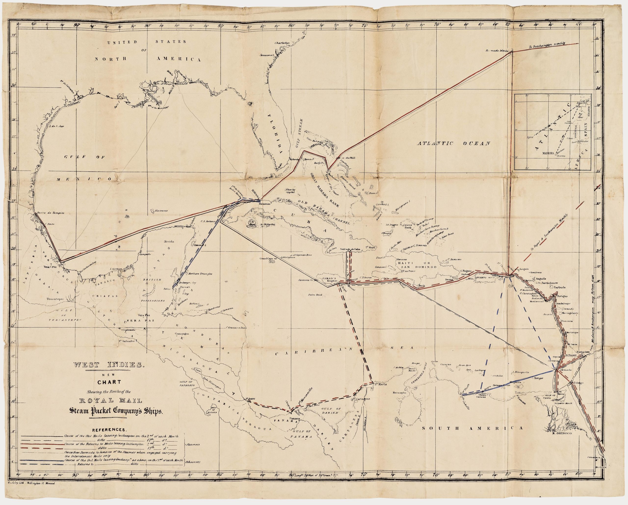
West Indies. New Chart shewing the Routes of the Royal Mail Steam Packet Company’s Ships.
- $2,400
- The communications lifeline of the British Caribbean: an unrecorded map of the Royal Mail Steam Packet Company’s Ships to the West Indies.
-
-
-
-
-
Add to cart
 Quick View
 - Americas, Mexico - Central & South America
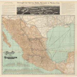
Mexico — Map of the Mexican Central Railway and Connections.
- $475
- 1908 Mexican Central Railway Map of Mexico.
-
-
-
-
Add to cart
 Quick View
 - Americas, North America
America with those known parts in that unknowne worlde both people and manner of buildings described and inlarged by I.S. Ano 1626.
- $4,000
- Speed’s cartes-à-figures map of the Americas: a milestone in English cartography.
-
-
-
-
Add to cart
 Quick View
 - Americas, Mexico - Central & South America
Panama – Canal.
- $975
- Early 20th-century bird's-eye teaching chart of the Panama Canal.
-
-
-
-
Add to cart
![[Persuasive Cartography] La Cuestión Chilena.](https://neatlinemaps.com/wp-content/uploads/2025/10/NL-02415_thumbnail-300x300.jpg) Quick View
Quick View - Americas, Mexico - Central & South America
[Persuasive Cartography] La Cuestión Chilena.
- $975
- Argentinian propaganda map of Chile’s advance into Patagonia.
-
-
-
-
Add to cart
 Quick View
 - Americas, North America, United States
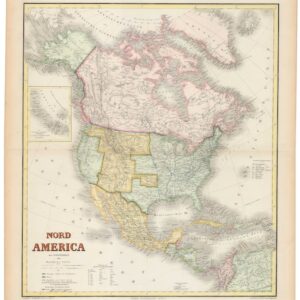
Nord America mit Westindien.
- $975
- Hand-colored ca. 1867 Kiepert map of North America, capturing the post-Civil War U.S., shifting Canadian and Mexican frontiers, and colonial Caribbean.
-
-
-
-
Add to cart
 Quick View
 - Americas, Featured Maps & Views, North America
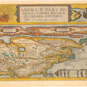
Americae Pars Borealis, Florida, Baccalaos, Canada, Corterealis. A Cornelio de Iudaeis in luce edita.
- $34,000
- The first printed folio map of North America and the most iconic American chart of the 16th century.
-
-
-
-
Add to cart
 Quick View
 - Americas, Cuba, West Indies, Caribbean
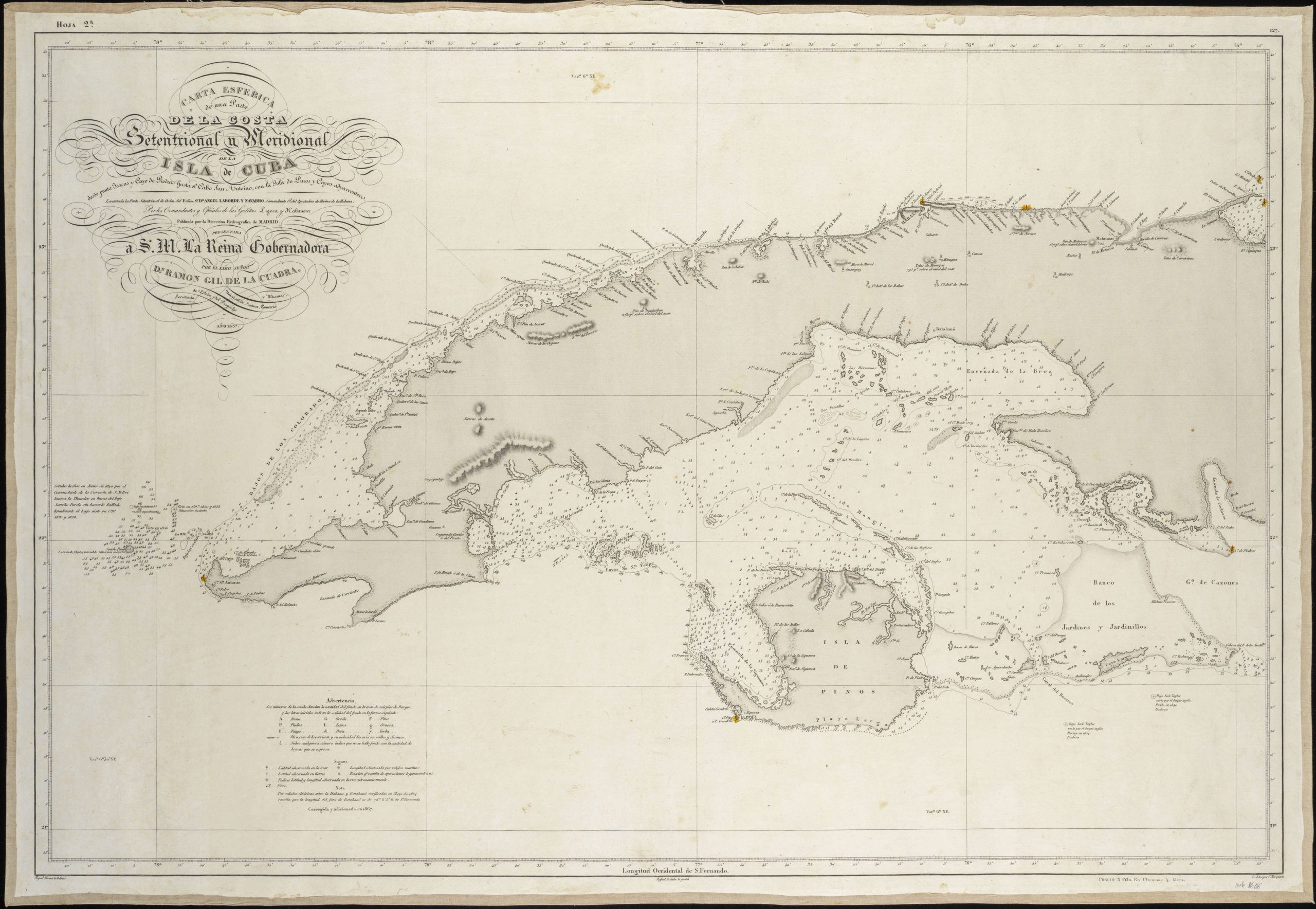
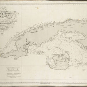
Carta Esferica De Una Parte de la Costa Setentrional y Meridional de la Isla de Cuba…
- $450
- Excellent Spanish sea chart of Western Cuba.
-
-
-
-
-
Add to cart
 Quick View
 - Americas, North America
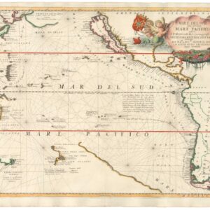
Mare Del Sud detto altrimenti Mare Pacifico.
- $2,500
- An excellent example of Coronelli's Pacific Ocean with California as an Island.
-
-
-
-
Add to cart
 Quick View
 - North America, California, Americas
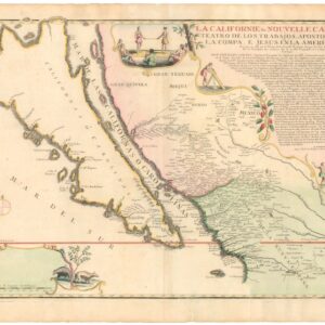
La Californie ou Nouvelle Caroline, Teatro De Los Trabajos Apostolicos De La Compa. E. Jesus En La America Septe…
- $7,500
- [Old Color] The largest cartographic depiction of the island of California ever made.
-
-
-
-
Add to cart
 Quick View
 - Americas, Cuba, West Indies, Caribbean, East & Midwest United States, North America
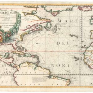
Mare del Nord.
- $2,200
- A gorgeous full-color example of Coronelli's chart of the Eastern Seaboard and North Atlantic.
-
-
