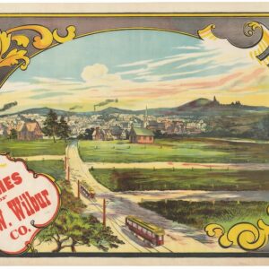
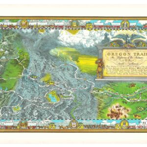
At the dawn of the highway system: a 1925 map showing the main connections bridging Canada and the United States.
Sketch map indicating main automobile roads between Canada and United States.
Out of stock
Description
This 1925 map showcases the main automobile roads connecting Canada and the United States, indicative of the era’s burgeoning car culture and the development of international road infrastructure. The map features a network of lines representing the major routes used by motorists, with thicker lines indicating primary roads and thinner lines secondary routes.
The map extends across the breadth of both countries, displaying roads that traverse diverse landscapes—from the populated corridors along the coasts to the less dense interior regions. Cities and towns along these routes are marked, providing motorists with essential waypoints during their travels.
Given its time, the map captures a moment just before the widespread construction of the U.S. interstate highway system, which would begin a few decades later. The map serves an important role in promoting automobile travel and tourism between the two nations, encouraging cross-border exploration and cultural exchange.
Cartographer(s):
Condition Description
Folds into original covers. Wear along folds and some discoloration in certain panels.
References
![[AMERICAN REVOLUTION] Boston, George Washington, Franklin, Philadelphia, Washington, D.C.](https://neatlinemaps.com/wp-content/uploads/2024/05/NL-02090a_thumbnail-300x300.jpg)