-
-
Add to cartQuick View
- Atlases & Books, Canada and The Great Lakes, North America, United States
Reports upon the Survey of the Boundary between the Territory of the United States and the Possessions of Great Britain. Washington: Government Printing Office, 1878.
- $500
- 1878 U.S. report on the survey that fixed the U.S.–Canadian border along the 49th parallel.
-
Add to cart
-
-
Add to cartQuick View
- Atlases & Books, Canada and The Great Lakes, North America, United States
Joint maps of the northern boundary of the United States: from the Lake of the Woods to the summit of the Rocky Mountains.
- $500
- Defining the U.S.–Canadian border along the 49th parallel from the Lake of the Woods to the Rockies.
-
Add to cart
-
-
Add to cartQuick View
- Americas, Atlases & Books, Canada and The Great Lakes, North America
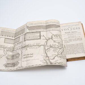
New Voyages to North-America. Containing an Account of the Several Nations of That Vast Continent…
- $8,500
- First English edition of Lahontan's description and mapping of New France, which propagated the myth of the Northwest Passage.
-
Add to cart
-
-
Add to cartQuick View
- Canada and The Great Lakes
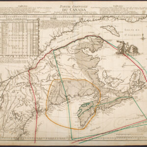
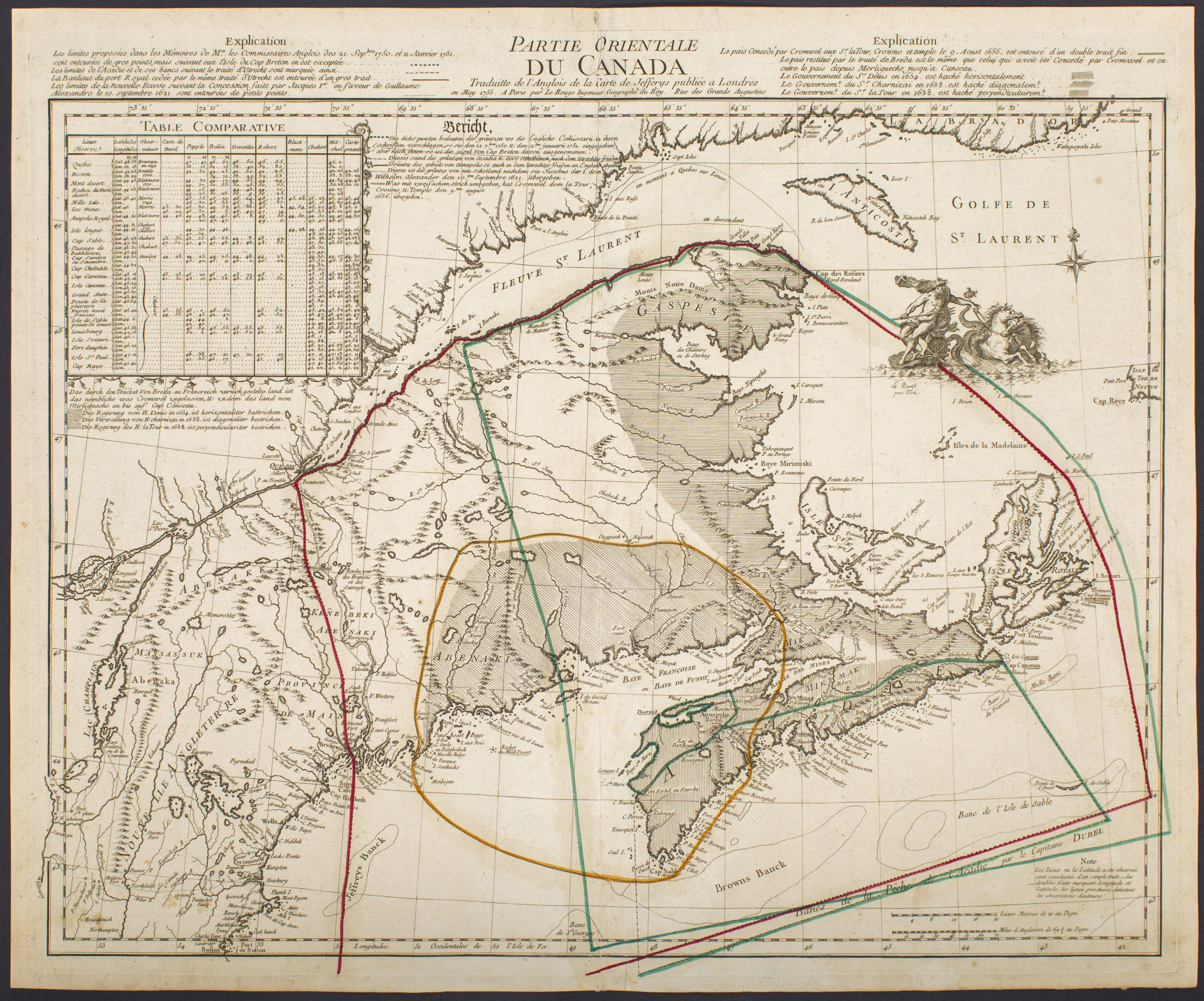
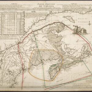
Partie Orientale Du Canada Traduite de l’Anglois de Carte de Jefferys publiée a Londres en May 1755…
- $2,850
- Scarce 1755 map of French and British historical claims, published in Paris on the eve of the Seven Years’ War.
-
Add to cart

