-
-
Add to cart
- North America, Texas and The West, United States
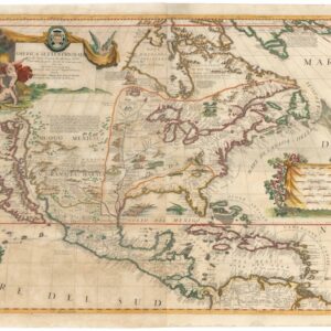
AMERICA SETTENTRIONALE Colle Nuove Scoperte fin all’Anno 1688…
- $14,500
- A beautiful hand-colored example of Coronelli’s ground-breaking 1688 map of North America.
-
-
-
-
Add to cart

- North America, Wall maps
Nord-Amerika.
- $1,900
- Von Sydow’s geophysical wall map of North America.
-
-
-
-
Add to cart

- North America, United States
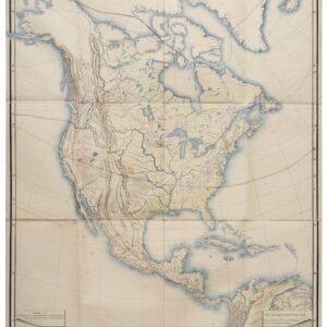
Charte Von Nord America Entworfen und gezeichnet von C.G. Reichard…Erganztr und nach den neuern Entdeckungen desr Hrn. Lewis, Clarke n. Pike…1817.
- $1,600
- A noteworthy and era-specific snapshot of North American geography and exploration during the early 19th century.
-
-
-
-
Add to cart
- North America
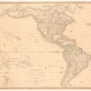
Amerique reduite d’apres celle d’Arrowsmith…
- $475
- A variation on Arrowsmith’s Western Hemisphere.
-
-
-
-
Add to cart
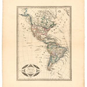
- Eastern United States, North America
Amérique septentrionale et méridionale: pour servir aux leçons de géographie de l’Abbé Gaultier.
- $100
- An 1809 French map of the Western Hemisphere shortly after the Louisiana Purchase.
-
-
-
-
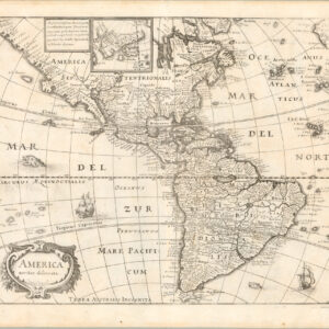
Add to cart

- North America, Pacific Northwest - Hawaii - Alaska
A Chart of North and South America, Including the Atlantic and Pacific Oceans, with the nearest Coasts of Europe, Africa, and Asia
- $4,200
- Sayer-Bennet-Mead's 1775 chart of the Western Hemisphere with Pacific and Arctic routes of exploration.
-
-
-
-
-
Add to cart
- North America, Wall maps
Nord-Amerika.
- $1,900
- Von Sydow’s geophysical wall map of North America.
-
-
-
-
Add to cart
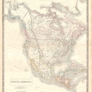
- North America, United States
North America.
- $500
- Disputed Pacific Northwest, with American Exclave.
-
-
-
-
Add to cart
- North America
General Charte von America nach dem besten hilfsmitteln
- $375
- An unusual depiction of America's changing borders in the Jacksonian Era.
-
-
-
-
-
Add to cart
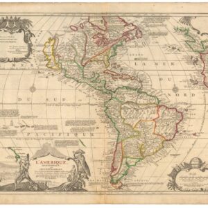
- North America
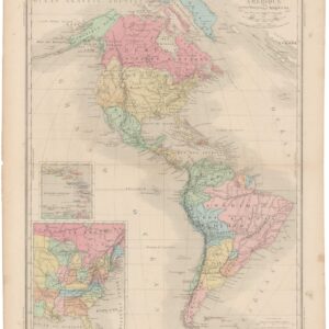
L’Amerique meridionale et septentrionale
- $1,800
- Nicolas de Fer’s seminal map of the Americas.
-
-
-
-
-
Add to cart
- North America
America noviter delineata.
- $975
- Beautiful 1638 Merian chart of the Americas dating back to the early days of exploration and representing an important transition from one level of New World cartography to another.
-
-
-
-
-
Add to cart
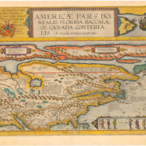
- North America, Featured Maps & Views
Americae Pars Borealis, Florida, Baccalaos, Canada, Corterealis. A Cornelio de Iudaeis in luce edita.
- $39,000
- The first printed folio map of North America and the most iconic American chart of the 16th century.
-
-
-