Disputed Pacific Northwest, with American Exclave.
North America.
$500
In stock
Description
An attractive c. 1845 map of North and Central America published in William and Alexander Keith Johnston’s The national atlas of historical, commercial, and political geography.
Perhaps the most striking element of this map is the unusual boundary between British and American claims in what is now the state of Washington. Border disputes between the American Republic and its former parent empire were frequent in the early-mid-19th century, and in the 1840s, the resolution of borders in the western portion of North America was a sticking point in relations between the two countries, as well as an important domestic political issue in the U.S. Both sides operated large fur trading companies in the area and had expansionist claims extending far beyond the border seen here, but a more realistic border was likely to be located either along the 49th parallel or along the Columbia River.
Reflecting the uncertainty of the situation, the Brothers Johnston here present the Olympic Peninsula as an exclave of the United States, cut off from the rest of the county by British claims around Ft. George (Astoria) on the coast. Soon after this map’s publication, the 1846 Treaty of Oregon set the Pacific border at the 49th parallel, though disputes remained until 1872, including the bloodless ‘Pig War’ of 1859.
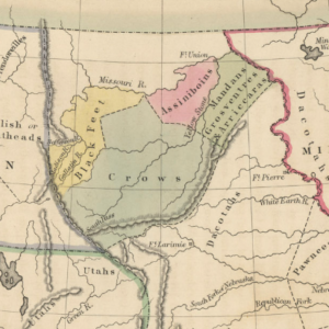
Native American tribes are named throughout the middle and western parts of the continent. In the central part of what is now the United States, several ‘districts’ are named, mostly after prominent Native American groups. These were commonly employed yet unofficial designations in the United States in the 1830s and 1840s for unorganized portions of the former Louisiana Territory west of the organized territories.
In California, Sutter’s Fort is noted at the future site of Sacramento, a region that would soon garner global attention with the Gold Rush. A dashed line near the Rio Grande marks the ‘Boundary of California’ with Texas while its continuation runs west from the Rocky Mountains, denoting the boundary between the United States and Mexico. The outlining of California and Texas in the same color as the United States is curious. The inclusion of Texas could be explained by the annexation of that Republic into the United States in 1845. Alta California’s division from the rest of Mexico may be due to reforms enacted in 1836 (las Siete Leyes) that granted the territory more autonomy from the central government.
Also notable are the (Second) Republic of Yucatan (1841-1848) and the putative unity of Central America as ‘Guatemala’ or, officially, the Federal Republic of Central America. In reality, the entity rapidly dissolved into its constituent parts (the current nation-states of the region) in 1840-1841 but may be maintained here as no permanent settlement was apparent when the map was published. The British-aligned Mosquito Kingdom is not depicted as independent of Guatemala, reflecting its uncertain international status. ‘Haiti or Santo Domingo’ is unified here, following the annexation of the latter by the former under Jean-Pierre Boyer in the early 1820s.
Though the map is undated, several of the features described above suggest that it dates from the early-mid 1840s and in any event, is no later than 1846.
Cartographer(s):
William and Alexander Keith Johnston were Scottish brothers based in Edinburgh who operated a prominent map engraving and printing business in the mid-19th century. A.K. Johnston was the driving force behind the business and remained in the world of cartography throughout his life, while William later entered politics, serving as the Lord Provost of Edinburgh and being knighted for his service. Johnston’s maps and atlases earned high praise for their accuracy and comprehensiveness (A.K. Johnston was strongly influenced by Alexander von Humboldt).
Condition Description
Very good. Toning along edges. Light foxing on verso.
References


