-
-
Add to cart
 Quick View
 - Pictorial maps, San Francisco
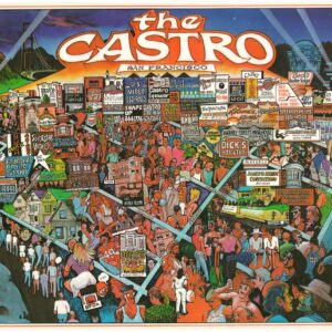
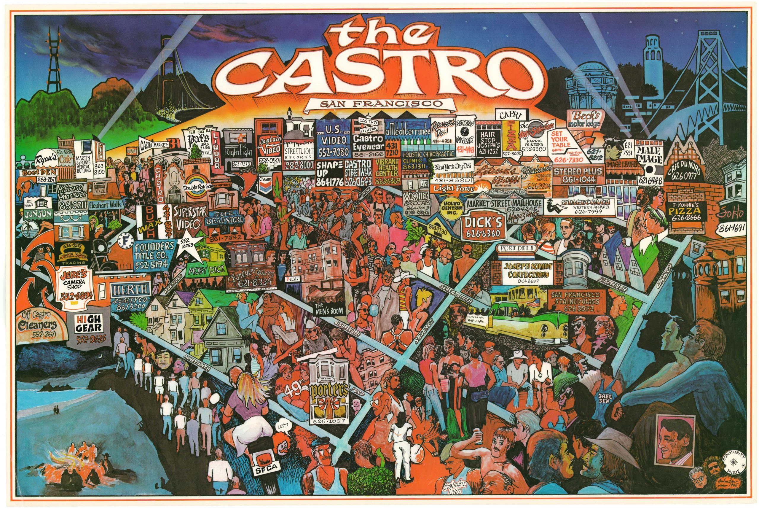
The Castro, San Francisco
- $1,800
- A rare poster map of unknown origin depicting San Francisco’s iconic Castro District in the mid-1980s.
-
-
-
-
-
Add to cart
 Quick View
 - San Francisco
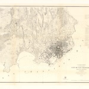
U.S. Coast Survey A.D. Bache, Superintendent, City Of San Francisco And Its Vicinity California. From a Trigonometrical Survey by R.D. Cutts, Assistant…
- $1,900
- Hand-colored 1853 United States Coast Survey master sheet map of the San Francisco Peninsula.
-
-
-
-
Add to cart
 Quick View
 - California, San Francisco
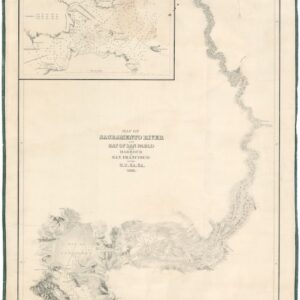
Map of Sacramento River and Bay of San Pablo with Harbour of San Francisco by the U.S. Ex. Ex. 1841.
- $4,500
- Extremely rare 1841/1858 Wilkes U.S. Exploring Expedition Map of the Sacramento River and San Francisco Harbor.
-
-
-
-
Add to cart
 Quick View
 - Pictorial maps, San Francisco
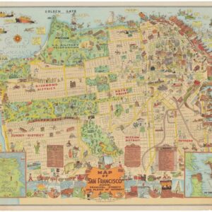
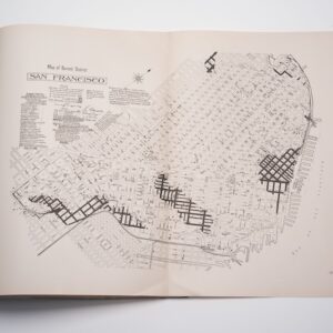
Map of San Francisco Showing Principal Streets and Places of Interest.
- $3,500
- Roaring Twenties Pictorial Map of San Francisco.
-
-
-
-
Add to cart
 Quick View
 - California, San Francisco
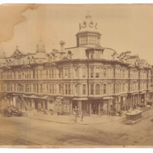
Grand Hotel, Johnson & Co., Proprietors, San Francisco, California.
- $3,200
- Carleton Watkins mammoth plate of San Francisco’s Grand Hotel (CEW 382).
-
-
-
-
Add to cart
![נמל סן פרנסיסקו איפה מתחיל המזרח הרחוק [Port of San Francisco Where the Far East Begins].](https://neatlinemaps.com/wp-content/uploads/2025/11/NL-02485_thumbnail-300x300.jpg) Quick View
Quick View - Bird's-eye-views, California, San Francisco
נמל סן פרנסיסקו איפה מתחיל המזרח הרחוק [Port of San Francisco Where the Far East Begins].
- $1,600
- Stylized Hebrew Version!
-
-
-
-
Add to cart
 Quick View
 - Atlases & Books, California, San Francisco
The Water Supply of San Francisco California before, during, and after the earthquake of April 18th, 1906, and the subsequent conflagration.
- $275
- Retrospective study on the origins of the 1906 catastrophe.
-
-
-
-
Add to cart
 Quick View
 - California, San Francisco
City of San Francisco and its Vicinity.
- $2,200
- A cornerstone map for the historical cartography of San Francisco.
-
-
-
-
Add to cart
 Quick View
 - Curiosities - Miscellanea, San Francisco
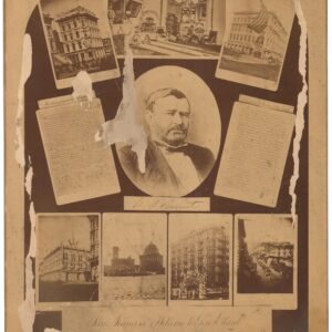
San Francisco’s Welcome to Gen. Grant. September 20, 1879.
- $1,200
- An unrecorded photographic commemoration of Ulysses S. Grant's 1879 visit to San Francisco.
-
-
-
-
Add to cart
![PORT OF SAN FRANCISCO. WHERE THE FAR EAST BEGINS [Japanese language version]](https://neatlinemaps.com/wp-content/uploads/2021/01/NL-00879_Thumbnail-300x300.jpg)
![PORT OF SAN FRANCISCO. WHERE THE FAR EAST BEGINS [Japanese language version]](https://neatlinemaps.com/wp-content/uploads/2021/01/NL-00879_Thumbnail.jpg) Quick View
Quick View - Bird's-eye-views, San Francisco
PORT OF SAN FRANCISCO. WHERE THE FAR EAST BEGINS [Japanese language version]
- $875
- Rare Japanese language bird's-eye-view in the style of Saul Steinberg showing the port of San Francisco as the gateway to Pacific commerce.
-
-
-
-
-
Add to cart
![[Yerba Buena Island Panoramic Photograph]](https://neatlinemaps.com/wp-content/uploads/2025/08/Screenshot-2025-08-29-at-8.43.38-AM-300x300.png) Quick View
Quick View - California, San Francisco
[Yerba Buena Island Panoramic Photograph]
- $875
- A scarce ca. 1909 panoramic photograph of the U.S. Naval Training Station on Yerba Buena Island.
-
-
-
-
Add to cart
 Quick View
 - San Francisco
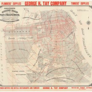
Crocker’s Guide Map of the City of San Francisco.
- $1,600
- A fantastic pre-1906 earthquake map of San Francisco.
-
-