-
-
Add to cart
 Quick View
 - Atlases & Books, Polar - Arctic
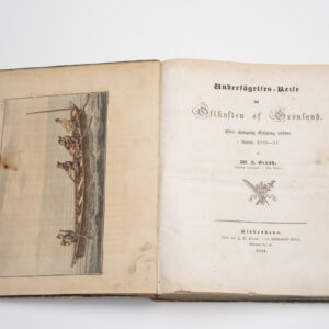
Undersögelses-reise til östkysten af Groenland: efter Kongelig Befaling, udført i Aaren 1828-31.
- $2,000
- The definitive reconnaissance of Greenland’s east coast and a milestone in Arctic exploration.
-
-
-
-
Add to cart
 Quick View
 - Atlases & Books, Polar - Arctic
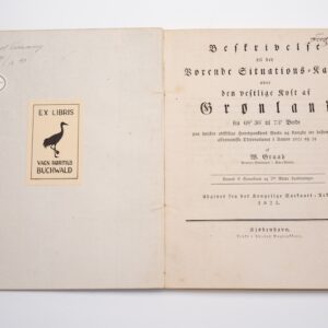
Beskrivelse til det vorende Situations-Kaart over den vestlige kyst af Grønland.
- $2,200
- The first modern pilot chart of Greenland’s west coast and the foundation of Graah’s Arctic legacy.
-
-
-
-
Add to cart
![[Ortelius & Hogenberg Atlas Factice]](https://neatlinemaps.com/wp-content/uploads/2023/03/NL-01678-leo-belgicus-3_thumbnail-300x300.jpg) Quick View
Quick View - Atlases & Books, Curiosities - Miscellanea, Europe, Germany & the Netherlands
[Ortelius & Hogenberg Atlas Factice]
- $28,000
- Fascinating Composite Dutch Atlas. With Frans Hogenberg’s very rare Germaniae Inferioris and Eytzinger’s Leo Belgicus. Bound in a unique double-folding format for travel.
-
-
-
-
Add to cart
![[Leo Belgicus] Germania Inferior id est, XVII provinciarum ejus novae et exactae tabulae geographicae, cum Luculentis Singularum additais…1622.](https://neatlinemaps.com/wp-content/uploads/2024/08/NL-02255-9_thumbnail-300x300.jpg) Quick View
Quick View - Atlases & Books, Europe, Germany & the Netherlands
[Leo Belgicus] Germania Inferior id est, XVII provinciarum ejus novae et exactae tabulae geographicae, cum Luculentis Singularum additais…1622.
- $34,500
- Pieter van der Keere’s iconic Germania Inferior atlas in rich original color.
-
-
-
-
Add to cart
![Reconnaissance of the Western Coast of the United States from San Francisco to Umpquah River [&] Voyages of Discovery and Exploration on the Northwest Coast of America from 1539 to 1603.](https://neatlinemaps.com/wp-content/uploads/2021/01/NL-00878_Thumbnail-300x300.jpg) Quick View
Quick View - Atlases & Books, California, Curiosities - Miscellanea
Reconnaissance of the Western Coast of the United States from San Francisco to Umpquah River [&] Voyages of Discovery and Exploration on the Northwest Coast of America from 1539 to 1603.
- $2,400
- Two works linked to historian George Davidson — an annotated Coast Survey chart and a proof copy of his 1887 report on early Pacific Coast exploration.
-
-
-
-
Add to cart
 Quick View
 - Atlases & Books, California, San Francisco
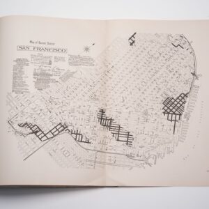
The Water Supply of San Francisco California before, during, and after the earthquake of April 18th, 1906, and the subsequent conflagration.
- $275
- Retrospective study on the origins of the 1906 catastrophe.
-
-
-
-
Add to cart
 Quick View
 - Atlases & Books, Eastern Mediterranean - Holy Land, Middle East - Holy Land Maps
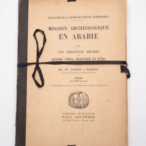
Mission Archéologique en ARABIE III: Les châteaux arabes.
- $375
- Jaussen & Savignac’s iconic plate atlas of Islamic desert architecture.
-
-
-
-
Add to cart
 Quick View
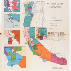
 - Atlases & Books, California, World War I and World War II
Japanese evacuation from the West Coast, 1942: Final Report.
- $775
- A chronicle of one of the most infamous events in American history.
-
-
-
-
Add to cart
 Quick View
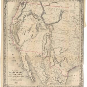
 - California, Texas and The West, Atlases & Books
Map of California, Oregon, Texas, and the territories adjoining, with routes &c.
- $1,900
- Colton’s iconic map of the West, with California Gold region and extended Texas borders.
-
-
-
-
Add to cart
 Quick View
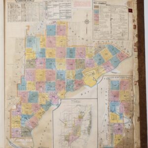
 - United States, East & Midwest United States, Atlases & Books
Insurance Maps of Miami, Florida Volume Three.
- $7,500
- Sanborn Fire Insurance Atlas of Miami, Florida – Volume 3: Coconut Grove & Silver Bluff.
-
-
-
-
Add to cart
 Quick View
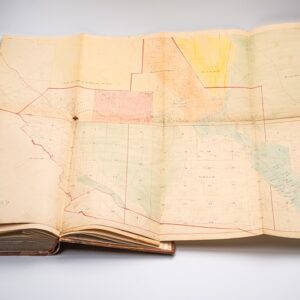
 - Atlases & Books, Bay Area & Silicon Valley, California
Assessment List Contra Costa County Sup. Dist. 2 Moraga Lafayette Walnut Creek & Alamo.
- $4,500
- Late 19th-century assessment with two fold-out maps, including a very early map of Walnut Creek.
-
-
-
-
Add to cart
 Quick View
 - World, Atlases & Books
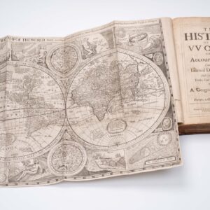
The history of the vvorld: or, An account of time. Compiled by the learned Dionisius Petavius. And continued by others, to the year of our Lord, 1659. Together with a geographicall description of Europe, Asia, Africa, and America.
- $7,500
- With Robert Walton's rare world map.
-
-