-

Southern California (9)
Original antique maps of Southern California, including Los Angeles and Santa Barbara. -
-
Add to cart
 Quick View
 - California, Southern California
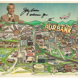
Johnny Carson Welcomes You to Beautiful Downtown Burbank.
- $1,600
- The Running Joke Became a Real Place — 1981 Pictorial Map of Johnny Carson Welcomes You to Beautiful Downtown Burbank.
-
-
-
-
Add to cart
 Quick View
 - Pictorial maps, San Francisco
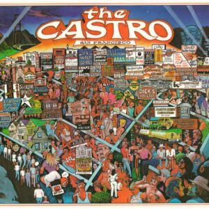
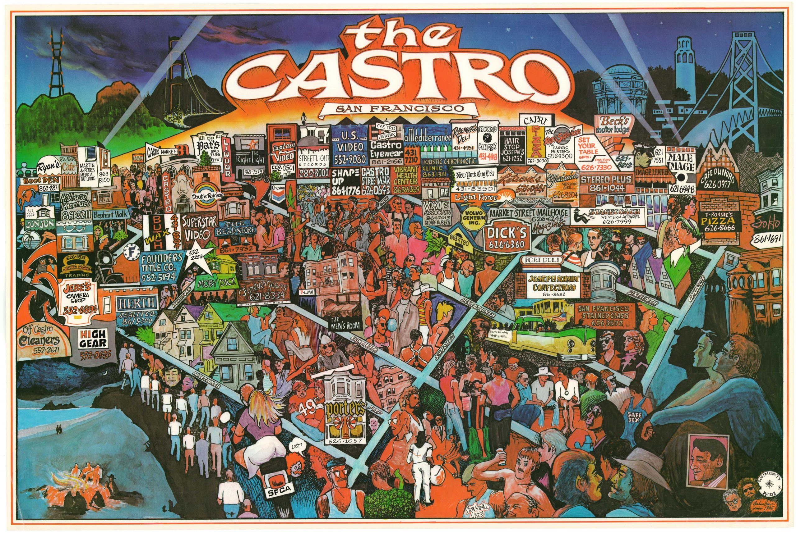
The Castro, San Francisco
- $1,800
- A rare poster map of unknown origin depicting San Francisco’s iconic Castro District in the mid-1980s.
-
-
-
-
-
Add to cart
 Quick View
 - Bay Area & Silicon Valley, California
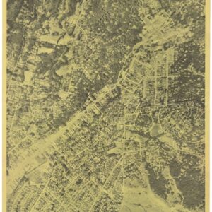
Beautiful Mill Valley “My Home Town”.
- $375
- 1962 circa Aerial Photograph of Mill Valley, Marin County, California.
-
-
-
-
Add to cart
 Quick View
 - San Francisco
U.S. Coast Survey A.D. Bache, Superintendent, City Of San Francisco And Its Vicinity California. From a Trigonometrical Survey by R.D. Cutts, Assistant…
- $1,900
- Hand-colored 1853 United States Coast Survey master sheet map of the San Francisco Peninsula.
-
-
-
-
Add to cart
 Quick View
 - California, San Francisco
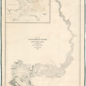
Map of Sacramento River and Bay of San Pablo with Harbour of San Francisco by the U.S. Ex. Ex. 1841.
- $4,500
- Extremely rare 1841/1858 Wilkes U.S. Exploring Expedition Map of the Sacramento River and San Francisco Harbor.
-
-
-
-
Add to cart
 Quick View
 - Pictorial maps, San Francisco
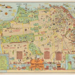
Map of San Francisco Showing Principal Streets and Places of Interest.
- $3,500
- Roaring Twenties Pictorial Map of San Francisco.
-
-
-
-
Add to cart

 Quick View
 - California
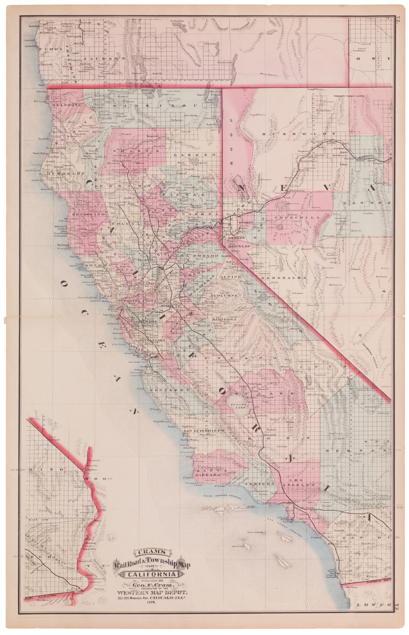
Cram’s Railroad & Township Map of California
- $575
- Excellent 1879 large-format edition railroad map of California.
-
-

-
-
-
Add to cart
 Quick View
 - California, San Francisco
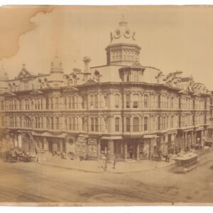
Grand Hotel, Johnson & Co., Proprietors, San Francisco, California.
- $3,200
- Carleton Watkins mammoth plate of San Francisco’s Grand Hotel (CEW 382).
-
-
-
-
Add to cart
 Quick View
 - Bay Area & Silicon Valley
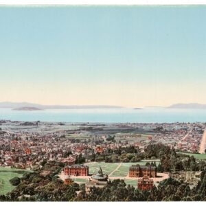
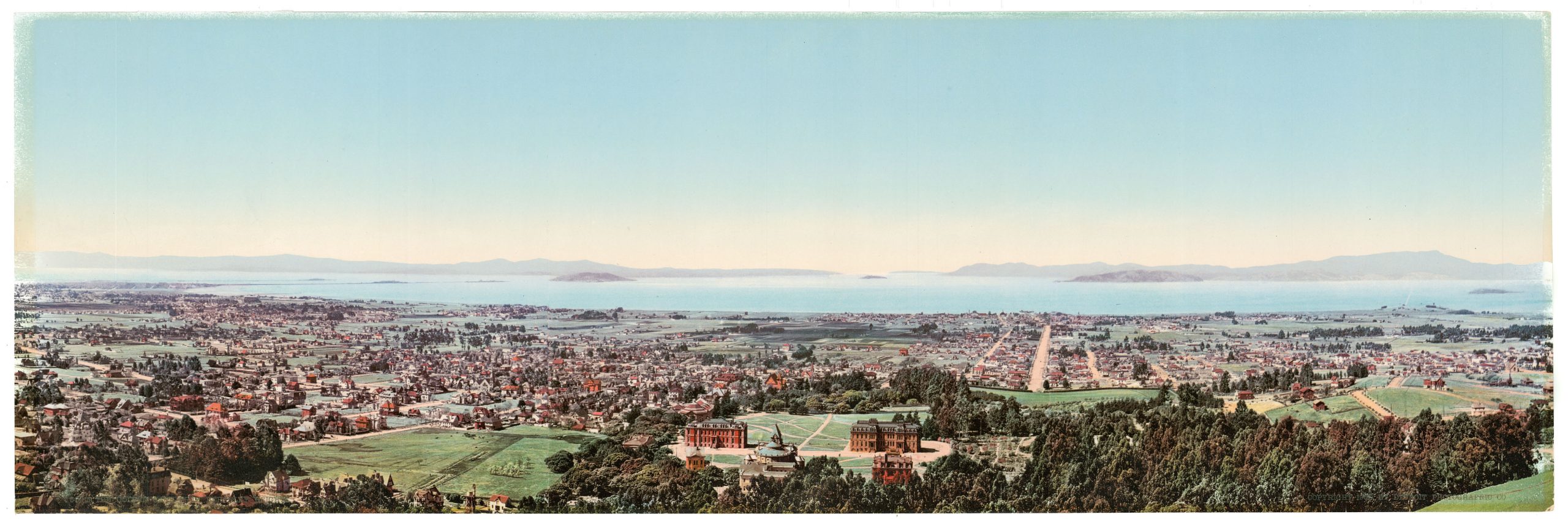
The Golden Gate from Berkeley Heights.
- $975
- William Henry Jackson’s panoramic photochrom of Berkeley and the Bay Area at the dawn of the 20th century.
-
-
-
-
-
Add to cart
 Quick View
 - California, Pictorial maps
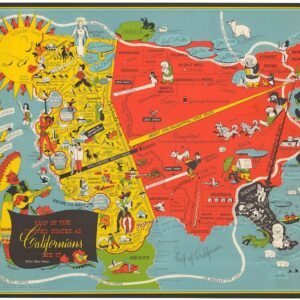
Map of the United States as Californians See It.
- $1,200
- The epitome of a new genre of comedic cartography that developed following the end of World War II.
-
-
-
-
Add to cart
 Quick View
 - Bay Area & Silicon Valley, California
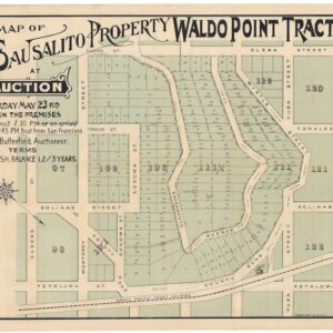
Map of Sausalito Property at Auction, Waldo Point Tract.
- Rare 1891 real estate map of Sausalito, CA.
-
-
-
-
Add to cart
![נמל סן פרנסיסקו איפה מתחיל המזרח הרחוק [Port of San Francisco Where the Far East Begins].](https://neatlinemaps.com/wp-content/uploads/2025/11/NL-02485_thumbnail-300x300.jpg) Quick View
Quick View - Bird's-eye-views, California, San Francisco
נמל סן פרנסיסקו איפה מתחיל המזרח הרחוק [Port of San Francisco Where the Far East Begins].
- $1,600
- Stylized Hebrew Version!
-
-