-
-
Add to cart
- Europe, British Isles, Pictorial maps, Rare City Plans
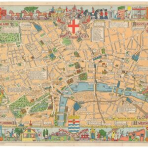
County of London (Children’s Map of London).
- $475
- A rare early edition of the Children's Map of London.
-
-
-
-
Add to cart
- California, Rare City Plans
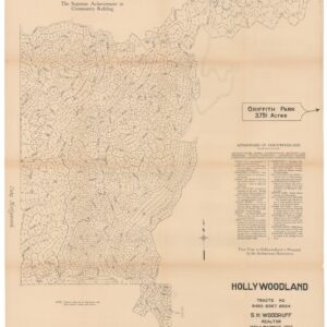
Hollywoodland, Tracts No. 6450 9367 9594.
- $1,800
- The birth of one of L.A.'s most iconic neighborhoods.
-
-
-
-
Add to cart
- Europe, Rare City Plans, Spain & Portugal
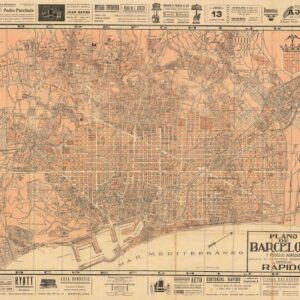
Plano de Barcelona y pueblos agregados.
- $375
- A beautiful and intricate plan of Barcelona, on the eve of the Spanish Civil War.
-
-
-
-
Add to cart

- San Francisco, Rare City Plans
Map of the City & County of San Francisco, from the Latest Certified Data.
- $575
- Settling the Southern Part of San Francisco.
-
-
-
-
Add to cart
- British Isles, Rare City Plans
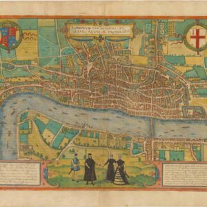
Londinum Feracissimi Angliae Regni Metropolis.
- $8,500
- Braun & Hogenberg’s extraordinary rendition of Elizabethan London as Shakespeare knew it.
-
-
-
-
Add to cart
- France & Switzerland, Rare City Plans
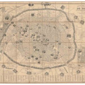
Nouveau Plan Illustré de la Ville de Paris
- $800
- A scarce third edition of Vuillemin’s illustrated map of Paris after the fortifications of Adolphe Thiers.
-
-
-
-
Add to cart
- Italy, Rare City Plans
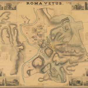
Roma Vetus In usum scholarum editit Herm. Rheinhard Tymn Stuggt. Prof.
- $2,400
- A rare and spectacular vision of ancient Rome, compiled by a German scholar in the mid-19th century.
-
-
-
-
Add to cart
- Featured Maps & Views, Italy, Rare City Plans
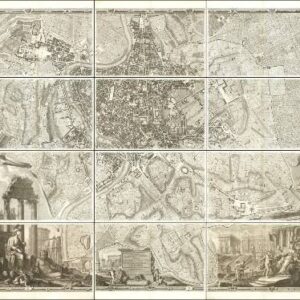
Alla Santità di Nostro Signore Papa Benedetto XIV La Nuova Topografia di Roma Ossequiosamente Offerisce e Dedica l’Umilissimo Servo Giambattista Nolli Comasco
- $35,000
- The famous Nolli wall map of Rome: one of the finest urban plans ever made.
-
-

-
-
-
Add to cart
- Italy, Bird's-eye-views, Rare City Plans
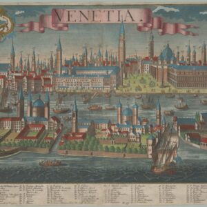
Venetia.
- $4,800
- A stunning and highly detailed view of the lagoon city of Venice, compiled in the early 18th century and issued by Probst, Augsburg’s most famous publishing dynasty.
-
-
-
-
-
Add to cart
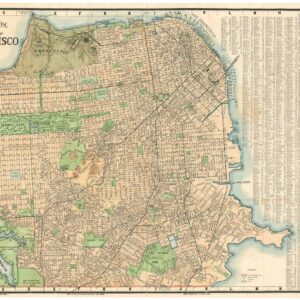
- Rare City Plans, San Francisco
Thomas Bros Map of the City and County of San Francisco.
- $475
- Large and attractive 1938 Thomas Brothers map of San Francisco.
-
-
-
-
-
Add to cart
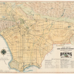
- California, Rare City Plans
Latest map of Los Angeles county and points of interest.
- $275
- A beautiful, hand-colored 1950 map of Los Angeles.
-
-
-
-
-
Add to cart
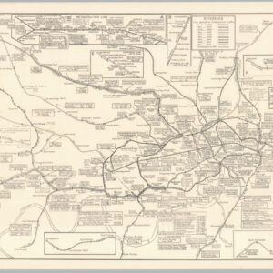
- British Isles, Rare City Plans
Historical Map of the Underground Railways
- $450
- A Tube map unlike any other: telling the story of London's famed transit system.
-
-
-