-
-
Add to cart
 Quick View
 - Pictorial maps, San Francisco
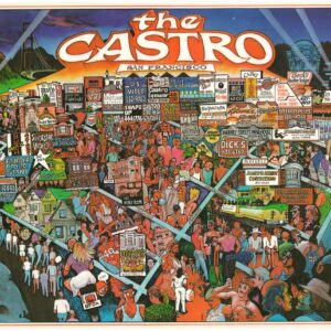
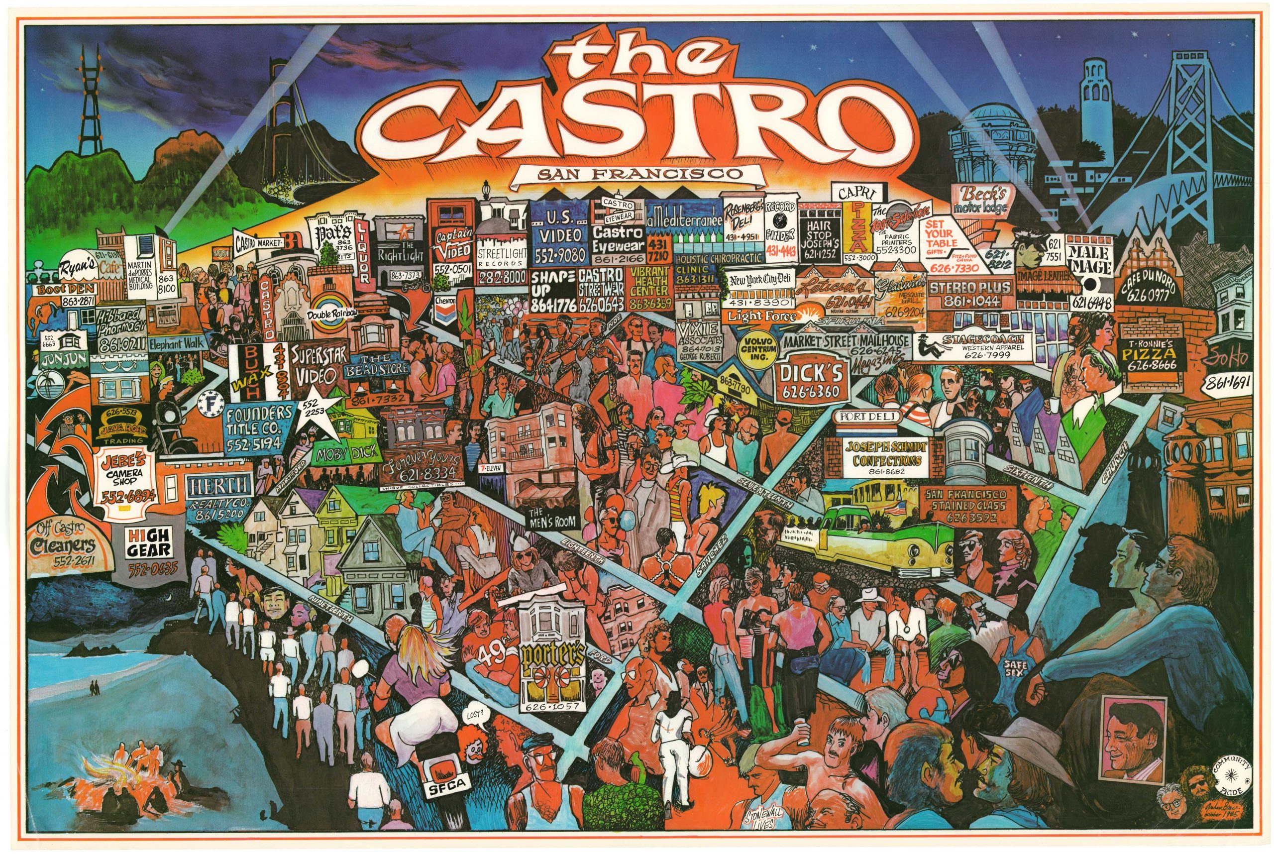
The Castro, San Francisco
- $1,800
- A rare poster map of unknown origin depicting San Francisco’s iconic Castro District in the mid-1980s.
-
-
-
-
-
Add to cart
 Quick View
 - Curiosities - Miscellanea, Pictorial maps, World
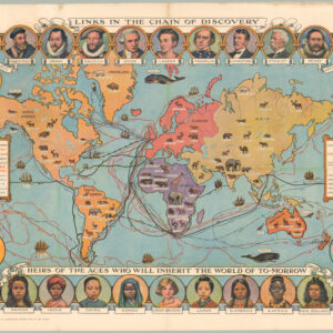
Cassell’s Children’s Book of Knowledge Wonder Map of the World.
- $450
- Thematic mapping for children: a fabulous circa 1930 world map depicting the history of exploration.
-
-
-
-
-
Add to cart
 Quick View
 - Pictorial maps, San Francisco
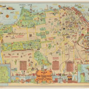
Map of San Francisco Showing Principal Streets and Places of Interest.
- $3,500
- Roaring Twenties Pictorial Map of San Francisco.
-
-
-
-
Add to cart
 Quick View
 - California, Pictorial maps
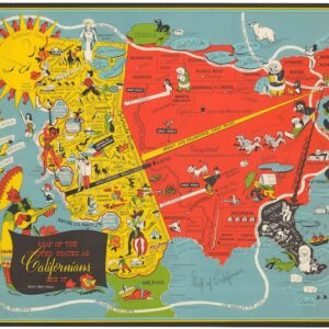
Map of the United States as Californians See It.
- $1,200
- The epitome of a new genre of comedic cartography that developed following the end of World War II.
-
-
-
-
Add to cart
 Quick View
 - Bay Area & Silicon Valley, California, Pictorial maps
Monterey California. Cannery Row.
- $275
- A colorful 1988 promotional pictorial view of Monterey's famous Cannery Row.
-
-
-
-
Add to cart
 Quick View
 - Bay Area & Silicon Valley, Bird's-eye-views, California, Pictorial maps
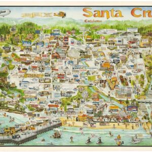
Santa Cruz California.
- $425
- A charming 1988 promotional pictorial view of Santa Cruz, California.
-
-
-
-
Add to cart
 Quick View
 - California, Pictorial maps
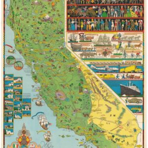
California.
- $1,600
- Jo Mora’s iconic 1945 map of California.
-
-
-
-
Add to cart
 Quick View
 - Eastern Mediterranean - Holy Land, Pictorial maps
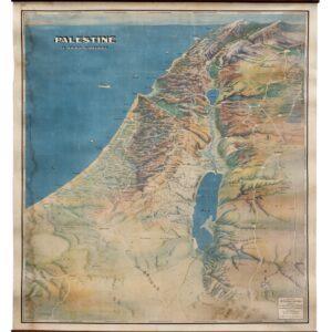
Palestine in Third Dimension.
- $975
- A Spectacular World War II-era View of the Holy Land.
-
-
-
-
Add to cart
 Quick View
 - Pictorial maps, Texas and The West, United States
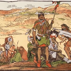
The Indian-detour; Santa Fe; Harveycars.
- $675
- The Roots of Romanticism of the American Southwest.
-
-
-
-
Add to cart

 Quick View
 - California, Bay Area & Silicon Valley, Pictorial maps, Bird's-eye-views
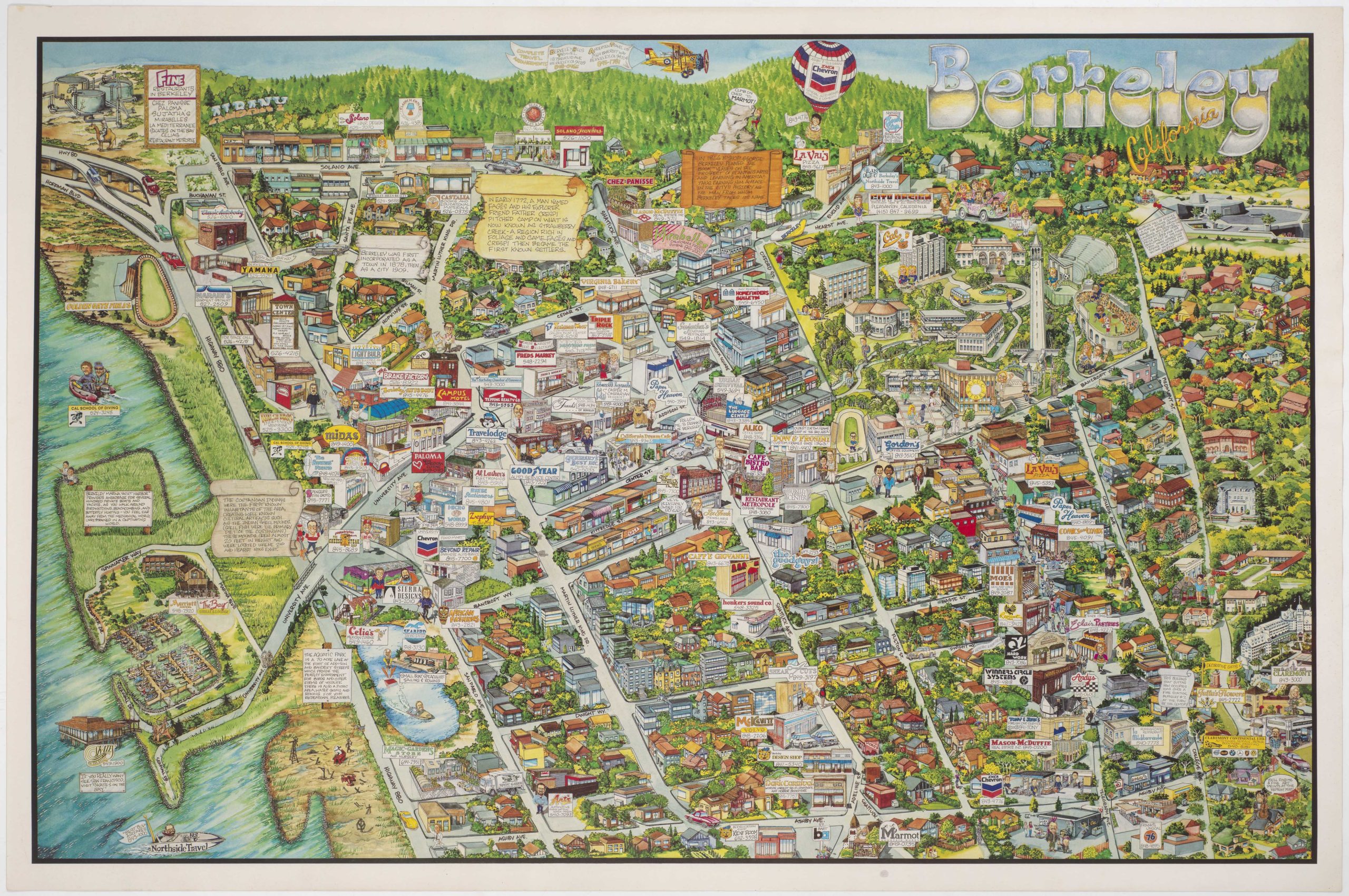
Berkeley California.
- $750
- Rich pictorial bird's-eye-view of Berkeley, including the University of California.
-
-
-
-
-
Add to cart
 Quick View
 - Pictorial maps, Texas and The West
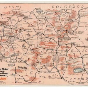
Harveycar Motor Cruises Through the Great Southwest.
- $975
- A vibrant testimony to the birth of the American Road Trip.
-
-
-
-
Add to cart
 Quick View
 - Pacific Northwest - Hawaii - Alaska, Pictorial maps, United States
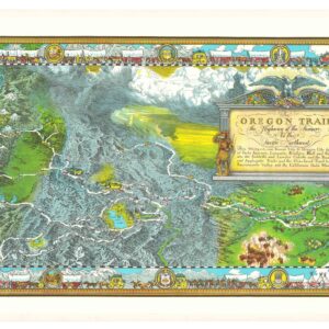
The Oregon Trail: The Highway of the Pioneers to the Pacific Northwest.
- $575
- William Forsyth McIlwraith’s vibrant and historically rich Oregon Trail map.
-
-