-

India (10)
Rare antique maps of India. -
Southeast Asia & Australia (14)
Original antique maps of Southeast Asia & Australia. -
-
Add to cart
 Quick View
 - Asia, India, Southeast Asia & Australia
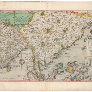
Tertiae Partis Asiae quae modernis India orientalis dicitur acurata delineatio Autore Iacobo Castaldo Pedemontano.
- $9,500
- De Jode’s 1593 seminal map of Asia in splendid original color.
-
-
-
-
Add to cart
 Quick View
 - Asia, Southeast Asia & Australia
แผนที่ประเทศไทย / MAP OF THAILAND
- $3,000
- Unrecorded 1958 Wall Map of Thailand Compiled from Royal Thai Army, Government, and French Indochinese Sources, Published in the Year of the Coup.
-
-
-
-
Add to cart
 Quick View
 - India
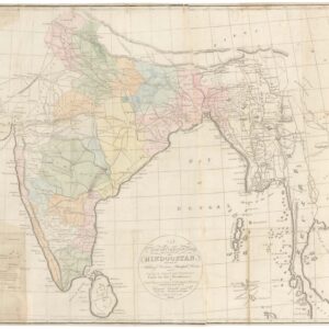
A New and Improved Map of Hindoostan.
- $3,600
- First map of India published in India?
-
-
-
-
Add to cart
 Quick View
 - Asia, Southeast Asia & Australia
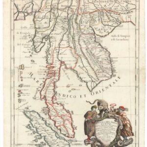
Penisola Dell India di la dal Gange Diusa ne i Regni…
- $2,200
- Stunning 1683 Cantelli-Rossi Map of Southeast Asia.
-
-
-
-
Add to cart
 Quick View
 - Asia, India
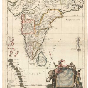
Penisola dell’India di qua dal Gange et Isole intorno ad essa adiacenti.
- $1,600
- Gorgeous 1683 Cantelli-Rossi Map of India, Ceylon, and the Maldive Islands.
-
-
-
-
Add to cart
 Quick View
 - Southeast Asia & Australia, Asia
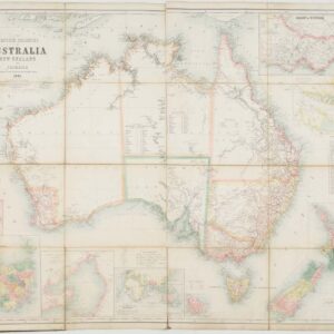
The British Colonies of Australia, New Zealand and Tasmania Shewing the Latest Discoveries and Travellers Routes.
- $2,200
- Large 1861 Case Map of Australia, New Zealand, and Tasmania Showing Early Exploration Routes.
-
-
-
-
Add to cart

 Quick View
 - Southeast Asia & Australia, Featured Maps & Views, Asia
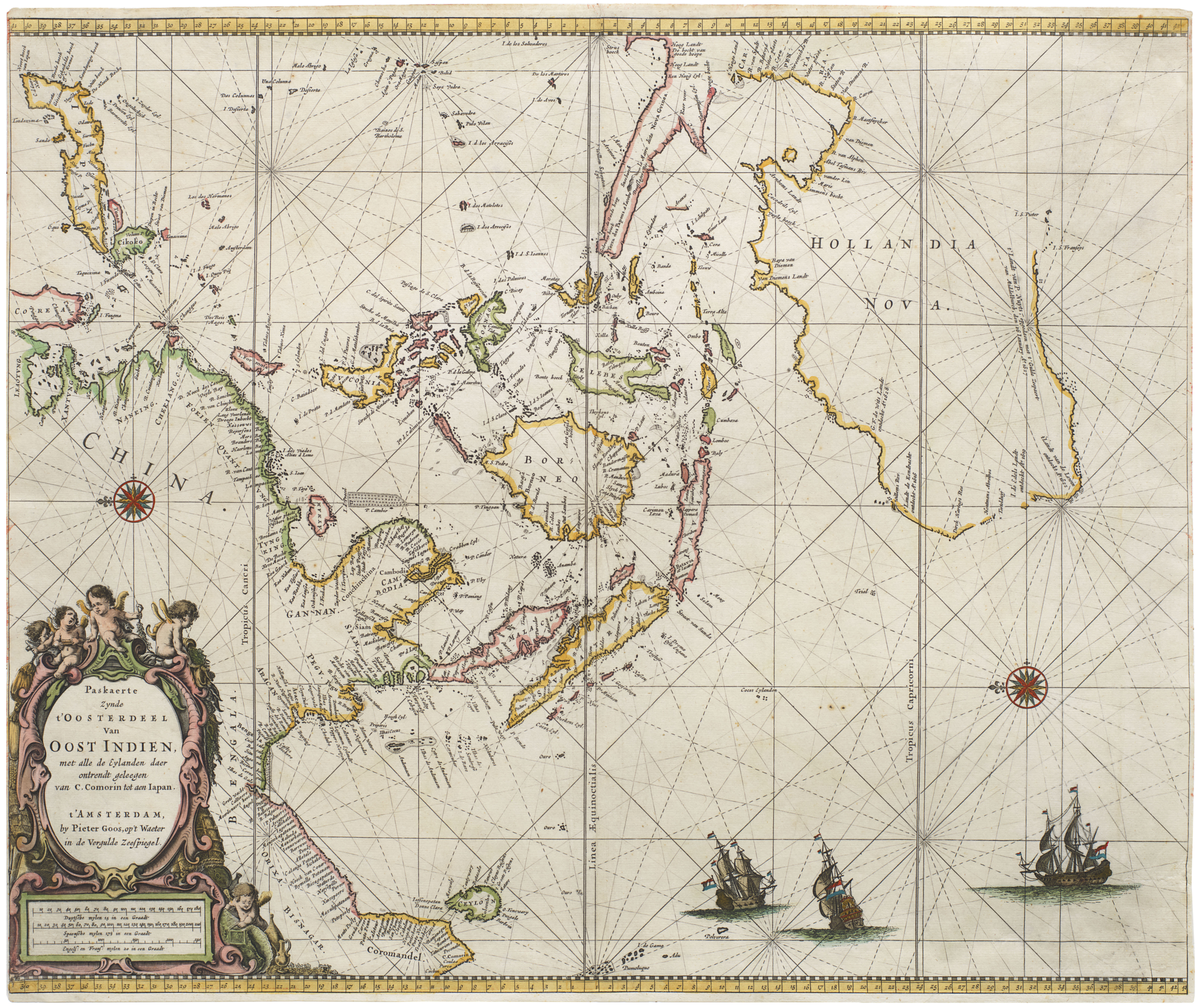
Paskaerte Zynde t’Oosterdeel van Oost Indien, met Alle de Eylanden daer Ontrendt Geleegen van C. Comorin tot aen Japan
- $6,500
- [Early color] Pieter Goos’ Striking Sea Chart of Southeast Asia, Australia, and the Indian Ocean.
-
-

-
-
-
Add to cart

 Quick View
 - Southeast Asia & Australia, Asia
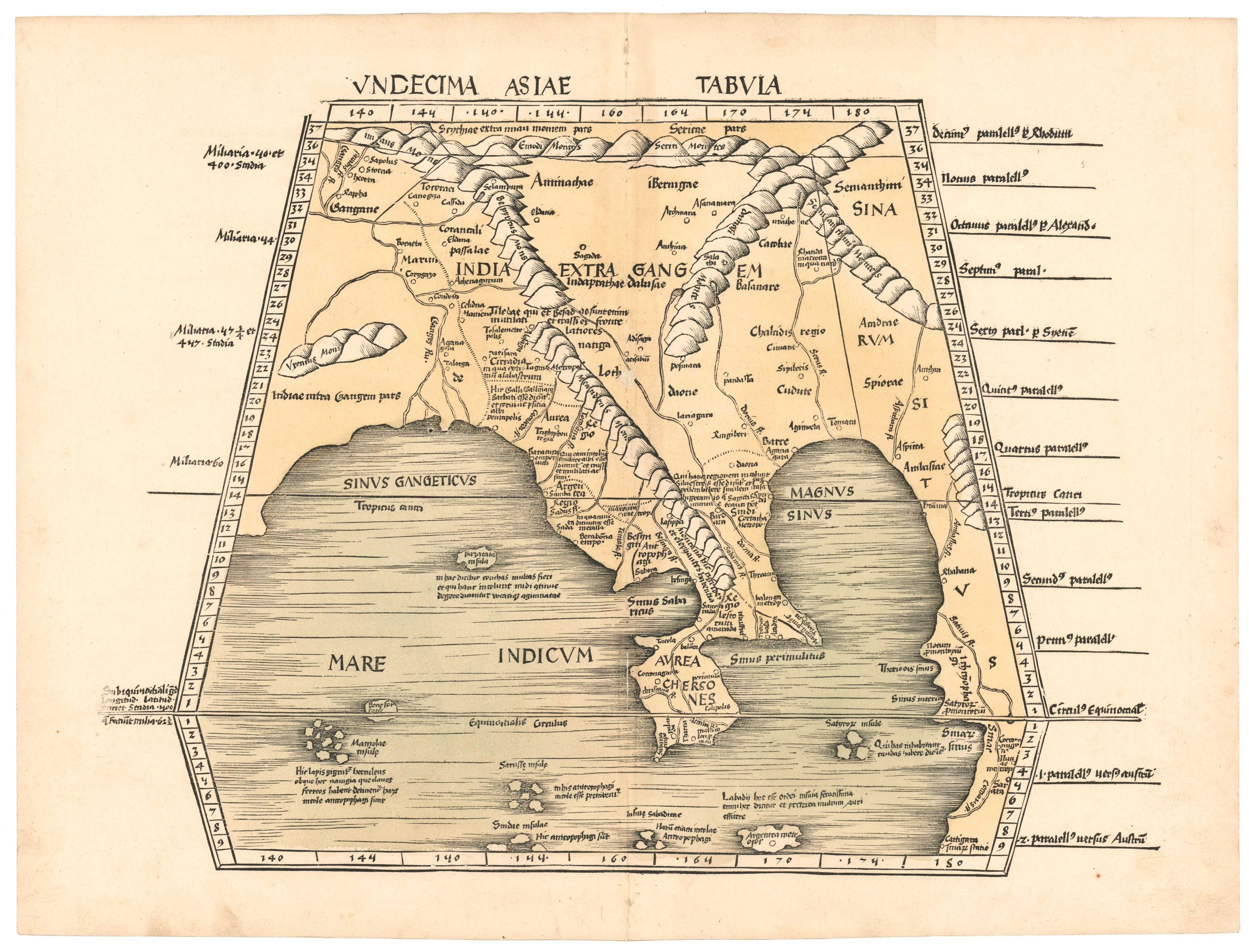
Undecima Asiae Tabula.
- $4,800
- An early printed map of Southeast Asia from the first modern atlas.
-
-

-
-
-
Add to cart
 Quick View
 - Asia, India
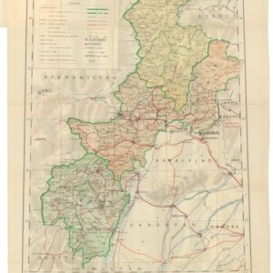
D.I. Khan & Peshāwar Divisions, Amb, Chitral, Dir and Swat.
- $275
- The Survey of Pakistan’s mapping of Peshawar and the Northwest Frontier.
-
-
-
-
Add to cart
 Quick View
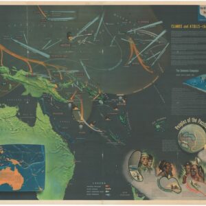
 - Asia, Southeast Asia & Australia, World War I and World War II
NavWarMap No. 5. Southwest Pacific.
- $1,000
- Large-format 1944 U.S. Navy “NavWar” training map of the Southwest Pacific, illustrating Japan’s expansion and the Allied counteroffensive toward victory.
-
-
-
-
Add to cart
![[The China Incident and Japan-Soviet Relations at a Glance].](https://neatlinemaps.com/wp-content/uploads/2025/11/NL-02475_thumbnail-300x300.jpg) Quick View
Quick View - Asia
[The China Incident and Japan-Soviet Relations at a Glance].
- $750
- Rare 1937 Japanese propaganda manga map portraying the Sino-Japanese War as a fight against “Red” China.
-
-
-
-
Add to cart
 Quick View
 - Asia, India
Operations in Waziristan 1919 – 1920. Confidential. Serial No. 224.
- $1,400
- Frontier warfare and colonial cartography: 1921 Survey of India “Confidential” atlas documenting the British campaign in Waziristan.
-
-