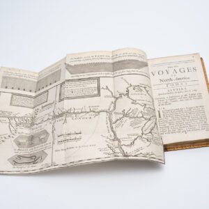
The cartographic record of Sven Hedin’s incredible Third Expedition across the Tibetan Plateau.
Southern Tibet. MAPS I.
$800
In stock
Description
While not as celebrated as Amundsen, Heyerdal, or Nansen, Sven Hedin was one of the great Scandinavian explorers of the early 20th century. His three large expeditions to the Tibetan Plateau and Central Asia are the stuff of legend, and every Swedish school child growing up in the first half of the 20th century would have heard of his incredible exploits. Now there are good reasons that Hedin’s popularity since waned and we have outlined both his exploits and some of the more problematic aspects in the bio section below. For now, it is merely important to note that this beautiful set of fifteen chromo-lithographs was issued as part of a much larger publication project that detailed Hedin’s Third Central Asia Expedition and the many ethnographical and geographical findings that resulted from it. The set comes beautifully presented in a hard cloth-bound folder, the frontispiece of which is adorned with a gilt letter title and a topographical map of the Asian landmass. The fifteen maps can be subdivided into three distinct types. The distinction between them hinges on scale, but in a place as unmapped and unforgiving as the Western Himalayas, scale makes an enormous difference in what can and cannot be shown.
The first map in the collection is a general topographic map of Asia and Tibet. The Himalayas and Tibetan Plateau stand out clearly as a massive barrier separating the Indian Subcontinent from the rest of Asia. In many ways, this map stands alone in the group and it was obviously intended as an introductory overview providing viewers with the basic geographical framework. What is perhaps most remarkable about this particular map are the red lines criss-crossing the entire region. An indistinct legend in the lower left corner tells us that these lines represent the routes travelled by Hedin between 1894 and 1908, underscoring just how extensive his explorations of Greater Tibet in fact were.
The next cluster consists of two regional maps of Eastern Turkestan and Tibet at a scale of 1:1.000.000. These two general maps of the region form part of a greater whole, in itself consisting of fifteen sheets. This is clear from the small map-key in the upper bar, which specifies exactly which quadrant of the larger map is depicted in this particular sheet. In this sense, they are reminiscent of regular ordinance maps from the late 19th and early 20th century, except that such maps did not exist for this region prior to Hedin’s voyages. The two maps included here are sheets VI and IX, meaning the easternmost sectors of the overall region. Throughout both these maps we once again find the red lines indicating the routes Hedin’s expeditions had covered, and when.
The third and last cluster of maps consists of the remaining twelve maps, each of which have been dedicated to specific stretches of his third formal expedition. This lasted for more than two years and Hedin spent the winter of 1906-1907 in altitudes above 5000 meters. All of these ‘route maps’ have been produced at a scale of 1:300.000, which allowed for much greater detail, but also meant that the areas immediately adjacent to them remained completely blank. Cartographically, mapping these remote eastern valleys constituted entirely new geographic information. Visually, however, this unmitigated focus also gives the maps an organic, almost artistic, quality. Each map is provided with a title and the dates in which the specific area was traversed and surveyed, making them an active part and product of the arduous journey that Hedin describes in his accounts.
The accomplishment that Hedin’s journeys constituted is described in greater detail in the bio below. For now, it is simply important to note that when Hedin mapped this region, it was one of the last blank spaces on the map, being traversed only occasionally by Tibetan and other Central Asian caravans. It was as such entirely unknown to modern geographic science. Many of Hedin’s expeditions, including the prestigious fourth Sino-Swedish Expedition, experienced great difficulties along the way – from bandits and extreme weather, to civil war. In particular entry into Tibet was problematic and Hedin was often delayed or simply forced to take alternative routes. The maps show in detail the route taken by Hedin through the Trans-Himalaya and into Tibet. More often than not, the high peeks and deep valleys of this region allow only insight into one’s immediate surroundings, and the ground covered by the expedition in each map sheet is so extensive that it is usually broken into two, sometimes even three sections on each sheet. This truly was pioneer cartography.
All maps printed by the Swedish Army’s Lithographic Institute in Stockholm. All of the route maps have scale bars in both kilometres and English statute miles. Below is a list detailing the contents of each sheet in the folder. Note that Plate 8 contains the Shigatse monastery and Tashi Limpo (Lama?), whereas Plate 12 contains the area around the sacred Lake Manasarovar, a large fresh-water lake on the Tibetan Plateau, which Hedin was the first European to formally visit and survey.
| Map no. | Cluster | Scope & Dates | Compiler/scale |
| General map | All of Central Asia, from the Takla-Makan Desert in the north to the Narmada River and Bay of Kambchat in the south. | Constructed and drawn by H. Byström
Scale 1:7.500.000 |
|
| Sheet VI | Regional map | General map of Eastern Turkestan & Tibet Sheet VI, showing from the southern fringes of the Taklamakan Desert to the Qaidam Desert. | Scale 1: 1.000.000 |
| Sheet IX | Regional map | General map of Eastern Turkestan & Tibet Sheet IX, showing the uncharted mountain ranges south of the Qaidam Desert. | Scale 1: 1.000.000 |
| Plate 1 | Route map | From Tankse to Camp IX
1906 August 20 – September 11 |
Constructed and drawn by C.J.O. Kjellström
Scale 1:300.000 |
| Plate 2 | Route map | From Camp X to Camp XXVIII, 1906 September 11 – October 2 | Constructed and drawn by C.J.O. Kjellström
Scale 1:300.000 |
| Plate 3 | Route map | From Camp XXVIII to Camp XL, 1906 October 2 – 15 | Constructed and drawn by C.J.O. Kjellström
Scale 1:300.000 |
| Plate 4 | Route map | From Camp XL to Camp LX, 1906 October 15 – November 13 | Constructed and drawn by C.J.O. Kjellström
Scale 1:300.000 |
| Plate 5 | Route map | From Camp LX to Camp LXXXIII, 1906 November 11 – December 9 | Constructed and drawn by C.J.O. Kjellström
Scale 1:300.000 |
| Plate 6 | Route map | From Camp LXXXIII to Camp CX, 1906 December 10 – 1907 January 21 | Constructed and drawn by C.J.O. Kjellström
Scale 1:300.000 |
| Plate 7 | Route map | From Camp CXI to Camp XXV, 1907 January 22 – February 6 | Constructed and drawn by C.J.O. Kjellström
Scale 1:300.000 |
| Plate 8 | Route map | From Camp CXXV to Camp CXLIX, 1907 February 7 – April 25 | Constructed and drawn by C.J.O. Kjellström
Scale 1:300.000 |
| Plate 9 | Route map | From Camp CL to Camp CLXIV, 1907 April 25 – May 23 | Constructed by C.J.O. Kjellström, drawn by H. Byström
Scale 1:300.000 |
| Plate 10 | Route map | From Camp CXLIV to Camp CLXXXV, 1907 May 25 – June 25 | Constructed by C.J.O. Kjellström, drawn by H. Byström
Scale 1:300.000 |
| Plate 11 | Route map | From Camp CLXXXV to Camp CCVIII, 1907 May 25 – July 20 | Constructed by C.J.O. Kjellström, drawn by H. Byström
Scale 1:300.000 |
| Plate 12 | Route map | From Camp CCVIII to Camp CCXXXIX, 1907 July 20 – Sept. 13 | Constructed by C.J.O. Kjellström, drawn by H. Byström
Scale 1:300.000 |
Cartographer(s):
Sven Hedin (1865-1952) was a Swedish geographer and topographer, and one of the great explorers of the 20th century. He is most famous for his three great expeditions to Central Asia and Tibet, but during the course of his career he traversed thousands of miles by foot and pack animal throughout Asia and the Middle East. Among his numerous achievements was the (European) discovery of the source of the Brahmaputra, Sutlej and Indus Rivers; the first ethnographic observations from Xinjiang and Tibet; and he was the first person to map the Western Himalayas and Tarim Basin according to modern cartographic standards. During the course of his expeditions, Edin also visited and mapped a range of ancient caravan cities unknown to western scholarship, including the Buddhist centres of Dandan Oilik and Kara Dung, and the ancient Chinese garrison town of Loulan.
As a young man, Hedin had been profoundly inspired by the Swedish Polar explorer Adolf Erik Nordenskiöld, who was the first to fully navigate the Northern Sea Route (i.e. east of Nova Zemlya, along the Russian coastline to the Bering Strait). The impact of Nordenskiöld’s achievement was so strong, that Hedin claims he decided to become a famous explorer by the age of 15. His first expeditions were marked by bad luck, ill preparation and the lack of a proper methodological apparatus to structure his observations, but even these have in later years proved to be pioneering voyages of exploration. Hedin completed his formal studies of geography under the renowned German geographer and China expert, Baron von Richthofen. It was Richthofen who had originally coined the term ‘The Silk Road’, and now his protege Hedin was becoming increasingly obsessed with exploring the unknown parts of this immense commercial network. But in his eagerness to launch his expeditionary career, he left his university life prematurely, waiting only to obtain his doctorate before staging his first expedition.
Hedin undertook no less than nine major expeditions, but it was especially the first three to Central Asia that established him as a great and important explorer. It was also during these early expeditions that he almost lost his life several times. In the first expedition, Hedin and his team explored the Pamir Mountains and western Tarim Basin, covering in excess of 15,000 miles across merciless terrain. Of the almost 16,000 miles covered, Hedin mapped more than 10,000; almost 4,000 of which passed through entirely uncharted areas. In addition to the geographic and cartographic achievement, completing this massive trek was a testament to Hedin’s determination, mental stamina, and physical endurance. Over the course of the expedition several local members supposedly died of thirst, and Hedin himself only survived because he continued on his own, reaching a source of water at the very last minute (according to his own accounts).
The second expedition (1899-1902) saw Hedin traverse the Tarim Basin to reach Tibet and then descend via Kashmir to India. En route he tried desperately and repeatedly to enter the forbidden city of Lhasa, but was rejected on every occasion. Descending south from the Himalayas, Hedin then passed through the great cities of Rajasthan and Uttar Pradesh, before reaching the Bengal port of Calcutta. Here, he was received by George Curzon, the English viceroy to India. This royal reception reflects not only Hedin’s status at this stage, but also the immensity of the journeys he had undertaken. It simply commanded respect. In his third expedition, Hedin in many ways completed his mapping of Central Asia by covering the Western Himalayas, which for a time came to be known as the Hedin Range as a result. During this expedition, he reached the isolated Kailash region and visited both the sacred Lake Manasarovar, Mount Kailash, and the secluded monastery of the 9th Panchen Lama. He was the first European to do so.
While the first three expeditions were the most significant from a scientific perspective, the most prestigious was no doubt the Sino-Swedish Expedition (1927-1935): a joint venture between Swedish and Chinese researchers to explore the deserts of Mongolia, Gobi, and Xinjiang. The project was supported by the Chinese government and Chiang Kai-shek himself had agreed to stand as patron. This expedition was nevertheless fraught with problems, finding itself repeatedly entangled in the political quagmire and conflicts of China’s so-called Warlord Era. At the end of it all, Hedin had large debts and was forced to do extensive speaking tours – especially in Germany – in which he presented his findings. During this period he received numerous prestigious awards and orders from governments and royal houses throughput Europe. It was also on this tour that he in 1935 met Adolf hitler for the first time.
Hedin had been decidedly pro-German most of his life. Certainly from the time of his university studies he entertained a predilection for all things Germanic. He staunchly supported Germany during the First World War and continued to admire and support her throughout most of the Nazi era as well. This later support in particular earned him considerable antipathy and a blemished reputation for the rest of his life. Over time, the result was gradual oblivion. While any Swedish child in the 1920s or 30s would have been extremely familiar with Sven Hedin, most Swedish children would not recognise his name today. During the 60s and 70s, both he and his achievements were largely erased from the curriculum.
Yet despite his support of Germany under hitler and national-socialism, Hedin’s case is not without merits. Among the reasons he stood by his support for Germany even after the war, was the influence he claimed he could exercise under Nazi rule, and his repeated ability to save friends and acquaintances from almost certain death. Among these were also Jewish colleagues and friends, and there is generally no evidence support that Hedin ever entertained any antisemitic views himself (not that that is an excuse). Throughout his adult life, Hedin was stern monarchist and supporter of a strong military within Sweden. In many ways, Hedin’s consistent support of Germany, as well as his nationalist and monarchist views on his own country, were shaped by a more global perspective in which Soviet communism and expansionism posed an enormous threat to civilization. This was no doubt coloured by his experiences with both Imperial and Soviet Russia in Central Asia, where Russia’s colonial assertions again and again manifested themselves in flurries of brutality.
Already during the First World War, his open support of Germany caused him to lose friends and connections in both France, England, and Russia. He was barred from the Royal Geographical Society in London, as well as form the Imperial Geographical Society of Russia. His real fall from grace nevertheless came after his support of hitler’s rise to power, and to some degree, even the Third Reich itself. Nazi Germany was, in Hedin’s view, the only real challenger to Stalin’s power and the seditious effects of communism. But his views were largely anchored in the conservative Christian values that he had grown up with, and so Hedin was from an early stage disenfranchised with the more revolutionary aspects of national-socialism. He repeatedly wrote to hitler, goebbels and other major party figures regarding the pointlessness of their antisemitic and anti-church views, arguing that the removal of Jewish scholars, writer and teachers would only serve to harm Germany’s interest. This was both in regard to the quality of the German education system, as well as in regard to international critique. Hedin also repeatedly sued for clemency for people he knew that were interred in concentration camps. In a book entitled America in the Battle of the Continents (1942), Hedin firmly supports Nazi Germany and lays the fault of the war at Roosevelt’s feet. He was also among the first to assert that the War was an inevitable outcome of the humiliation Germany had suffered in the Treaty of Versailles.
Yet despite his ardent support for Germany during both World Wars, and his admiration for hitler, Hedin also stepped selflessly into the breach on several occasions to in order to try to help others. On one occasion, Hedin refused to receive one of countless German honours until his Norwegian colleague, Professor Didrik Arup Seip, had been released from Sachsenhausen concentration camp, which he then promptly was. A more complex case was that of the German Jewish geographer Alfred Phillipson and his family. Phillipson and Hedin were old friends and the Nazis knew Hedin would go to great lengths to help and protect him. They therefore singled out Phillipson and his family as they were trying to flee Germany in 1938, and held them as bargaining chips for when dealing with Hedin. When the Phillipsons were sent to Theresienstadt, Hedin negotiated for them to be categorised as prominent prisoners, thus securing them (very) basic rations and accommodations. The price for this leniency would be repeated acceptances of propagandistic censorship from his German publishers, so that any Nazi critical stances were deleted form his books. In addition to Didrik Arup Seip and the Phillipsons, it was largely through Hedin’s efforts that dozens of young Norwegian saboteurs were shown clemency and sentenced to hard labour in stead of death.
Ultimately, Sven Hedin entertained political views for most of his life that in the end were very hard to defend. In addition to an unparalleled expeditionary career, Hedin was a prolific writer of both journalism and commentary, and so he made many of his views known and could therefore later held accountable for them. But it is important to remember the world that Hedin was born into, and the anxiety with which patrons of this ‘old world order’ watched the dramatic changes of the 20th century unfold. There can be no doubt that Hedin was one of the greatest explorers of the era, achieving results and traversing distances and terrains that even his most hardened contemporaries would have succumbed to. He was, for as long as it was humanly possible, loyal to his convictions, but also a hard man; a man of discipline and hierarchy, blinded by privilege and a sizeable ego. Yet as is so often the case, had he not been a man forged by hard convictions, it is unlikely that he would ever have embarked on his amazing journeys, let alone survived them.
Condition Description
Excellent.
References

![[Ortelius & Hogenberg Atlas Factice]](https://neatlinemaps.com/wp-content/uploads/2023/03/NL-01678-leo-belgicus-3_thumbnail-300x300.jpg)
![Narrative of a Journey to the Shores of the Polar Sea, in the Years 1819, 20, 21 and 22. [First Edition, First Issue]](https://neatlinemaps.com/wp-content/uploads/2022/09/NL-01510_thumbnail-300x300.jpg)
![Narrative of a Journey to the Shores of the Polar Sea, in the Years 1819, 20, 21 and 22. [First Edition, First Issue]](https://neatlinemaps.com/wp-content/uploads/2022/09/NL-01510-cover-oblique_thumbnail-scaled-300x300.jpg)