First English edition of Lahontan’s description and mapping of New France, which propagated the myth of the Northwest Passage.
New Voyages to North-America. Containing an Account of the Several Nations of That Vast Continent…
$8,500
1 in stock
Description
A gorgeous example of the first edition in English, which was published the same year as the French edition.
Of the two, Lahontan considered this to be the superior work, for he was able to supervise the printing himself.
The English edition includes a new map of Newfoundland and incorporates expanded contents of the supplement, detailing the author’s travels in Europe and the five imaginary dialogues with the Indian chief Adario, identified by some historians as the recently deceased Huron chief Kondiaronk (Adario being a partial anagram of Kondiaronk).
Along with Louis Hennepin, Lahontan was the most widely read author on North America in the first half of the 18th century. He came to New France in 1683 as captain of a regiment which he led in expeditions against the Iroquois: “Between the fifteenth and sixteenth year of my Age I went to Canada, and there took care to keep up a constant Correspondence by Letters with an old Relation Tis these very letters that make the greatest part of the first Volume. They contain an account of all that pass’d between the English, the French, the Iroquese, and the other Savage Nations, from the year 1683 to 1694.” (Preface to this English edition).
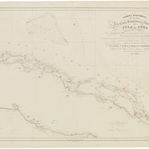
The two principal maps, which were engraved by Herman Moll, are described as follows:
1. A Map of ye Long River and of some others that fall into that small part of ye Great Great River of Missisipi wich is here laid down.
This fascinating and significant map influenced a generation of some of the most important cartographers of the 18th century, including Guillaume de l’Isle and John Senex, and their depictions of the American Northwest. The intriguing map is a composite of two depictions. The first draws a fictitious “Rivière Longue” emanating from the Great Lakes region and the Mississippi, while the second is a depiction of the “Rivière Morte” that was claimed to have been drawn from reports by the Gnacsitares tribe. This latter river system emanated from a Western mountain range, which we now know as the Rocky Mountains, and was linked to another river system on its western side in the region of the “Pais des Mozeemlek.”
Lahontan’s map was influential because it provided the possibility of an internal river route to the Pacific from the Great Lakes region. Lahontan’s depictions of the “Rivière Longue” and the “Rivière Morte,” which eventually became known as the “River of the West” with its various fanciful drawings, might be pure fabrications on the part of Lahontan.
His map is adorned with different markings showing his route to the interior from the French outpost of Misilimakinak as well as displaying the different French trading outposts and forts near Superieur or Upper Lake and Ilinese Lake (Michigan) and native tribes such as the Mozeemlek, the Gnacsitares, the Tahuglauks, the Esanapes, the Eokors who were supposedly located on Lahontan’s fictitious rivers. Also added by Lahontan are drawings of lodgings and canoes of the Tahuglauk tribe and their copper medals.
However, it is conceivable that Lahontan’s depictions were not entirely fabricated and were the result of his discovery or (more likely) his access to native reports of the Missouri River. It should be noted that Lahontan based his recollections on actual travels to the upper Mississippi River valley in 1688 while leading French forces in their conflicts with the Iroquois Nations. As such, native claims of the Missouri River, the longest river in North America, which begins in the Rocky Mountains in Montana and flows east into the Mississippi north of St. Louis, Missouri, could have come to his attention.
Lahontan’s map should, therefore, be seen not only as a fanciful depiction that influenced the cartography of the Northwest but also as a potential first impression of the Missouri, America’s longest river.
2. A General map of New France, com, call’d Canada.
Filled with extensive notations in English, this map extends from the Gulf of St. Lawerence to the Mississippi River. Two critical updates have been made over the corresponding map from the French edition: Long Island now appears, and Long River veers west as a tributary of the Mississippi, thus forming a connection with the Long River map. Essentially a French fur trading map, canoe routes, portages, and outposts are all delineated in great detail.
Overall, Lahontan’s New Voyages to North America is a highly readable and seminal work for the history of New France and North America in the 17th century.
Cartographer(s):
Herman Moll (ca. 1654–1732) was a Dutch-born cartographer, engraver, and publisher who became one of the most prominent mapmakers in England during the late 17th and early 18th centuries.
After migrating to London in the 1670s, Moll quickly established himself in the city’s cartographic and publishing circles. In England, Moll forged relationships with other notable figures, both in the world of cartography and in the broader literary and commercial spheres. His detailed and often innovative maps, covering areas from the British Isles to the world at large, reflected both the political landscape and the expanding knowledge of the world during his era.
Moll’s works are not only significant for their geographical accuracy and detail but also for their cultural and historical insights, often including intricate details and commentary on colonial ambitions and trade routes.
In the 17th century, France laid claim to a vast territory in the Americas. In the 1530s Jacques Cartier claimed Canada for France and had explored the Gulf of Saint Lawrence and the Saint Lawrence River. By the 1580s, the French were trading in furs up the Saint Lawrence River, and in 1682, La Salle had explored the Ohio and Mississippi River valleys, laying claim to the vast Louisiana Territory—mostly the Mississippi Valley—for France.
The next year, 1683, Louis Armand, Baron de Lahontan, age 17, arrived in New France as an officer in the French troupe des marines. Over the next 9 years, he traveled extensively, often leading troops in combat against native peoples. He had an inquisitive spirit, which led to his learning Algonquian, and exploring the land in which he lived. In 1687 and 1688, he led troops in the Iroquois Wars, and commanded the Fort St. Joseph (now Port Huron, Michigan) at the southern tip of Lake Huron. In the summer of 1688, knowing that he would receive no supplies to support his command, he burned the fort, and led his men to Michillimackinac—the strait joining Lakes Huron and Michigan—where he hoped to find supplies. During that winter and the following spring, Lahontan explored extensively in the region and to the south in the upper Mississippi valley. Lahontan served until 1692, when, after a conflict with the governor, he deserted service and found passage to Portugal.
Lahontan was an explorer in the sense that he was the first European to travel in certain areas of the North American continent, but his explorations were in lands already claimed by France due to the explorations of La Salle some years earlier. Lahontan’s travels are best known because of his books. In 1703, unable return to France for having deserted service in New France, he was living in Amsterdam, where he published the two volumes of his book New Voyages in North America [Nouveaux Voyages de Mr. Le Baron de Lahontan Dans L’Amerique Septentrionale].
This book was extremely popular and influential in its day—over 20 editions were published from 1703 to the 1740s, including English, Dutch, and German editions, as well as the original French—and is still recognized as perhaps the best seventeenth century book on New France, despite some parts that may be fabrication. It contains extensive descriptions of his exploration of the land, including beaver hunting grounds, portages, French forts, and native and Jesuit settlements. In addition to its descriptions of America, the New Voyages to North America include an extensive political and philosophical dialogue that contains one of major early 18th-century exemplars of the “noble savage,” in the character of one Adario [i.e., “the Rat,” based on the real Huron chief Kondiaronk], a supposed Huron chief, who debates with the character Lahontan on a range of religious, philosophical, and political issues in the course of the four dialogues included in the second volume.
One of his most notable discoveries was La Rivière Longue, which was possibly the Missouri River valley, or was possibly no more than a fiction. As described in more detail below, this idea would have an enormous and lasting impact on the European cartographic representations of North America for nearly a century to follow.
Condition Description
Excellent.
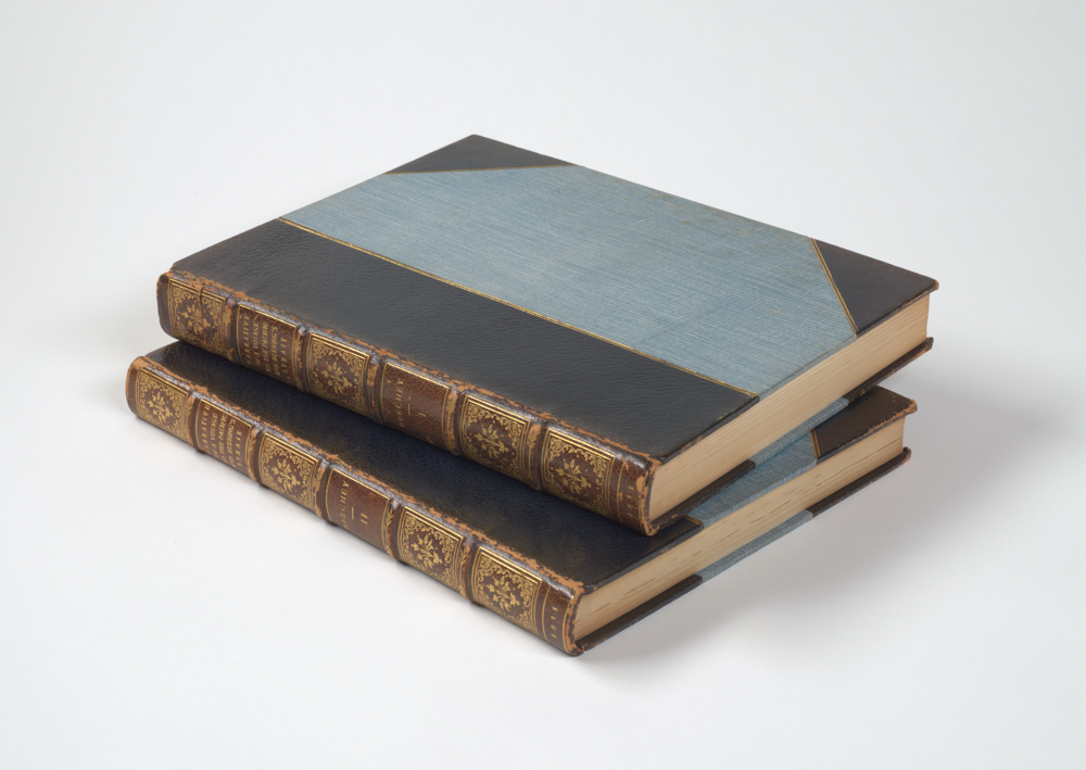
Engraved frontispiece (map of Lake Huron in volume one) in each volume and 21 plates (some folding), 2 engraved folding maps (backed with linen). Lacking the advertisement leaf in volume one, a few plates closely trimmed with slight loss. Early 20th century paneled calf, gilt extra by Zaehnsdorf (re-backed preserving original spines); modern black quarter calf slipcases and chemises.
Provenance: bookplates of Daniel T. Patton on the front paste-down of each volume; Frank Sherwin Streeter (1918-2006) (Collection of Important Navigation, Pacific Voyages, Cartography and Science).
References
Kershaw 299-306, Mapp, P., The Elusive West and the contest for Empire, 2011. Howes L25; Karpinski p. 127; Kershaw #282, #289, #298; McCorkle 703.3, 703.4; Wheat #86.