-
-
Add to cart
![[Pictorial Map of Oahu] / Piggy Bank Rates on U-Drives (verso).](https://neatlinemaps.com/wp-content/uploads/2026/05/NL-02591_thumbnail-300x300.jpg) Quick View
Quick View - Pacific Northwest - Hawaii - Alaska, United States
[Pictorial Map of Oahu] / Piggy Bank Rates on U-Drives (verso).
- $175
- Piggy Bank Rates and Diamond Head — Oahu in 1965.
-
-
-
-
Add to cart
![The Island of Hawaii, The Big Island of the Territory of Hawaii… [with] Street Map of Hilo showing points of interest (verso).](https://neatlinemaps.com/wp-content/uploads/2026/05/NL-02590_thumbnail-300x300.jpg) Quick View
Quick View - Pacific Northwest - Hawaii - Alaska, United States
The Island of Hawaii, The Big Island of the Territory of Hawaii… [with] Street Map of Hilo showing points of interest (verso).
- $275
- [First edition?] Ruth Taylor White Pictorial Map of the Island of Hawaii.
-
-
-
-
Add to cart
![North Pacific Coast Hawaiian Islands South Coast of Oahu Pearl Harbor [Confidential].](https://neatlinemaps.com/wp-content/uploads/2026/04/NL-02556_thumbnail-300x300.jpg) Quick View
Quick View - Pacific Northwest - Hawaii - Alaska, United States, World War I and World War II
North Pacific Coast Hawaiian Islands South Coast of Oahu Pearl Harbor [Confidential].
- $1,400
- 1944 U.S. Navy Confidential Nautical Chart of Pearl Harbor, with post-Attack modifications.
-
-
-
-
Add to cart
 Quick View
 - Pacific Northwest - Hawaii - Alaska
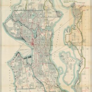
A Map for the City of Seattle and adjacent territory accompanying a report of MUNICIPAL PLANS COMMISSION.
- $1,200
- The famous ‘Bogue Plan’ of Seattle: an ambitious urban design for the city and environs from 1911.
-
-
-
-
Add to cart
 Quick View
 - Pacific Northwest - Hawaii - Alaska
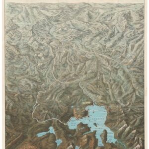
Mount St. Helen’s Quadrangle (7.5 Minute Series)
- $575
- Washington’s dramatic volcanic peak, taken a few years before the catastrophic 1980 eruption.
-
-
-
-
Add to cart
 Quick View
 - Bird's-eye-views, Pacific Northwest - Hawaii - Alaska
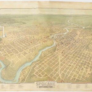
Spokane. Washington.
- $4,500
- A scarce and gorgeous bird’s-eye-view of Spokane during its heyday as the railroad hub of the Northern Plains.
-
-
-
-
Add to cart
 Quick View
 - Bird's-eye-views, Pacific Northwest - Hawaii - Alaska, Texas and The West
Yellowstone National Park. Northern Pacific Railway / Northern Pacific Railway Company for Yellowstone National Park Puget Sound and Alaska.
- $700
- A magnificent view of one of America's most majestic parks in its original envelope.
-
-
-
-
Add to cart
 Quick View
 - Pacific Northwest - Hawaii - Alaska
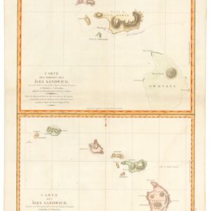
Carte des Parties des Îles Sandwich & Carte des Îles Sandwich.
- $1,600
- History’s second mapping of Hawaii.
-
-
-
-
Add to cart
 Quick View
 - Pacific Northwest - Hawaii - Alaska, United States, Pictorial maps
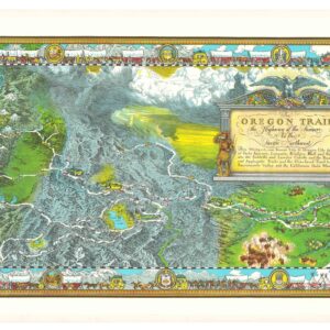
The Oregon Trail: The Highway of the Pioneers to the Pacific Northwest.
- $575
- William Forsyth McIlwraith’s vibrant and historically rich Oregon Trail map.
-
-
-
-
Add to cart

 Quick View
 - Americas, North America, Pacific Northwest - Hawaii - Alaska, United States
A Chart of North and South America, Including the Atlantic and Pacific Oceans, with the nearest Coasts of Europe, Africa, and Asia
- $4,200
- Sayer-Bennet-Mead's 1775 chart of the Western Hemisphere with Pacific and Arctic routes of exploration.
-
-
-
-
-
Add to cart
 Quick View
 - Pacific Northwest - Hawaii - Alaska, United States, Europe, Russia & Eastern Europe, Atlases & Books
Account of the Russian discoveries between Asia and America. To which is added the conquest of Siberia and the history of the transactions and commerce between Russia and China.
- $900
- The most comprehensive English assessment of Russian explorations in the Arctic and Pacific ever written.
-
-
-
-
Add to cart
 Quick View
 - Pacific Northwest - Hawaii - Alaska
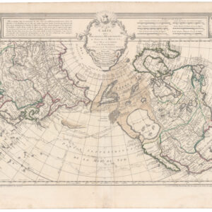
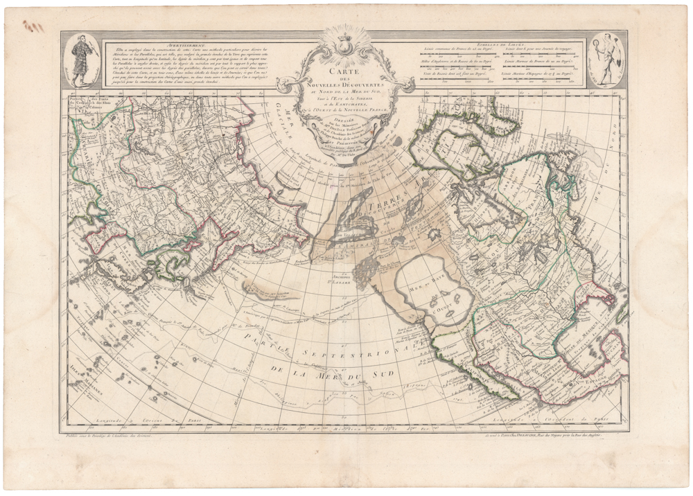
Carte Des Nouvelles Decouvertes Au Nord de la Mer de Sud, Tant a l’Est de la Siberie et du Kamtchatcka, Qu’a l’Ouest de la Nouvelle France, Dressee sur les Memoires…1750
- $1,800
- Famed North Pacific map, with a giant Sea of the West and the dubious discoveries of Admiral de Fonte.
-
-
-