-
-
Add to cart
 Quick View
 - Russia & Eastern Europe
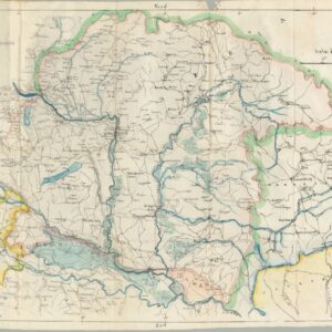
Cenni Geografico-Storici sull’Ungheria.
- $975
- Unrecorded 1849 Italian guide and history of Hungary published in Florence during the height of the Hungarian Revolution.
-
-
-
-
Add to cart
 Quick View
 - Russia & Eastern Europe, World War I and World War II
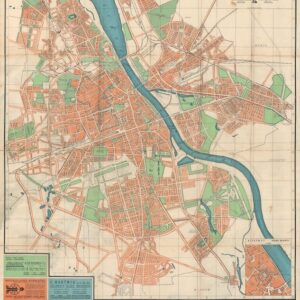
Stadtplan von Warschau / Plan Warszawy.
- $1,200
- With blue over-print highlighting the Jewish Ghetto.
-
-
-
-
Add to cart
 Quick View
 - Europe, Russia & Eastern Europe
Carte de l’Esclavage en U.R.S.S.
- $875
- An early map of Stalin’s horrific Gulag system by one of the most ardent critics of Communism in the United States.
-
-
-
-
Add to cart
 Quick View
 - Europe, Russia & Eastern Europe
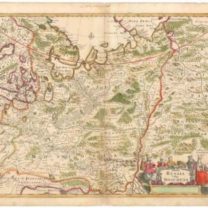
Tabula Russia Vulgo Moscovia.
- $425
- A grand depiction of the Russian Empire by one of the best representatives of the Golden Age of Dutch cartography.
-
-
-
-
Add to cart
 Quick View
 - Pacific Northwest - Hawaii - Alaska, United States, Europe, Russia & Eastern Europe, Atlases & Books
Account of the Russian discoveries between Asia and America. To which is added the conquest of Siberia and the history of the transactions and commerce between Russia and China.
- $900
- The most comprehensive English assessment of Russian explorations in the Arctic and Pacific ever written.
-
-
-
-
Add to cart
 Quick View
 - Curiosities - Miscellanea, Europe, Iran - Persia - Central Asia, Russia & Eastern Europe
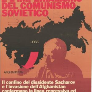
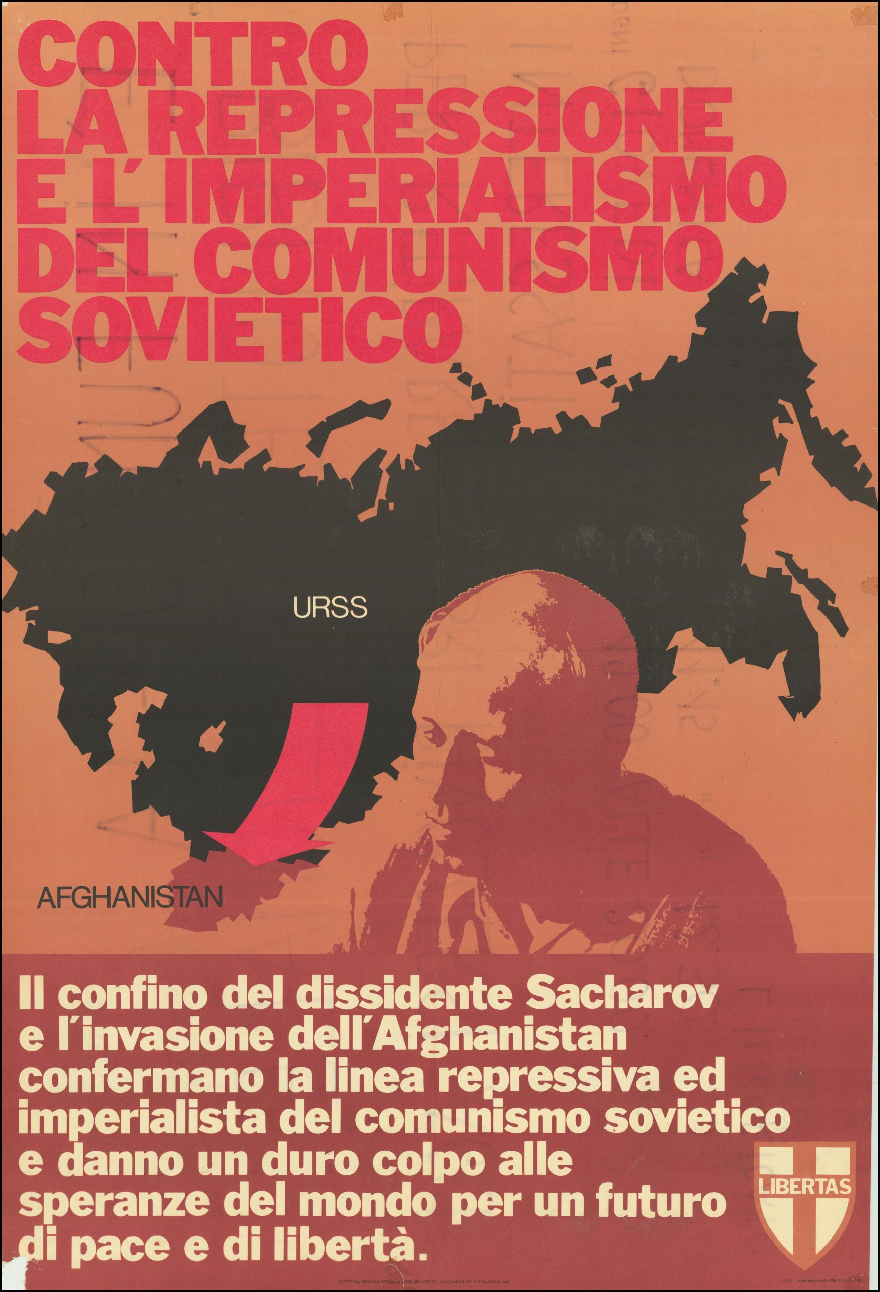
Contro La Repressione e L’Imperialismo del Comunismo Sovietico.
- $750
- Italian Anti-Communist Poster protesting the Soviet invasion of Afghanistan and the arrest of peace activist and nuclear physicist, Andrey Sakharov.
-
-
-
-
-
Add to cart
![[Map of Steamship Routes and the Railways and Post Roads of the Russian Empire]](https://neatlinemaps.com/wp-content/uploads/2020/04/NL-00827_Thumbnail-300x300.jpg)
![[Map of Steamship Routes and the Railways and Post Roads of the Russian Empire]](https://neatlinemaps.com/wp-content/uploads/2020/04/NL-00827-scaled.jpg) Quick View
Quick View - Europe, Russia & Eastern Europe
[Map of Steamship Routes and the Railways and Post Roads of the Russian Empire]
- $1,850
- In-progress construction of the Trans-Siberian Railway: a scarce wall map depicting the transportation network of the Russian Empire at the end of the 19th century.
-
-
![[Map of Steamship Routes and the Railways and Post Roads of the Russian Empire]](https://neatlinemaps.com/wp-content/uploads/2020/04/NL-00827-scaled-300x300.jpg)
-
-
-
Add to cart
![[Title in Russian] Russian Empire in the 18th Century (European Section)](https://neatlinemaps.com/wp-content/uploads/2020/04/NL-00822_Thumbnail-300x300.jpg)
![[Title in Russian] Russian Empire in the 18th Century (European Section)](https://neatlinemaps.com/wp-content/uploads/2020/04/NL-00822-scaled.jpg) Quick View
Quick View - Russia & Eastern Europe, Curiosities - Miscellanea
[Title in Russian] Russian Empire in the 18th Century (European Section)
- $675
- Educating school children during the Cold War: Soviet historical wall map of the Russian Empire in the 18th century.
-
-
![[Title in Russian] Russian Empire in the 18th Century (European Section)](https://neatlinemaps.com/wp-content/uploads/2020/04/NL-00822-scaled-300x300.jpg)
-