A grand depiction of the Russian Empire by one of the best representatives of the Golden Age of Dutch cartography.
Tabula Russia Vulgo Moscovia.
$425
1 in stock
Description
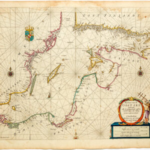
Frederick de Wit’s map of the Russian Empire, Tabula Russia Vulgo Moscovia, is an impressive testament to the cartographic artistry of Dutch mapmakers in the 17th century. Crafted in the 1670s and printed in Amsterdam in 1680, this vivacious copper engraving includes intricate original coloring, enhancing its visual allure. The copper printing plate was carved by the French Huguenot Jan l’Huilier, who had sought fled religious persecution and settled in Calvinist Amsterdam.
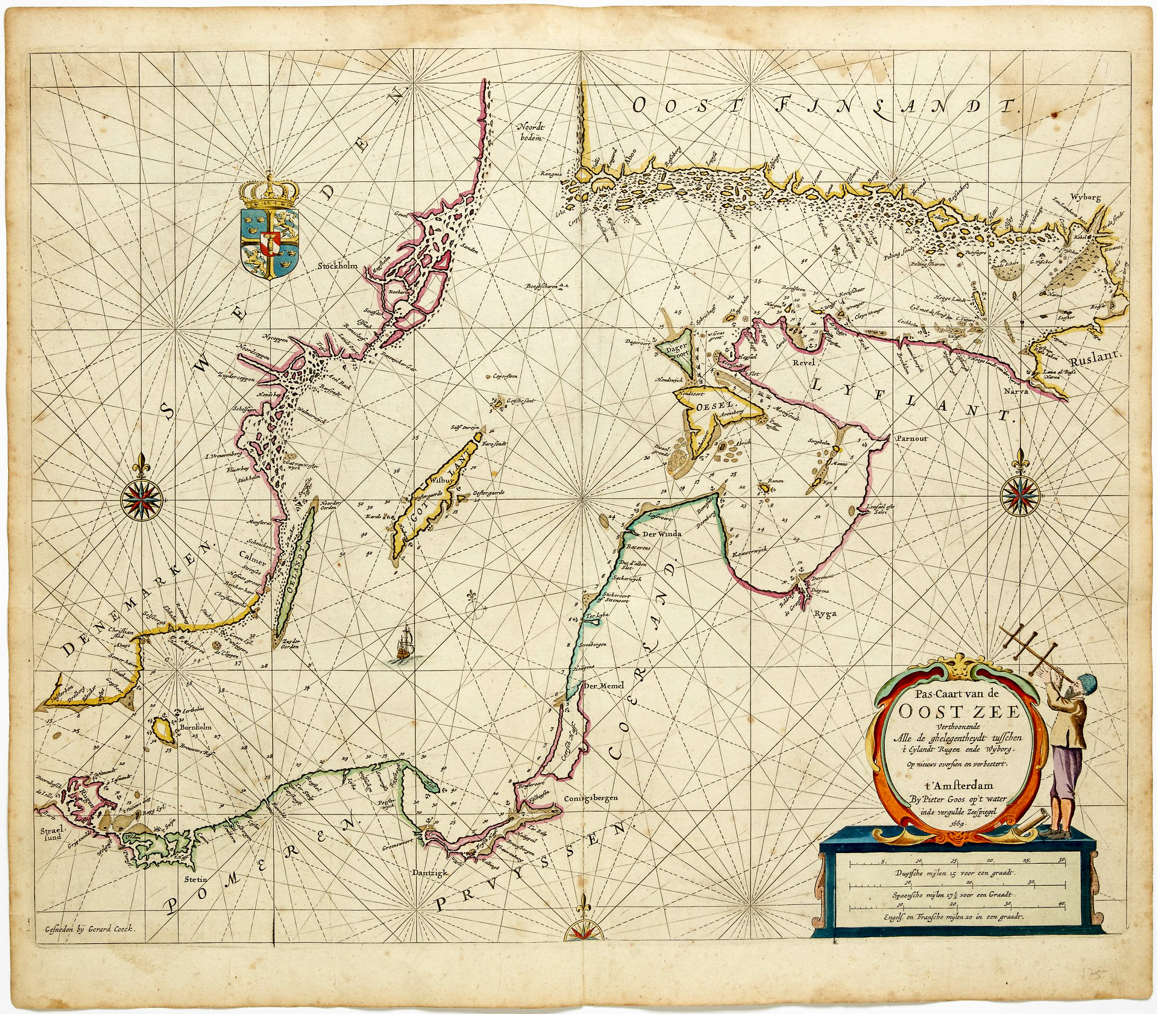
The map encompasses a vast expanse, spanning from the Arctic Ocean to the Black Sea and from the Gulf of Bothnia to eastern Siberia, providing detailed cartographic insight into European Russia. In meticulous detail, De Wit’s map delineates western Russia and much of Finland with groundbreaking precision. The map’s scope encompasses cities like Jaroslavl, Niznij Novgorod, and Kazan, depicting geographical nuances like their placement along rivers, within forests, and amidst vast mountain ranges.
The embellished title cartouche captures particular attention and aligns with De Wit’s high aesthetic aspirations. The composition is adorned with intricate designs and flanked by five figures, representing royalty and hunting – two elements of Russian imperial society that were intimately connected.
In sum, this map boasts many rich embellishments and is highlighted by a large, ornate cartouche teeming with human and animal figures. These elements add a sense of grandeur and cultural richness to this cartographic marvel.
Cartographer(s):
Frederick de Wit (1629–1706) was a Dutch cartographer and artist who drew, printed, and sold maps from his studio in Amsterdam. He was a pioneer of Dutch Golden Age cartography, and the founder of one of the most famous map-publishing houses in Amsterdam. He was born in Gouda but moved to Amsterdam at the end of the Thirty-Years-War (1618-48), which had engulfed most of Europe and ultimately liberated the Netherlands from centuries of Spanish dominion.
Soon after arriving in Amsterdam, probably in 1654, De Wit opened a printing shop named The Three Crabs (De Drie Crabben). A year or two before, he had married Maria van der Way, the daughter of a wealthy Catholic merchant, and this may have helped secure the funding to start his new operation. His aspirations as a cartographer were nevertheless made clear when he shortly after changed the name to The White Chart (Het Witte Pascaert), under which he gained international renown.
In the latter half of the century, De Wit began drawing, copying, and publishing atlases and maps. By the 1670s he was issuing large folios with up to a hundred maps in each tome, including a famous nautical atlas in 1675. From 1689, De Wit received a state privilege from the Dutch government to draw and issue maps. This protected his work from the illegal copying known from his earlier charts. De Wit was among the first to apply extensive coloring and his original color atlases and continental charts remain highly sought after to this day.
Following De Wit’s death in 1706, his wife ran the business for four years before selling it at auction in 1710. Their only surviving son was a successful merchant in his own right and had no interest in taking over. At the 1710 auction, most of De Wit’s plates were sold to Pieter Mortier, another Amsterdam cartographer and engraver. After passing the firm to his son, who teamed up with Johannes Covens, the firm became Covens & Mortier, the largest cartographic publisher of the eighteenth century.
Condition Description
Some loss visible at fold line, discoloration. Small tear in upper right.
References
![Delimitation de la Zone Occupee [German Occupation of France]](https://neatlinemaps.com/wp-content/uploads/2019/12/NL-00782-scaled-300x300.jpg)
![Delimitation de la Zone Occupee [German Occupation of France]](https://neatlinemaps.com/wp-content/uploads/2019/12/NL-00782-scaled.jpg)