Dufour’s Map of British and Portuguese Colonies on the Indian Subcontinent.
INDES, Colonies Anglaises.
$500
1 in stock
Description
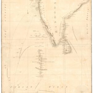
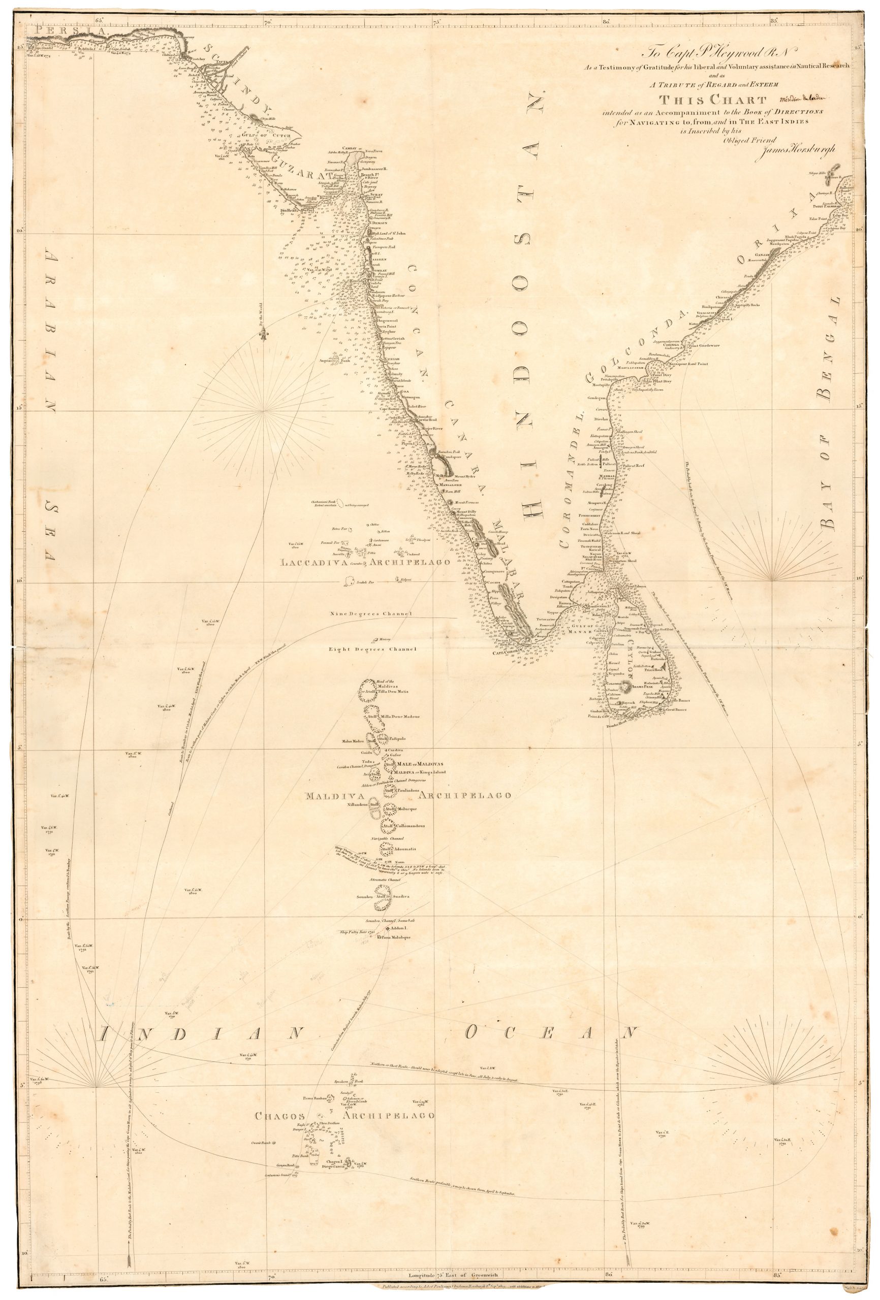
This large format map of the British and Portuguese colonies in India was produced by the French mapmaker A. H. Dufour and issued in 1858. It is a folding case map comprising 20 panels mounted on fine canvas. The map is a remarkable and detailed representation of Southeast Asia, India, and the region’s English and Portuguese colonies. It offers a comprehensive view, spanning from Afghanistan in the northwest to the Gulf of Manaar in the south and from the vast Chinese Empire to the east (including the regions of Malacca and Borneo) to the vast Indian Ocean in the west.
Key Features of the Map
1. Geographical Coverage: The map extensively covers Southeast Asia, with a primary focus on India and the English colonies. It encompasses an impressive expanse, from the rugged terrain of Afghanistan through the mystical lands of Tibet and China and south through India to Sri Lanka.
2. Topographical Details: The map is rich in topographical detail. It highlights prominent features of the landscape, including rivers, islands, and mountains. This topographical information adds depth and context to the map, making it a valuable resource for understanding the region’s geography.
3. Territorial Boundaries: The map accurately delineates the regional boundaries throughout the depicted area. It meticulously demarcates the borders of most counties and territories of India, as well as both English (outlined in blue) and Portuguese (outlined in yellow) colonies. In doing so, the map precisely represents political divisions at the time.
4. Towns and Infrastructure: The map features an intricate network of major roads and towns, granting viewers a fundamental understanding of the infrastructure and distribution of urban centers in the 19th century.
5. Hand-Coloring: The map is adorned with original hand coloring, which enhances the visual appeal and adds vibrancy and clarity to the map, making it aesthetically pleasing and easy to interpret.
6. Large Format: The map is presented in a large format, which provides a comprehensive view of the region. It consists of 20 panels that are expertly mounted on fine canvas, ensuring its durability and longevity.
In sum, this large, beautifully hand-colored map is a remarkable cartographic representation of Southeast Asia, India, and the English colonies of the Victorian Age. It offers a wealth of geographical and political information and a detailed topography, making it a valuable resource for historians, geographers, and collectors interested in the 19th-century depiction of this region.
Census
The map was prepared by Auguste-Henri Dufour and engraved by Charles Dyonette. It was published as plate 34 of the 1858 edition of the Universal Atlas, Physics, History, and Politics of Ancient and Modern Geography by Armand Le Chevalier.
Cartographer(s):
Adolphe Hypolite Dufour (1798-1865) was a French geographer and mapmaker. Dufour studied with Lapie and worked with him on several maps for the Dépôt de la Marine. In 1824, he published the first map under his name: A Geographical Analysis of the Map of Palestine. After his initial success, Dufour took part in many historical and topographical publications for which he prepared and drew plans and maps. Dufour contributed maps and insights to many well-known French publications, but he is most famous for the Dufour atlas, a physical, historical, and political atlas of France, its departments, and its colonies (106 maps) published in 1857. Among Auguste Henri Dufour’s students was Alexandre Vuillemin.
Condition Description
Very good. Folding map on original linen with orginial marbled case.
References
![[Sri Lanka] Tabula Duodecima Dasia.](https://neatlinemaps.com/wp-content/uploads/2023/03/NL-01721_thumbnail-300x300.jpg)