Settling the Southern Part of San Francisco.
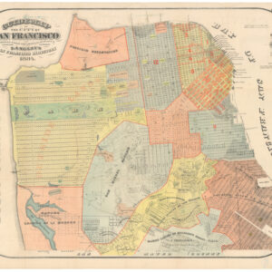
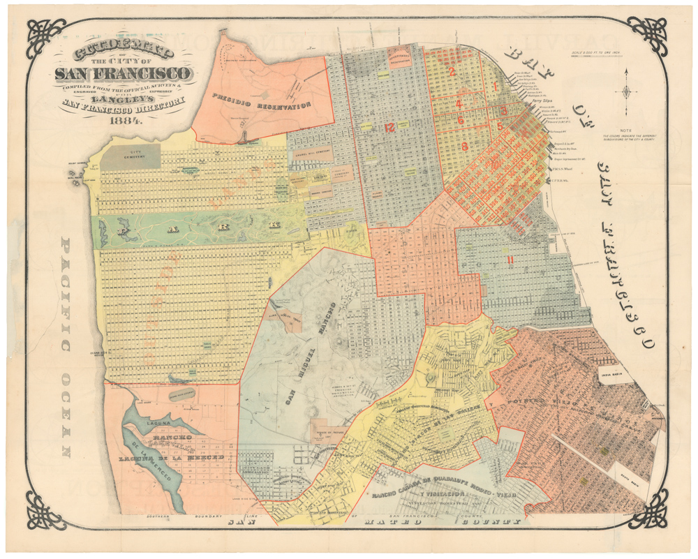
Map of the City & County of San Francisco, from the Latest Certified Data.
$575
1 in stock
Description
A highly detailed circa 1925 map of San Francisco by H. A. Candrian. Streets, block numbers, streetcar lines, railways, parks, schools, military reservations and facilities, cemeteries, golf courses, and other features are noted throughout. Concentric circles emanate from the Ferry Building at half mile intervals.
The map is especially interesting for reflecting the development of the southern and western portions of the city. A number of earlier “tracts” set aside by the city are labeled, as are the remnants of the Rancho San Miguel and Rancho Laguna de Merced. Other areas were owned by land, homestead, and development associations or companies. The entire southwestern and southern part of the city was undergoing rapid development at the time, with some recently-built neighborhoods defying the city’s fairly uniform grid, such as St. Francis Wood and Ingleside Terrace.
Some of this development shown here was speculative. For instance, much of the grid laid out in University Mound was not ultimately built as mapped here but instead became a park, initially named Mission Park and later renamed McLaren Park, that surrounded the old ladies’ home and the Somps Tract.
Although not dated, from context the map must have been published in either 1925, when the streetcar line traced in green (“New Car Line to Ocean View”) opened, or 1926, when the future McLaren Park was set aside by the Board of Supervisors. In addition to the just-mentioned streetcar line, some information (such as the labels for Olympic Gold Club and Lake Merced Golf and Country Club at bottom-left) looks to have been added later, suggesting that here Candrian has updated a somewhat earlier map without changing its fundamental design.
Candrian’s maps of San Francisco are among the most detailed and desirable maps of the city in the early 20th century. Because they are often undated, catalog listings cannot be entirely reliable. However, the present example may correspond to a map listed in the OCLC (47913027) and speculatively dated to 1935, noted among the holdings of six institutions.
Cartographer(s):
Hermon Anton Candrian (fl. c. 1881-1940) was an American map publisher active in San Francisco in the first half of the 20th Century.
Condition Description
Wear along fold lines (toning along fold lines on verso). Two small areas of infill along fold lines.
References