A pioneering road atlas covering the Bay Area and Monterey.
[Bay Area Road Atlas] Auto Roads of San Francisco and Oakland to Monterey and Santa Cruz.
$2,800
1 in stock
Description
The early 20th century saw the emergence of automobile travel in California. The first road atlas to cover Northern California, especially the Bay Area, was produced in 1907 and is extremely rare. The atlas offered here was issued only a year later and is of similar scarcity.
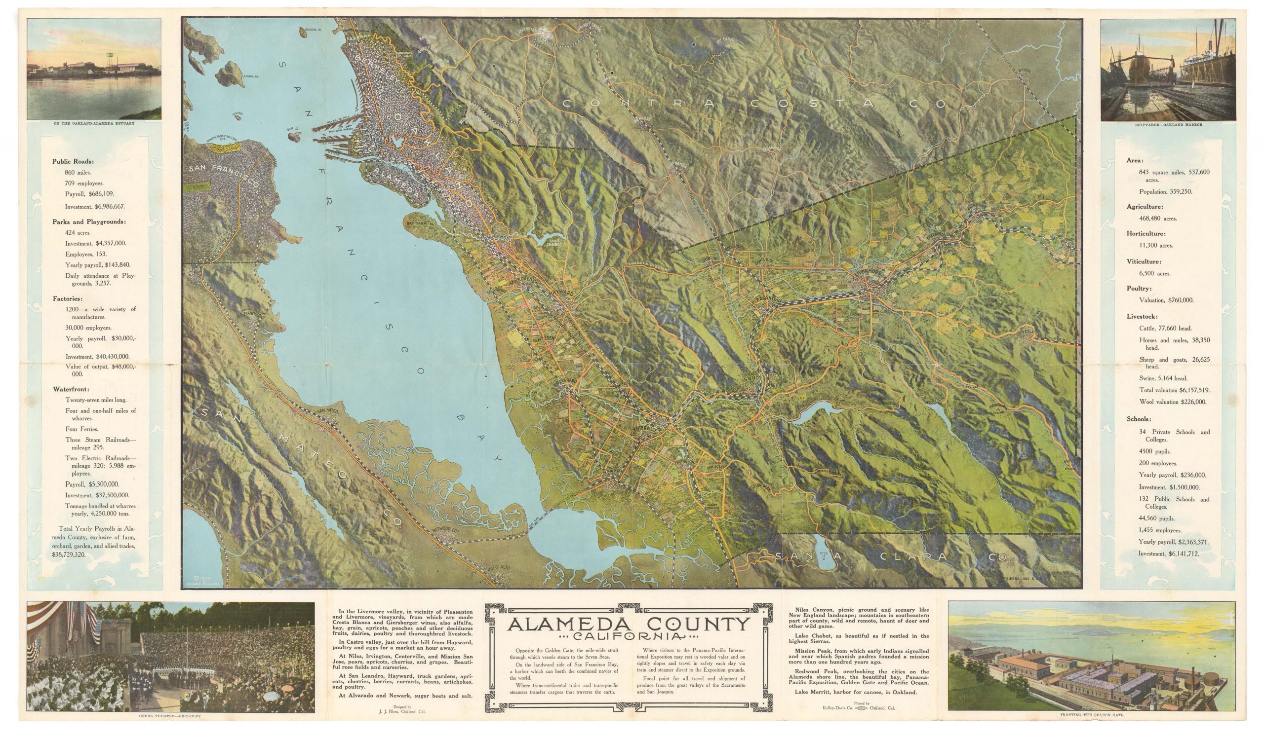
This historical document sheds light on the infancy of American car culture on the West Coast, meticulously outlining routes from major urban centers like San Francisco and Oakland to coastal destinations including Monterey and Santa Cruz. It contains eight maps that denote landmarks and the optimal roads to take and inform motorists of more subtle aspects, such as slope gradients or the intersection of different routes. It served as an indispensable guide for those first pioneering motorists.
A new way to move
The emergence of the first gasoline-powered vehicle in the West began in 1897 and was soon followed by the establishment of Southern California’s first Automobile Club in 1900. The club heralded a new era of mobility. Despite the increasing popularity of automobiles, intercity travel posed significant challenges due to unmarked and poorly maintained roads. To mitigate these issues, institutions like the Automobile Club delineated the best routes and installed signage, thus laying the groundwork for smoother motorcar journeys.
By 1908, the popularization of car ownership loomed large, notably with Henry Ford’s introduction of the Model T. This early atlas, which predates the watershed California Highway Act of 1910, captures a pivotal moment in this transition towards independent automobile ownership. At the time of this atlas’ publication, which predated the dominance of industry giants like Ford, smaller car manufacturers flourished, as evidenced by the advertisements interspersed within the pages of our atlas. With the infrastructure for automobile travel still at its formative stages, the Auto Roads of San Francisco and Oakland to Monterey and Santa Cruz represents the enthusiasts’ dedication to opening up California’s scenic beauty to motorized exploration.
Content and sister publications
The atlas contains a total of eight maps. Even though the numbering of these appears inconsistent, the introduction text confirms the inclusion of all eight maps as initially intended. The most likely explanation for the irregular numbering is that the maps originated from a more extensive collection with its internal numbering system, presumably the internal collection of maps featured in other publications by C.J. Gray & Co.
The eight maps included cover the following stretches:
- San Francisco to Redwood
- Redwood to San Jose
- Oakland to Alvarado or Decoto
- Alvarado or Decoto to San Jose
- Gilroy to San Jose
- San Juan to Monterey
- Santa Cruz to San Juan [Bautista]
- Watsonville to Salinas
In light of the rapidly expanding motorist in California, it is interesting to note that the introduction to our atlas also references three other road atlases published by Gray & Co. that year, stressing just how early they were on this market:
1. Central California, priced at $2.50, showcasing roads in Marin, Sonoma, Lake, Mendecino, Alameda, Contra Costa, Santa Clara, and Santa Cruz Counties, as well as the Coastal Route to Los Angeles.
2. Southern California, priced at $2.50, and illustrating the road from San Francisco to Los Angeles and encompassing all of Southern California.
3. Northern California, priced at $2.50, and depicting routes to Redding and Yosemite Valley, as well as through Fresno and Bakersfield to Los Angeles.
Indeed, preceding the California Highway Act of 1910 and the first strip maps issued by the Automobile Club of Southern California (1912), the early road atlases from Gray & Co are a tribute to the adventurous spirit of early automotive pioneers and the evolving landscape of American mobility.
Cartographer(s):
C. J. Gray & Co. was a California-based maps and road atlases publisher in the early 20th century. They created some of the pioneering road maps of California in the 1900s.
Condition Description
Very minor wear and creasing. Price reduction "25c" stamp in the lower right corner.
References