Before Silicon Valley: a stunning, large-scale 1910 map of San Mateo County.
Map of the County of San Mateo California Compiled from the County Records by Davenport Bromfield, Civil Engineer, Ex-County Surveyor, 1910.
$6,500
1 in stock
Description
A scarce and extremely detailed 1910 map of San Mateo County on four sheets, produced by Davenport Bromfield, formerly the county surveyor. It details the ownership of land plots and coastal waters throughout the county with their size noted in acres, while also indicating town and section lines, the location of former ranchos, rail lines, streets, and a variety of geographical features.
San Mateo County split off from San Francisco County in 1856, setting a dividing line at San Bruno Mountain (not marked but located at the top at the Rancho Canada de Guadalupe la Visitacion y Rodeo Viejo). In 1868, the new county annexed a portion of northern Santa Cruz County and assumed its present borders. In San Mateo County’s early years, a long-running and bitter dispute ran over the location of the county seat, which was originally designated and ultimately confirmed as Redwood City.
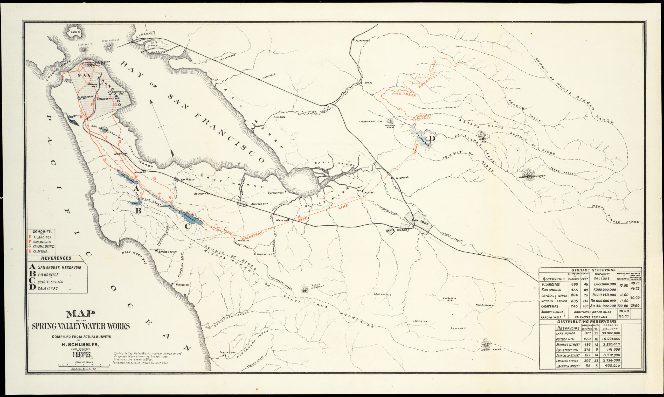
Major property owners include one of several land or land improvement companies, water companies (especially the Spring Valley Water Works), lumber companies, the Morgan Oyster Co., and Stanford University, just beyond the county limits in Santa Clara County. Other property owners include descendants of past and contemporary members of the San Francisco elite, such as Ralston, Crocker, Mills, and the “John Center Co.” Less famous landowners played a prominent role in the local community and had lives just as dramatic and colorful as the San Francisco grandees. For instance, Loren Coburn, who owned most of the land around Pigeon Point Lighthouse in Pescadero, was known for his eccentricity and feistiness, battling renters, relatives, and the county over property rights and his own mental competence in courts for decades. Coburn died in 1918 at the age of 92; the following year, someone murdered his widow in their home, possibly a relative’s attempt to gain the family’s considerable inheritance.
Present also are landowners with Spanish names, who, in at least some cases, are likely descendants of pre-statehood owners of the ranchos. Forty acres belonging to ‘Chung Hong’ in Daly City are also notable, as they appear to be the site of the Chinese Cemetery, financed by the Six Companies (六大公司) of San Francisco. As part of the general disinterment of graves in San Francisco, the remains of thousands of Chinese in City Cemetery (Lincoln Park) were relocated first to a dedicated cemetery in Colma, which had already assumed its specialized role as a city of cemeteries. The remains were then either repatriated to China (generally Taishan / Toishan) or to the nearby Chinese Cemetery in Daly City, a process undertaken around the time of this map’s publication. This plot is significant because discrimination against Asian Americans was intense at the time, with social taboos and legal restrictions on selling land to Asian Americans, culminating in the California Alien Land Law passed three years later.
A number of towns and neighborhoods appear that are no longer extant, having been absorbed by nearby communities or reverted to parkland (much of the western side of this map is now state parkland). Spanishtown, perhaps the oldest town in the county, had already been renamed Half Moon Bay by this point, but the town’s earlier name continued to be used interchangeably. Here, a string of small neighborhoods along the Pacific coast mimic the names of beach towns in Los Angeles (Venice, Redondo, Manhattan).
The Ocean Shore Railroad can be seen at left; this ambitious route was meant to seamlessly connect San Francisco and Santa Cruz via interurban electric railway, but legal and financial troubles held up the project for years. Construction did not begin until 1905, with the earthquake the following year dooming the railway’s fortunes; it was defunct by 1921. The lines of the Southern Pacific at right have enjoyed greater longevity, today forming the basis of the Caltrain passenger service.
Census
This map was prepared by Davenport Bromfield and lithographed by Britton and Rey in San Francisco in 1910. It is held by Stanford University, the University of California Santa Cruz, the University of California Berkeley, the University of California Davis, and the California Historical Society (in some cases, the sheets have been joined and, in at least one instance, placed on rollers).
This map is a successor to Bromfield’s similarly huge 1894 map of San Mateo County (“Official map of San Mateo County, California,” lithographed by Schmidt Label & Lith., Co.), produced while he was still the County Surveyor. On their own and in comparison, the two maps highlight important changes in the development of the county in its early decades.
Cartographer(s):
Britton & Rey (1852 – 1906) was a lithographic printing firm based in San Francisco and founded by Joseph Britton and Jacques Joseph Rey in 1852. Especially during the second half of the 19th century, Britton and Rey became the leading lithography firm in San Francisco, and probably California. Among their many publications were birds-eye-views of Californian cities, depictions of the exquisite landscapes, stock certificates, and no least maps. While Rey was the primary artist, Britton worked not only as the main lithographer but was essentially also the man running the business. In addition to their own material, the firm reproduced the works of other American artists like Thomas Almond Ayres (1816 – 1858), George Holbrook Baker (1824 – 1906), Charles Christian Nahl (1818 – 1878), and Frederick August Wenderoth (1819 – 1884). Following Rey’s death in 1892 Britton passed the form on to Rey’s son, Valentine J. A. Rey, who ran it until the great earthquake and fire of 1906 destroyed most of the company’s assets.
Joseph Britton (1825 – July 18, 1901) was a lithographer and the co-founder of the prominent San Francisco lithography studio Britton and Rey. He was also a civic leader in San Francisco, serving on the Board of Supervisors and helping to draft a new city charter. In 1852, he became active in lithography and publishing, first under the name ‘Pollard and Britton,’ and then ‘Britton and Rey,’ a printing company founded with his friend and eventual brother-in-law Jacques Joseph Rey. Britton and Rey became the premier lithographic and engraving studio of the Gold Rush era, producing letter sheets, maps, and artistic prints.
Jacques Joseph Rey (1820 – 1892) was a French engraver and lithographer born in the Alsatian town of Bouxwiller. At the age of about 30, he emigrated to America, eventually settling in California. Here, he soon entered into a partnership with local entrepreneur and civic leader Joseph Britton. Three years later, Rey also married Britton’s sister, allowing his business partner and brother-in-law Britton to live in their house with them. Rey and Britton were not only an important part of the San Francisco printing and publishing scene but also owned a plumbing and gas-fitting firm. In the early years, both men would sometimes partner up with others on specific projects, but by the late 1860s, their partnership was more or less exclusive.
Davenport BromfieldDavenport Bromfield (July 2, 1862 – August 22, 1954) was an Australian-born civil engineer and surveyor active in San Francisco in the late 19th and early 20th centuries. Relocating to San Francisco in 1870, Bromfield apprenticed as a civil engineer, then took a surveyor position in San Francisco and later became the County Surveyor of San Mateo County.
Both in his official role and later operating as a private business, Bromfield was the most prolific surveyor of San Mateo County in its early decades, producing highly detailed maps of the entire county as well as cities and towns in the region. In the early 20th century, these were sometimes published in conjunction with Hermon Anton Candrian, a prominent publisher of maps of San Francisco.
Condition Description
Very good. Linen backed. Four unjoined sheets, as issued. Chipping along edge and in one spot in main part of sheet. Minor damp staining along edge.
References
