-
-
Add to cart
- California, Mexico - Central & South America, North America, World
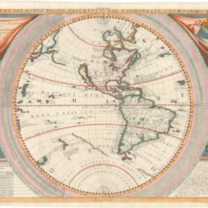
Planisfero Del Mondo Vecchio, Descritto Dal P. Coronelli, Cosmographo Publico.
- $2,600
- Stunning, full-color Coronelli map of the New World with California as an Island.
-
-
-
-
Add to cart
- Americas, Cuba, West Indies, Caribbean, East & Midwest United States, North America
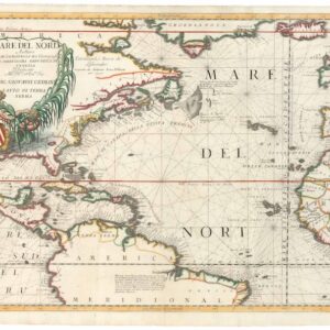
Mare del Nord.
- $2,200
- A gorgeous full-color example of Coronelli's chart of the Eastern Seaboard and North Atlantic.
-
-
-
-
Add to cart
- Americas, Mexico - Central & South America, North America
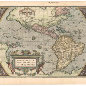
Americae Sive Novi Orbis, Nova Descriptio.
- $4,800
- Ortelius’ decisive mapping of the Western Hemisphere.
-
-
-
-
Add to cart
- North America
Carte de l’Amerique et des Mers Voisines.
- $475
- Bellin's splendid rendition of the Americas at the end of the French & Indian War, with Le Petit Atlas Maritime's distinctive green tinting.
-
-
-
-
-
Add to cart
- Americas, North America
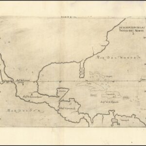
Descripcion De Las Yndias Del Norte.
- $2,800
- A rare early edition of Antonio de Herrera’s secret map of New Spain.
-
-
-
-
Add to cart
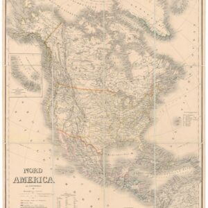
- North America
Nord America mit Westindien.
- $475
- A detailed German map of North America providing the latest configuration of the American West.
-
-
-
-
Add to cart
- Americas, North America
Nord-Amerika.
- $1,200
- Von Sydow’s geophysical wall map of North America.
-
-
-
-
Add to cart

- Americas, North America, Pacific Northwest - Hawaii - Alaska, Texas and The West
Map of Oregon Territory.
- $550
- One of the earliest maps of Oregon Territory.
-
-
-
-
Add to cart

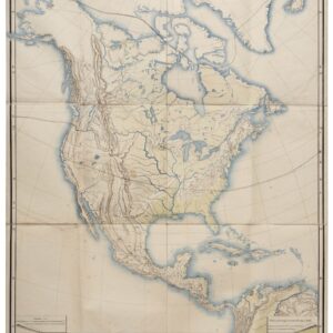
- Americas, North America, United States
Charte Von Nord America Entworfen und gezeichnet von C.G. Reichard…Erganztr und nach den neuern Entdeckungen desr Hrn. Lewis, Clarke n. Pike…1817.
- $1,600
- A noteworthy and era-specific snapshot of North American geography and exploration during the early 19th century.
-
-
-
-
Add to cart
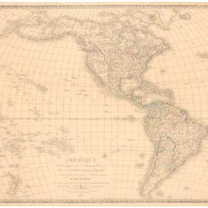
- Americas, North America
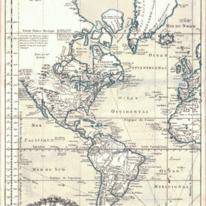
Amerique reduite d’apres celle d’Arrowsmith…
- $475
- A variation on Arrowsmith’s Western Hemisphere.
-
-
-
-
Add to cart
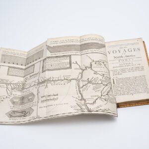
- Americas, Atlases & Books, Canada and The Great Lakes, North America
New Voyages to North-America. Containing an Account of the Several Nations of That Vast Continent…
- $10,500
- First English edition of Lahontan's description and mapping of New France, which propagated the myth of the Northwest Passage.
-
-
-
-
Add to cart

- Americas, North America, Pacific Northwest - Hawaii - Alaska, United States
A Chart of North and South America, Including the Atlantic and Pacific Oceans, with the nearest Coasts of Europe, Africa, and Asia
- $4,200
- Sayer-Bennet-Mead's 1775 chart of the Western Hemisphere with Pacific and Arctic routes of exploration.
-
-
-