An 1809 French map of the Western Hemisphere shortly after the Louisiana Purchase.
Amérique septentrionale et méridionale: pour servir aux leçons de géographie de l’Abbé Gaultier.
Out of stock
Description
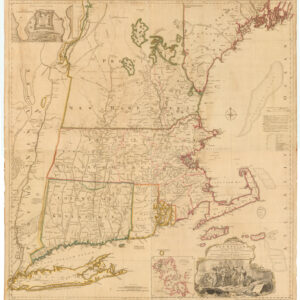
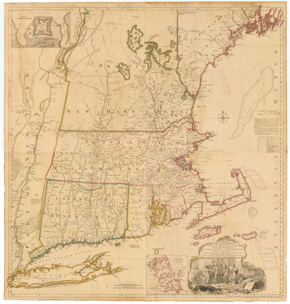
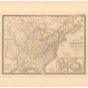
This 1809 map provides a detailed view of the Western Hemisphere, with the countries and regions hand-colored in pastel shades, a common practice in cartography at the time to distinguish political boundaries. The map reflects the geopolitical state of the Americas in the early 19th century, with colonial powers still exerting significant influence, especially in Central and South America.
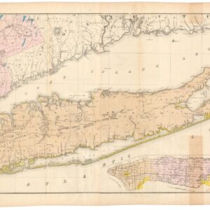
In North America, the map shows the boundaries of the young United States post its independence and subsequent Louisiana Purchase (1803), which significantly expanded its territory. An inset provides a closer look from the Eastern Seaboard out to Texas and the Northwest Territory.
Geographical features like mountain ranges, rivers, and major lakes are drawn with attention to detail, along with cities and ports that were crucial for trade and navigation. The map also includes lines of latitude and longitude, essential for navigation and exploration. Published in Paris, a second inset focuses on the Antilles.
Overall, the map serves as a comprehensive overview of the Western Hemisphere at a time when the continents were undergoing rapid changes due to exploration, colonization, and the burgeoning independence movements in Latin America.
Cartographer(s):
Condition Description
Lovely color map, with some wear discoloration and spotting. Two repairs visible on verso.
References