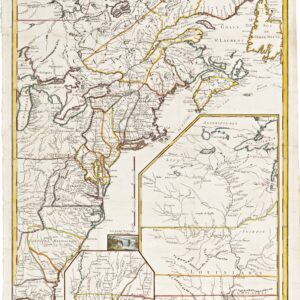
Locally published plan of New Orleans, issued three years before the 1852 city charter.
Norman’s Plan of New Orleans & Environs. 1849.
Out of stock
Description
One of the greatest maps in the history of New Orleans.
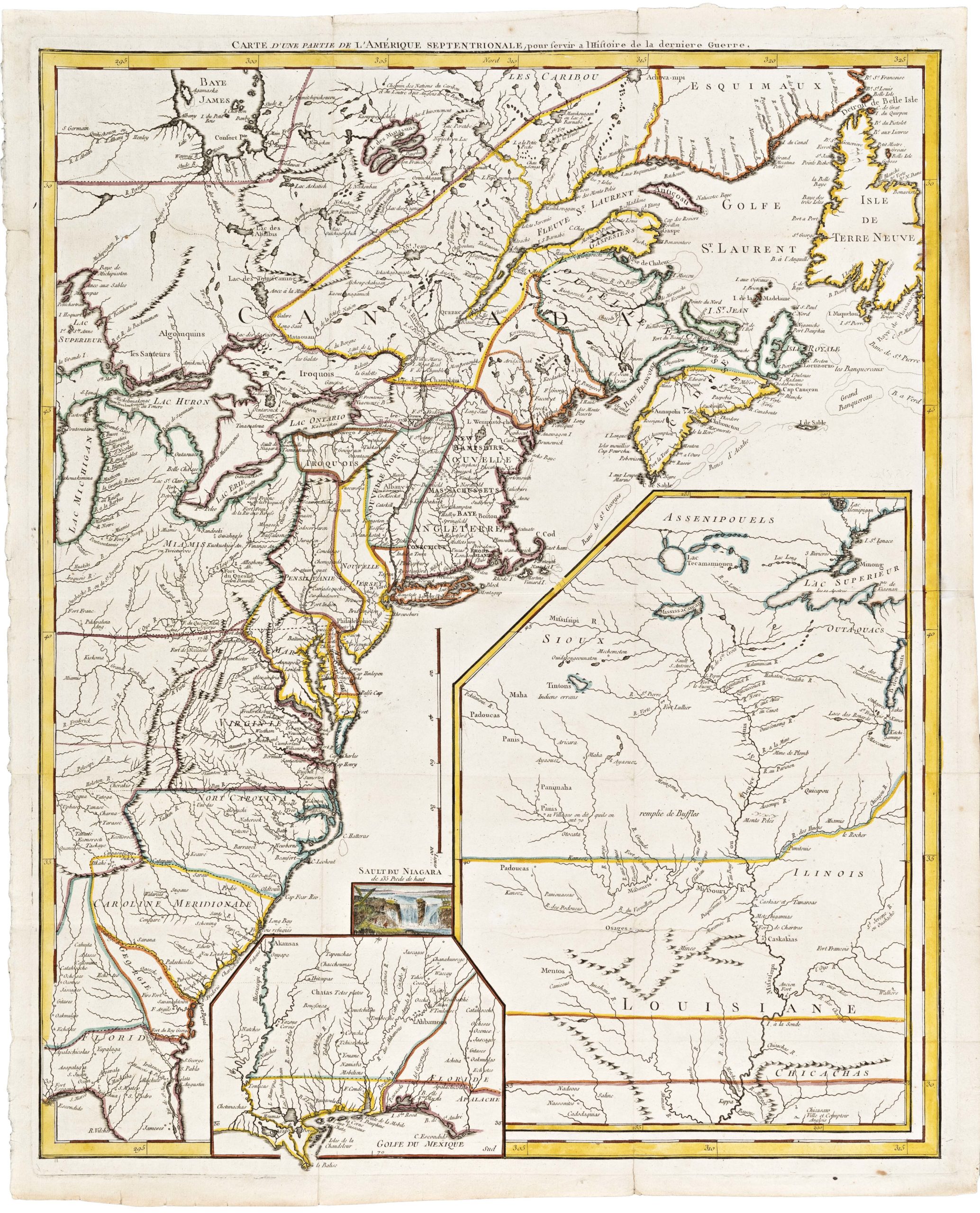
Published for the first time in 1845, this map was compiled, engraved, and published locally. It quickly became a huge success, but as New Orleans developed and expanded, so too did the map, and we consequently see revised editions hitting the streets in 1849 and 1854. Each of these maps captures New Orleans during a distinct epoch in its history, embedding specific stories related to particular events and making them individually collectible. Neatline’s example is the 1849 edition, the most intriguing of Norman’s three renditions of the Crescent City.
Mardi Gras and the French Quarter: A recognizable New Orleans
The map is oriented northwest at the top, with most of the city north of the Mississippi River. The city’s different municipalities have been delineated with thick red and green lines, whereas the wards and fire districts are shown using thinner blue and orange lines. Many of the famous historic districts that we know from today’s New Orleans are visible in this early mapping of the city, though not all have recognizable names yet.
On the left side of the map, we find Lafayette, which in 1849 was being swallowed by New Orleans but still formally remained its town. Lafayette borders the so-called Second Municipality, near the large bend in the river. This is what today is known as the French Quarter. Further north is the First Municipality, and to the right of the bend is the Third Municipality. The latter has since been subdivided into the riverfront neighborhoods of Marigny, St. Claude, and Bywater that we still know today. When our map was published, this area north of the river was on the verge of a grand reconfiguration that would permanently change its developmental trajectory.
Made in New Orleans: the power of local knowledge
The compiler of this map was Benjamin Moore Norman, and the engraving was done by Shields & Hammond, all of whom were based in New Orleans. Nevertheless, the survey work underpinning the plan was executed by a Prussian architect, surveyor, and civil engineer named Henry Moellhausen (Heinrich Müllhausen). While he was accredited on the original 1845 edition of Norman’s map, his name was removed from the 1849 edition onward.
The other main change from the original 1845 edition to our 1849 state was the addition of the new Belle Ville neighborhood, just south of the large bend in the Mississippi River. The new area centered on a broad thoroughfare named West Chestnut, which extended towards the riverfront from the south. On the last plot of this new street, closest to the Mississippi River, Norman notes the presence of a new iron foundry that would characterize the Belle Ville neighborhood over the coming years.
A particularly intriguing feature is the identification of no less than eleven cotton presses within the city. Many of these buildings are palpably larger than the rest of the city’s architecture. Their prominence underscores the cotton industry’s size in pre-Civil War Louisiana and highlights what a crucial economic foundation cotton generally constituted in the South.
A city divided, a city united, and the map that stood in between
In 1836, New Orleans was divided into three distinct “municipalities” because of rising tensions between different groups of inhabitants. The primary source of tension came from strife between the Anglo-American and French-Creole communities. Even though this map was compiled almost 15 years after this division into municipalities, it is still clearly visible from our map, which labels the districts closest to the river as the First, Second, and Third Municipality, respectively. After the division, New Orleans continued to have a single mayor running the city hall. Still, the internal discord was so profound that each municipality had its autonomous city council, which retained the right to raise taxes and control its police force.
As New Orleans grew and new districts and neighborhoods were added to the urban layout, this division became increasingly outdated and strained. In 1852, three years after our map was published, a new city charter was drawn up that reunited the three municipalities and incorporated what had initially been the independent town of Lafayette, just upriver from New Orleans. Today, the historical divisions of New Orleans have been all but forgotten, and Lafayette constitutes one of the city’s districts.
After the charter of 1852, the face of New Orleans changed so rapidly that by the time the 1854 edition of Norman’s map hit the streets, there were significant changes to document. Instead of centering on the Three Municipalities, the map divided the city into four districts and nine wards. The three editions of Norman’s map reflect the decisive changes in New Orleans during these formative years. The 1849 edition offered by Neatline fits snugly between the creation of Three Municipalities in 1836 and the city’s reunification in 1852, making this one of the most iconic and period-specific maps of New Orleans available to collectors.
Historical foundations of the Norman map
Even though the map was compiled and published by Benjamin Norman, we have already noted that he built this map on the survey work of Prussian architect and surveyor Henry Moellhausen. Moellhausen worked in New Orleans from 1841-49, conducting surveys and drafting architectural plans for both commercial and municipal aims. He produced several topographical maps of the city and its surroundings, which were added to a report by the chief engineer of the state of Louisiana, George Dunbar, originally submitted in 1840. This report advocated the construction of an underground drainage system within the city. Moellhausen was more than just a surveyor, though. He also designed several buildings in New Orleans and helped train the next generation of crucial New Orleans architects. Sadly, only a few original Moellhausen buildings remain today (i.e. two brick cottages in Treme Faubourg and two brick stores in St. Mary Faubourg).
Census
Norman’s Map of New Orleans and Environs exists in three editions or states (1845, 1849, 1854). The OCLC lists seven institutional holdings of the 1849 edition of the map, including the university libraries at Duke, Chicago, Alabama, Louisiana State, and the University of Texas (no. 7375503). A slightly enlarged version of the map is also held by the New York Public Library (865985492).
The map is scarce on the open market. Swann sold an example of the 1849 edition in 2022 for $4,500 and an original 1845 edition in 2021 for $5,500. In 2017, an 1854 edition sold with Bonham’s for just under $4,500, which almost doubled the estimate. Prices for Norman’s map have been on a consistent incline over the last 30 years.
Cartographer(s):
Benjamin Moore Norman (1809-1860) was an American writer, book dealer, and mapmaker born in New York. Among his accomplishments was the published description of a journey to the Yucatan in the footsteps of John Lloyd Stephens. Norman initially took over his father’s bookshop in Hudson, NY, and would later move to Philadelphia. In 1837, he relocated to New Orleans, where he lived for the rest of his life.
Norman is an essential figure in the cartographic history of Louisiana and New Orleans. His most famous maps are a plan of New Orleans, originally published in 1845 (with subsequent editions in 1849 and 1854), and the iconic Chart of the Lower Mississippi River from 1858. Both maps were nevertheless built around the survey work of others. In the New Orleans map, he drew heavily on the surveys of Prussian engineer Heinrich Müllhausen, whereas his Lower Mississippi chart hinged on the work of Marie-Adrien Persac.
Condition Description
Folds into publisher's gilt-and-blind-stamped cloth case; light age toning, small area of ink graffiti to verso partly showing through recto.
References
![[Untitled] Portraits and facsimile signatures of 48 American patriots.](https://neatlinemaps.com/wp-content/uploads/2024/05/NL-01743_thumbnail-300x300.jpg)