-
-
Add to cart
 Quick View
 - San Francisco
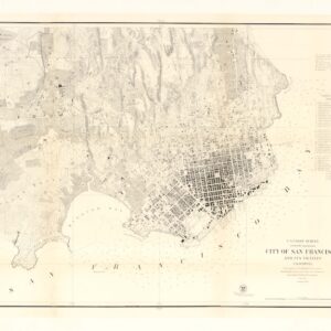
U.S. Coast Survey A.D. Bache, Superintendent, City Of San Francisco And Its Vicinity California. From a Trigonometrical Survey by R.D. Cutts, Assistant…
- $1,900
- Hand-colored 1853 United States Coast Survey master sheet map of the San Francisco Peninsula.
-
-
-
-
Add to cart
 Quick View
 - California, San Francisco
City of San Francisco and its Vicinity.
- $2,200
- A cornerstone map for the historical cartography of San Francisco.
-
-
-
-
Add to cart
 Quick View
 - Bird's-eye-views, Pacific Northwest - Hawaii - Alaska
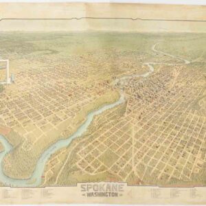
Spokane. Washington.
- $4,500
- A scarce and gorgeous bird’s-eye-view of Spokane during its heyday as the railroad hub of the Northern Plains.
-
-
-
-
Add to cart
 Quick View
 - Bird's-eye-views, East & Midwest United States, Featured Maps & Views, Michael's Collection, United States
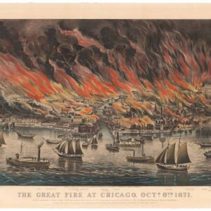
The Great Fire at Chicago. Octr. 8th 1871.
- $8,500
- Currier & Ives 1871 Great Chicago Fire.
-
-
-
-
Add to cart
 Quick View
 - San Francisco
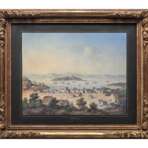
Yerba Buena.
- $8,500
- A stunning retrospective of early San Francisco, painted by a highly skilled anonymous artist of America’s Continental School.
-
-
-
-
Add to cart
 Quick View
 - Atlases & Books, San Francisco
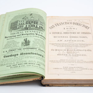
San Francisco Directory Year and Business Guide for 1858: Henry G. Langley Compiler.
- $2,400
- The first Langley San Francisco city directory!
-
-
-
-
Add to cart
![[Seventeen original Taber albumen photographs of California and Oregon]](https://neatlinemaps.com/wp-content/uploads/2023/07/447973_0-300x300.jpg) Quick View
Quick View - California, San Francisco
[Seventeen original Taber albumen photographs of California and Oregon]
- $975
- An extraordinary collection of late 19th-century photographs from America's West Coast.
-
-
-
-
Add to cart
 Quick View
 - San Francisco
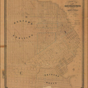
Official Map Of The City Of San Francisco, California. Published by Josiah J. LeCount…Approved By Geo. R. Turner City & County Surveyor
- $12,500
- The definitive Silver Rush plan of a new and expanded San Francisco.
-
-
-
-
Add to cart
 Quick View
 - San Francisco, Curiosities - Miscellanea
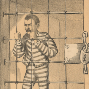
The Tables Turned – “You Sabe Him? Kealney Must Go!”
- $575
- Political satire from one of San Francisco's first antiquarian booksellers.
-
-
-
-
Add to cart
 Quick View
 - Bay Area & Silicon Valley, California
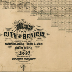
Map of the City of Benicia Founded By Mariano G. Vallejo, Thomas O. Larking & Robert Semple 1847 Surveyed & Drawn By Benjamin Barlow City & County Surveyor.
- $6,500
- Barlow’s rare and pioneering map of Benicia - the earliest comprehensive plan of one of California’s first state capitals.
-
-
-
-
Add to cart
 Quick View
 - Bird's-eye-views, Texas and The West
Salt Lake City, 1887.
- $2,900
- The Bustling New Jerusalem of the American West.
-
-
-
-
Add to cart
 Quick View
 - San Francisco
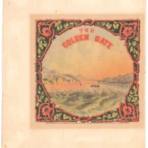
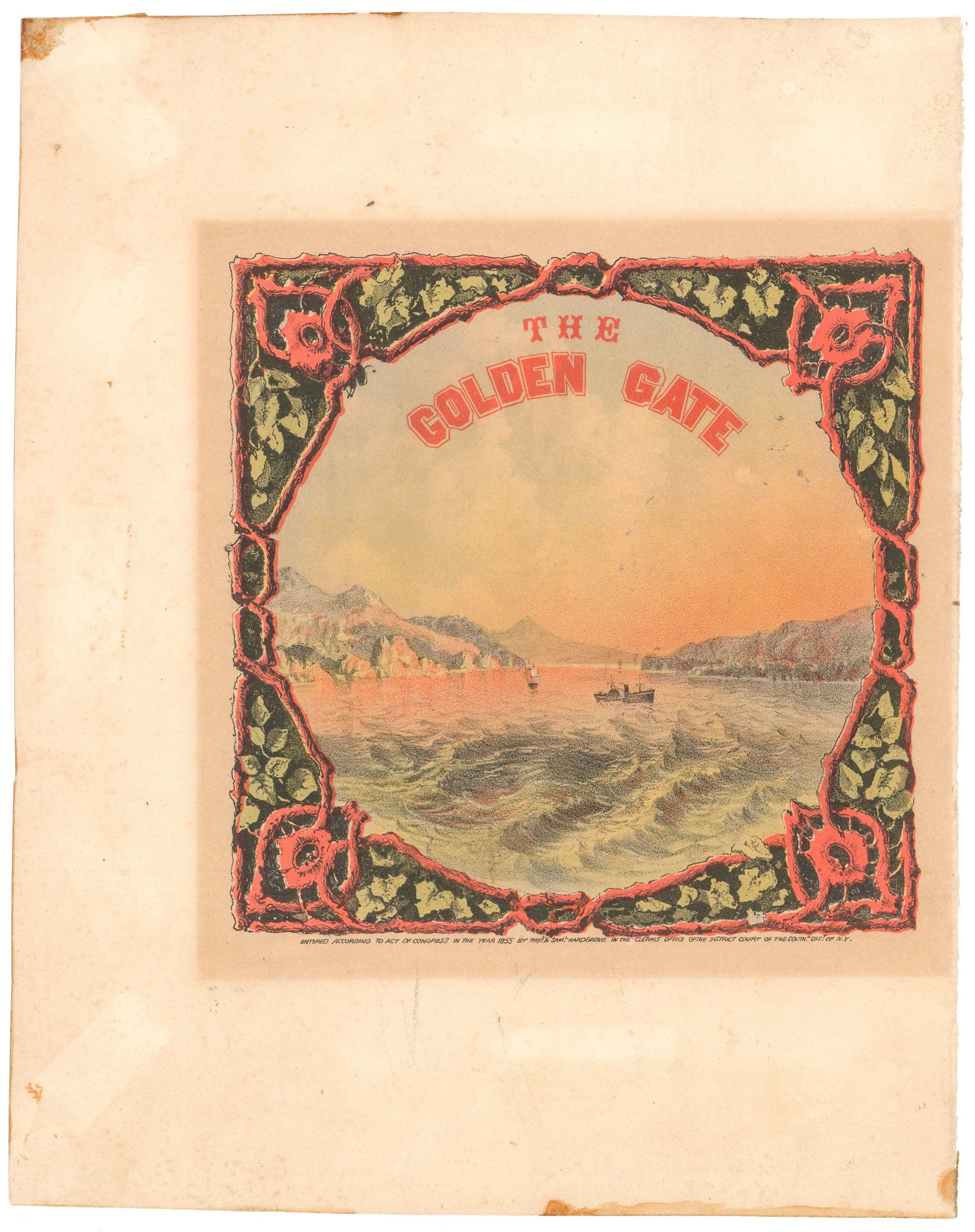
The Golden Gate.
- $1,200
- Possibly the first American view of The Golden Gate ever produced.
-
-
-