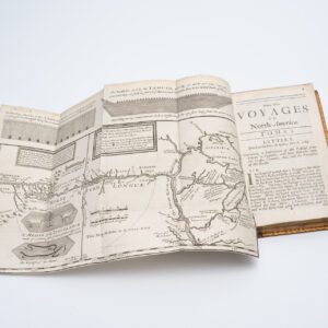
A cornerstone map for the cartography of the Great Lakes.
Carte des Lacs du Canada Dresse sur les Manuscrits du Depost des Carts, Plans et Journaux de la Marine et sur le Journal de RP. De Charlevoix.
Out of stock
Description
The 1744 Bellin-Charlevoix map of the Great Lakes was a significant cartographic achievement. It constituted one of the most pioneering and trendsetting depictions of this region on the market. The map stands out in the cartographic history of Canada/New France because it, on one hand, offered unparalleled accuracy and detail, but on the other, instigated a cartographic myth that would resound for generations. The apocryphal elements introduced by this map did not just affect geographic conceptions of this region but also directly impacted the confrontations between British Canada and an emergent American republic.
Measuring 18 by 11 inches, Bellin’s map presents a meticulously detailed view of the Great Lakes region. All five lakes are fully delineated, including the complex systems of tributaries that feed into them. Other anchoring points, such as fortifications, Native American villages, and missions, are generously intermixed with a speculative topography. Among the most notable features are four spurious islands in Lake Superior labeled Philippeux, Pontchartrain, Maurepas, and St. Anne. Despite not reflecting any observed reality, these islands would play a significant role in delineating the United States’ border with Canada (see context section).
In addition to introducing non-existent islands in Lake Superior, the map includes early mentions of important American toponyms, such as Detroit and Chicago. While these would develop into iconic American cities over the coming centuries, at this stage, they were little more than landing sites for riverine trade. Their inclusion underscores Bellin’s cartographic expertise, but for us, their presence also echoes a greatness still to come.
Context is Everything
The map was prepared by Jacques-Nicolas Bellin for inclusion in Pierre Francois Xavier de Charlevoix’s seminal work from 1744: Histoire et description generale de la Nouvelle France. Charlevoix was a Jesuit missionary and traveler whom the French Crown had commissioned to undertake an exploratory mission to the French territories in North America. Charlevoix traveled extensively throughout New France, but we know from his writings that he never visited Lake Superior. Even so, he ingeniously invented the four fictitious islands as a tribute to his main patron, the Count of Maurepas.
When Bellin was provided with Charlevoix’s extensive notes to compile this map, he faithfully incorporated the four islands – partly because Charlevoix claimed them to be extremely rich in minerals. Being one of France’s foremost cartographers, Bellin’s reliability was considered unimpeachable – especially in New France. The non-existent islands were adopted by other great 18th-century mapmakers, including John Mitchell, in his seminal 1755 Map of the British and French Dominions in North America.
This map was a guiding document behind the Treaty of Paris (1783), formally ending the Revolutionary War. The treaty delineated a new border between the United States and British Canada and used the fictitious Philippeaux Islands as a marker for that border. While this eventually would lead to renewed strife over territorial boundaries, one cannot attribute carelessness to Mitchell for using Bellin’s map as a template. Indeed, Charlevoix’s descriptions of New France continued to be among the best descriptions of North America for generations.
Cartographer(s):
Jacques Nicolas Bellin (1703 – 1772) was a French hydrographer, geographer, and intellectual who worked for the Ministère de la Marine from age 18. Born in Paris, Bellin was appointed to the hydrographic office of the French Navy in 1741, rising quickly through the ranks to become its chief mapmaker. He was appointed to the Académie de Marine and the Royal Society of London.
During his long career, Bellin developed new and very accurate systems for compiling coastal charts, and he became one of the most copied cartographers of the 18th century. Over the course of fifty years, Bellin produced a large number of maps for the Ministère de la Marine. His maps of Canada and French territories in North America (New France, Acadia, Louisiana) were particularly valuable because they helped secure navigation on the St. Lawrence River and formed the cartographic basis for French claims of the Great Lakes region and Mississippi River Valley. He died at Versailles.
Pierre François-Xavier de CharlevoixPierre François Xavier de Charlevoix (1682-1761): Born in Picardy, France, Charlevoix was a significant figure in the exploration and documentation of New France. After completing his Jesuit training in Paris, he embarked on a journey to the French colony of Canada, where he taught and immersed himself in the local culture. His extensive travels throughout North America, including expeditions to Saint-Domingue and along the Mississippi River, provided him with firsthand knowledge of the continent’s geography and inhabitants. Charlevoix’s seminal work, Journal d’un voyage fait par l’ordre du Roi dans l’Amérique Septentrionale de la Nouvelle France (1722), chronicled his experiences and contributed valuable insights to the geographical understanding of North America. Despite never reaching the Pacific Ocean, Charlevoix’s observations laid the foundation for continued explorations.
Throughout his life, Charlevoix remained dedicated to scholarly pursuits, serving as one of the directors of the prestigious academic journal Mémoires pour l’Histoire des Sciences & des beaux-Arts and contributing to historical, geographical, and scientific discourse. His magnum opus, History of New France (1744), offered a comprehensive account of French holdings based on his observations. Charlevoix’s legacy endures, with numerous places named in his honor and his works remaining essential references in the study of early colonial America.
Condition Description
Very good.
References