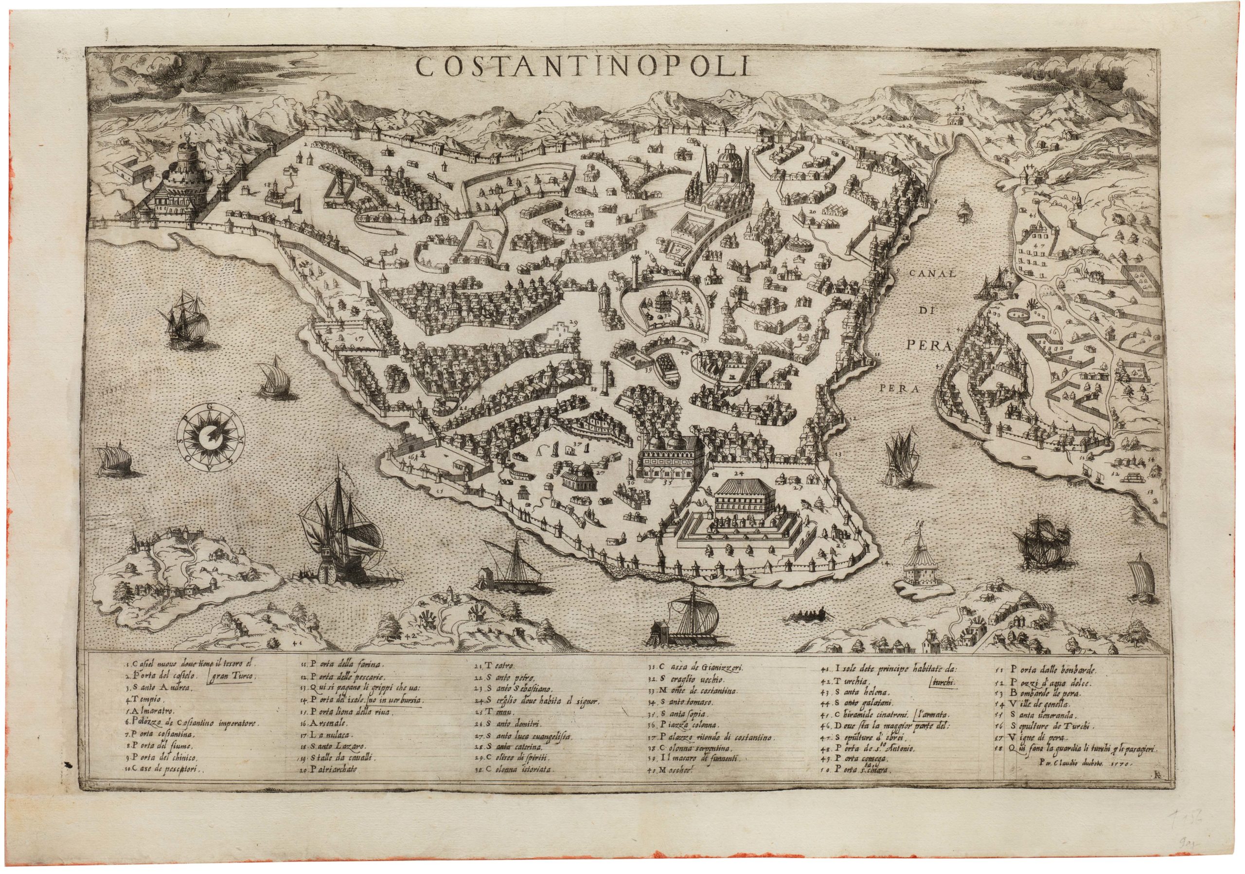
Mapping the Berlin-Baghdad Railway: official Ottoman government map of Mesopotamia.
[Map of Mesopotamia, for instruction in military and Ottoman geography]
Out of stock
Description
Joghrāfyā-yi ʿaskerī ve ʿOsmānī derslerine makhṣuṣ Nahrayn kharīṭası eser-i sābıq joghrāfyā-yi ʿaskerī muʿāvini piyāde qol aghası ‘ Osmān Nūrī
Detailed map of Eastern Iraq and Western Iran, published to illustrate the progress of the Baghdad Railway. The map extends from Basra in the South, along the border between Iran and Iraq, up to Lake Urmia and Southeastern Turkey.
The regional inset map at lower right is titled ‘Upper Mesopotamian Basin.’ It shows the governorates of Diyarbakr, Kharput, Erzurum, and Bitlis, with the upper courses of the Euphrates and Tigris. The inset map illustrates the western extension of the railroad towards Aleppo.
The map would appear to have been printed sometime between 1903 and 1914. In 1903, the Ottoman government gave permission to Germany to extend the track eastward to Baghdad, at which time the initial plan, to route it via Erzurum was altered in favor of the route shown on this map, east from Konya through the Taurus Mountains. The map still shows the projected continuation from Basra to Kuwait, which was abandoned in a German-British agreement (1914). The British had begun to feel that the access provided by the railway threatened their oil fields around the Gulf. The powerful director of the Anglo-Persian Oil Company was eventually able to secure an agreement with the Baghdad Railway Company and in March 1914 the German government was obliged to recognize southern Mesopotamia, as well as central and southern Persia, as the exclusive field of operations of the Anglo-Persian Company.
Berlin-Baghdad Railroad
The origins of the railway can be traced to 1889, when a group of German industrialists and bankers, led by Deutsche Bank, secured a concession from the Ottoman government to begin work on the Anatolian Railway connecting Istanbul, Ankara, and Konya. This was the first leg of what would become the Baghdad Railway. The Ottoman government saw the endeavor as a means to improve transportation infrastructure and communication in this part of its empire, as well as an economic link to the Gulf through Basra.
The project was an important part of German economic strategy in the region, opening new markets to the bustling German economy. German interest further intensified with reports of vast petroleum reserves between the Tigris and the Euphrates. Eventually, Russia, France, and Britain all began to regard a Baghdad to Berlin Railway as threat to their regional interests, and the contentious economic and political issues surrounding the project are reflective of the tensions that contributed to World War I.
Co-owned with BLR Maps.
Cartographer(s):
Condition Description
Several areas of loss and minor repairs at the fold intersections.
References
We are very grateful to Dr. Gottfried Hagen of the University of Michigan for his help understanding this map.