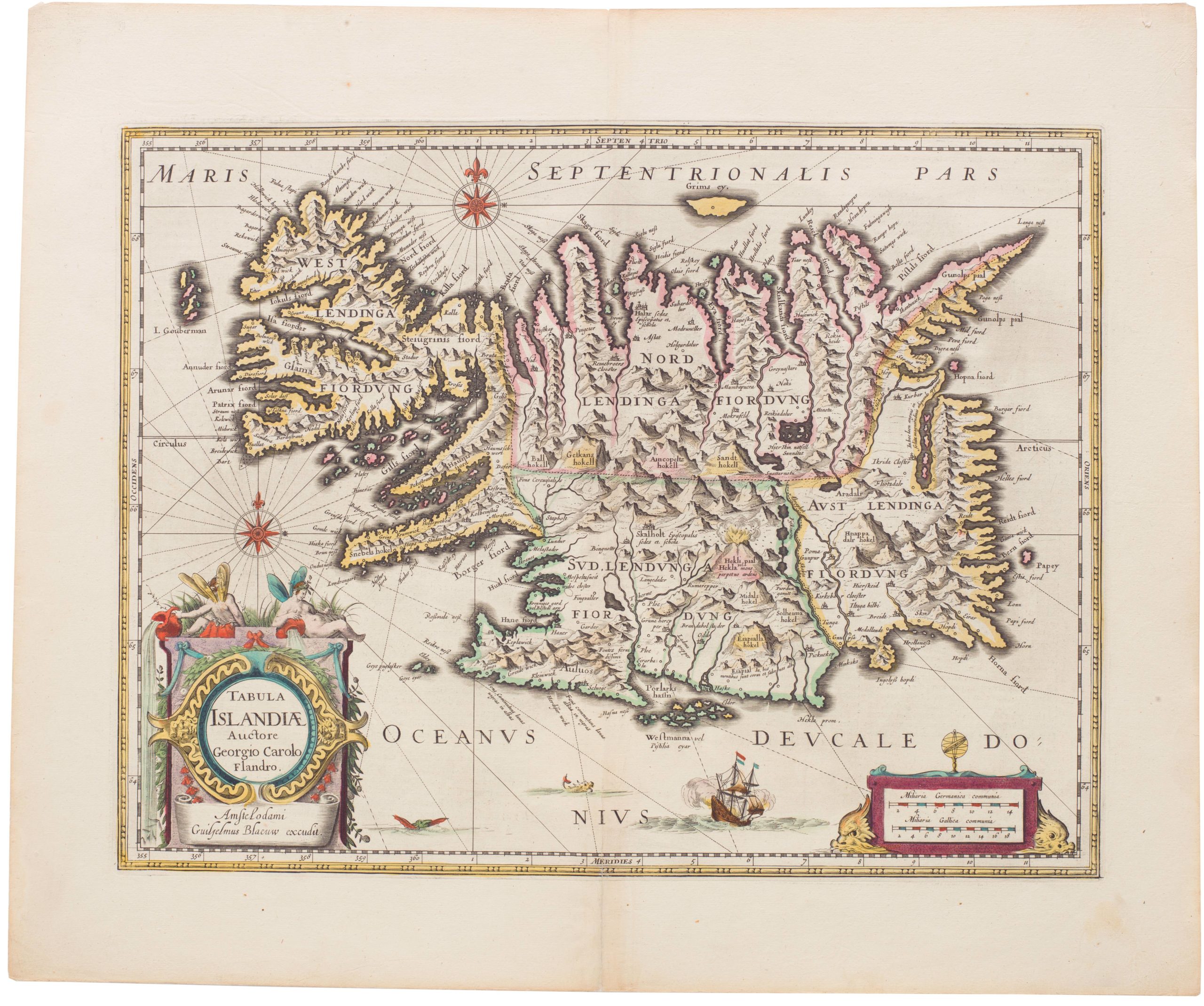
Large, detailed 1791 map of Greece and Asia Minor with striking cartouche.
Greece Archipelago and part of Anadoli. By L.S. de la Rochette. MDCCXC. London, Published for Willm. Faden, Geographer to the King. January 1st. 1791
On Hold
Description
This is a later 18th-century map of Greece and the Aegean Sea, Ionian Sea, Dalmatian coast, Constantinople, western Anatolia, Crete, parts of Albania, Macedonia, and Romania.
Detailed and accurate, this map by the royal cartographer to King George III is enhanced with hand colors indicating cities, landforms, and watercourses.
Cartographer(s):
William Faden (1749 – 1836) stands out as one of the eminent English cartographers and map publishers of the late 18th and early 19th centuries.
Early in his career, Faden was mentored by Thomas Jefferys, a leading map engraver and publisher in London, who held the distinguished title of “Geographer to the King.” Upon Jefferys’ death in 1771, Faden inherited his business, and by 1783, his exceptional skills earned him the appointment as the royal geographer to King George III.
His cartographic prowess was particularly evident in his detailed maps of the British Isles and depictions of battles during the American Revolution. In addition to his cartographic ventures, Faden was a shrewd publisher, running a renowned map store in London. This establishment quickly became a nexus for geographers and explorers.
Condition Description
In good condition, apart from a few spots of use in the low west of Crete. Laid on contemporary linen.
References