A rare early edition of the Children’s Map of London.
County of London (Children’s Map of London).
Out of stock
Description
A charming and colorful work, perfect for any Anglophile, this c. 1939 pictorial, folding “children’s map” of London was drawn by L. G. Bullock for John Bartholomew and Sons.
Displaying the central part of the city, a range of government offices, royal palaces, rail stations, parks, museums, hospitals, educational institutions, and other famous sites are illustrated and labeled. Major streets and bridges are also noted. Quotes from famous works about different parts of London are included near the relevant locale. The borders of the map are filled with mythological figures and references to nursery rhymes, including Gog and Magog (statues of which sit in Guildhall), Old King Cole, Jack and Jill, Little Bo-Peep, Cinderella, Humpty Dumpty, and more. Crests relating to the city, the monarchy, and the constituent parts of the United Kingdom are also drawn.
This map was drawn by Leslie George Bullock, part of a series of pictorial maps by him, including historical maps of Scotland, Ireland, and England and Wales. The date is difficult to establish since the buildings labeled had all been built by the 1930s and since there were multiple issues of the map from the late 1930s onwards. However, the use of the term “London Passenger Transport Board” for the offices of that organization in Westminster suggests a date between 1933 and 1948. At the same time, the acknowledgement to Mrs. Kipling at bottom-left suggests that the map was published after the death of her husband, in 1936.
Cartographer(s):
John Bartholomew and Son Ltd. was a renowned Scottish map-making company, a family business that traced its roots back to the 19th century. The company was famous for its detailed and innovative cartography and played a significant role in the development of modern map-making techniques. They were particularly known for their detailed city plans, wall maps, and atlases and for pioneering the use of color contouring in topographical maps.
The Bartholomew firm’s work was highly respected for its accuracy, artistry, and craftsmanship, and the name Bartholomew became synonymous with high-quality maps not just in the United Kingdom but internationally. The company also produced a wide range of thematic maps, like the whiskey map of Scotland, which combined the firm’s cartographic skills with cultural and historical content.
Condition Description
Folding map on original light linen. Wear along fold lines and some loss at fold intersections and at margins.
References
Related products
-
-
Add to cart
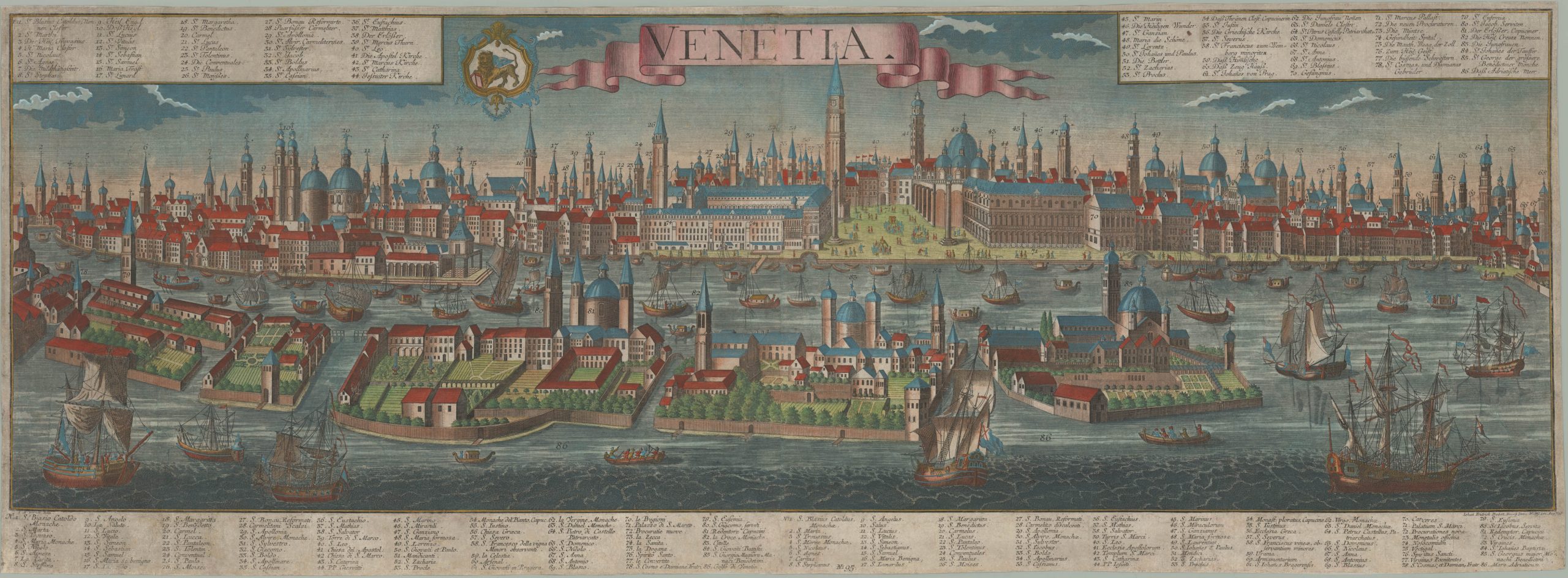
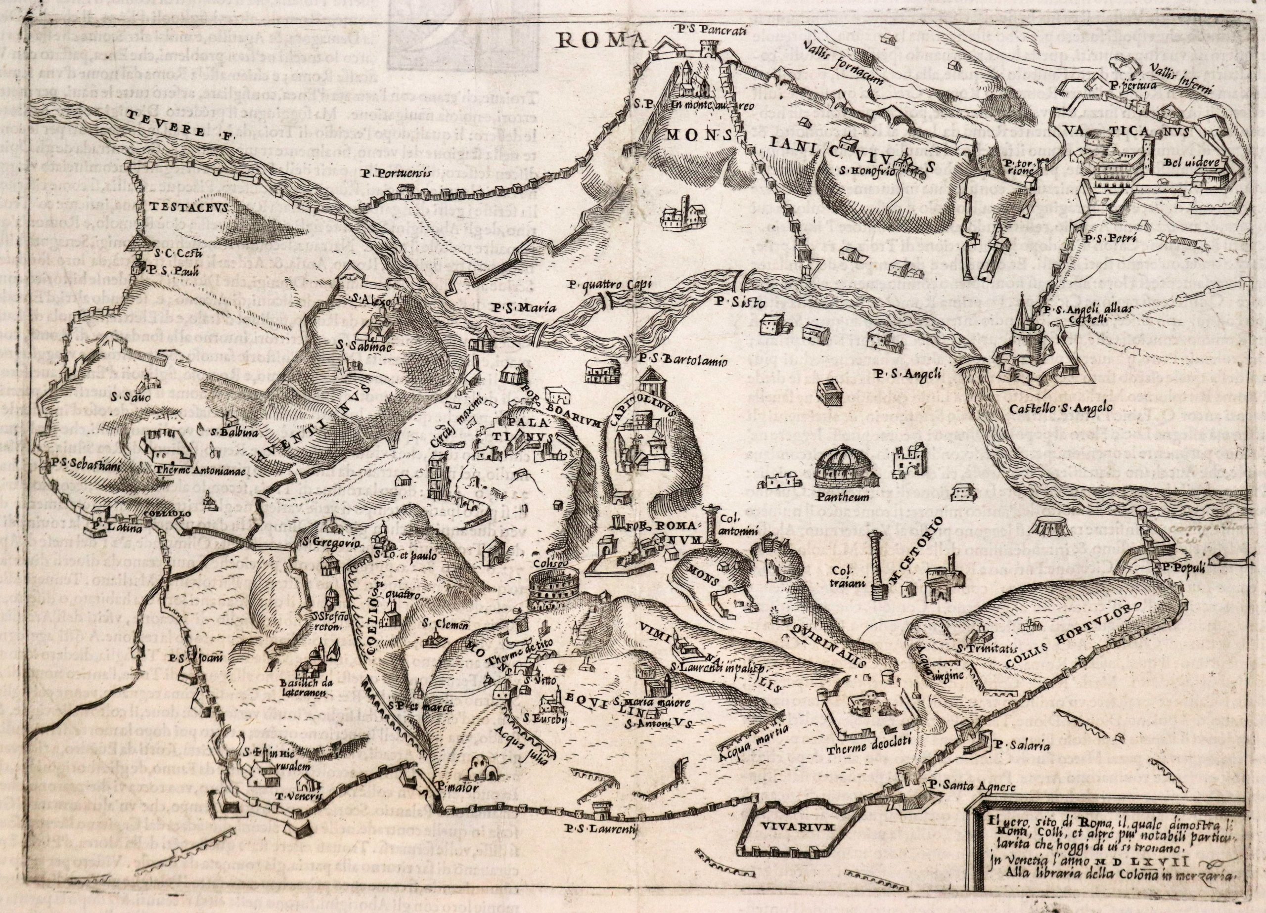
- Europe, Italy, Bird's-eye-views
Venetia.
- $4,800
-
-
-