About half-way through The North Water by Ian McGuire I stumbled upon the perfect way to describe it to anyone who asked me what I was currently reading (or eventually to everyone, because I began telling people about the book even if they didn’t ask): if the Cohen-brothers wrote a novel-form adaptation of a hybrid of Moby Dick and Endurance: Shackleton’s Incredible Voyage. Most major reviews say something similar, although tend to use Conradian rather than Cohenbrothersesque; I like my reference better. Either way, I loved this book.
At this point, however, I must include an anecdotal caveat. When I was 16 years old I worked at a now-defunct Warehouse Music store. A guy came in one night and said his wife had the flu and they wanted to watch a movie together. I had just seen Fargo and suggested it. He asked if it was funny and I told him it was a dark comedy. Now, apparently he had no idea what that means because about an hour later I heard my manager pick up the phone to immediate screaming about how one of her employees had recommended a movie that was decidedly NOT FUNNY! Oops.
The point is that you should go and read some real reviews before you take my recommendation – that way it’s not all on me. And what does The North Water have to do with maps? Well the novel is all about exploration and journeys, traveling into the unknown, new environments, contact between previously unknown cultures (including devastating consequences of European contact with people in their native lands), and more. These are the same themes we confront in the study of cartographic history.
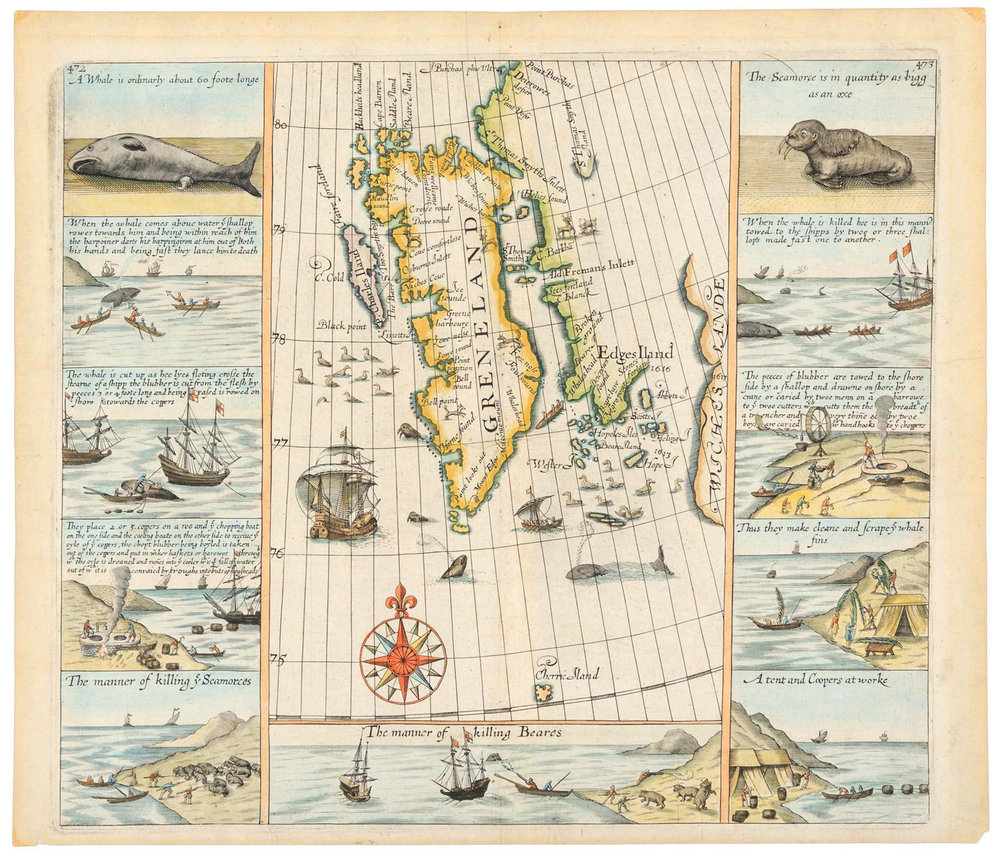
The North Water is also about decline: the decline of the human condition, the decline of the British Empire, and the decline of the whaling industry in the 19th century, especially as kerosene came to replace whale oil as an energy source. Like Moby Dick (albeit with more editing), McGuire’s work offers an intricate and cruel look at whaling and the complex, untethered souls who engaged in it. Of course, these souls had been venturing into the North Water for centuries before the time setting of the novel, as seen in this 1625 map of Spitsbergen by Samuel Purchas published in London.

My only real critique of the book is that it doesn’t include any maps. For a work defined by raw realism of time and place, I would have liked to follow along with the visual aid of a map. Without giving away any spoilers, I provide here a quick plot of the course of the main narrative.
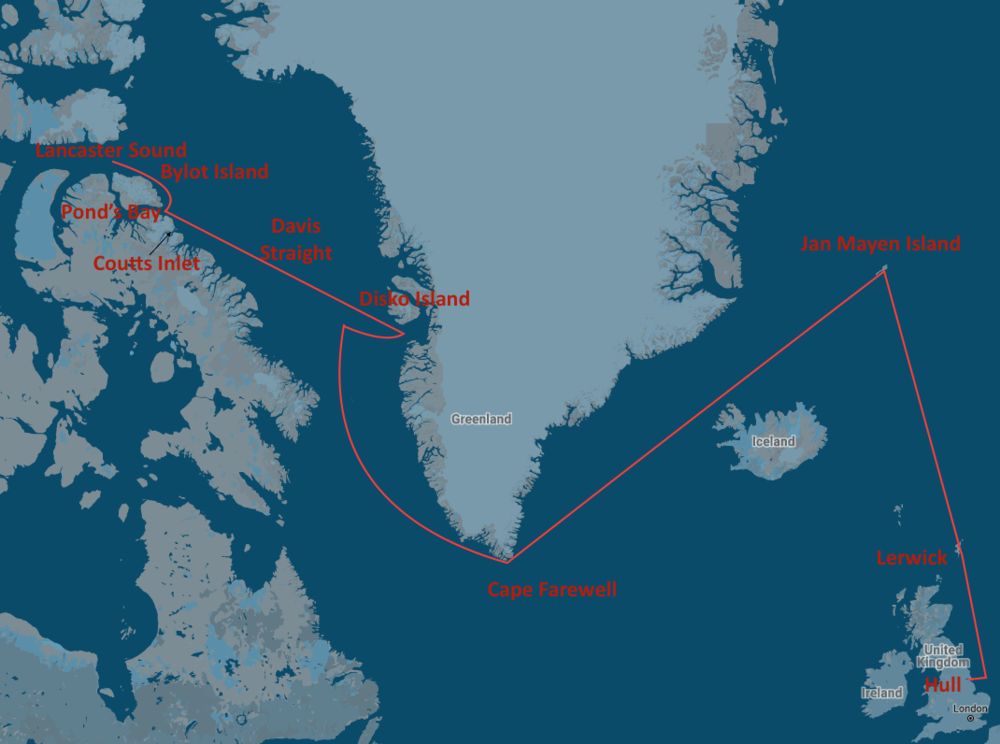
The North Water main journey: Hull – out the Humber to Lerwick – north to Jan Mayen Island – around Cape Farewell into the Davis Straight – waters off Disko Island – past Cape Horsburgh to Pond’s Bay – into Lancaster Sound – back past Bylot Island into Pond’s Bay and down to Coutts Island – back to Hull.
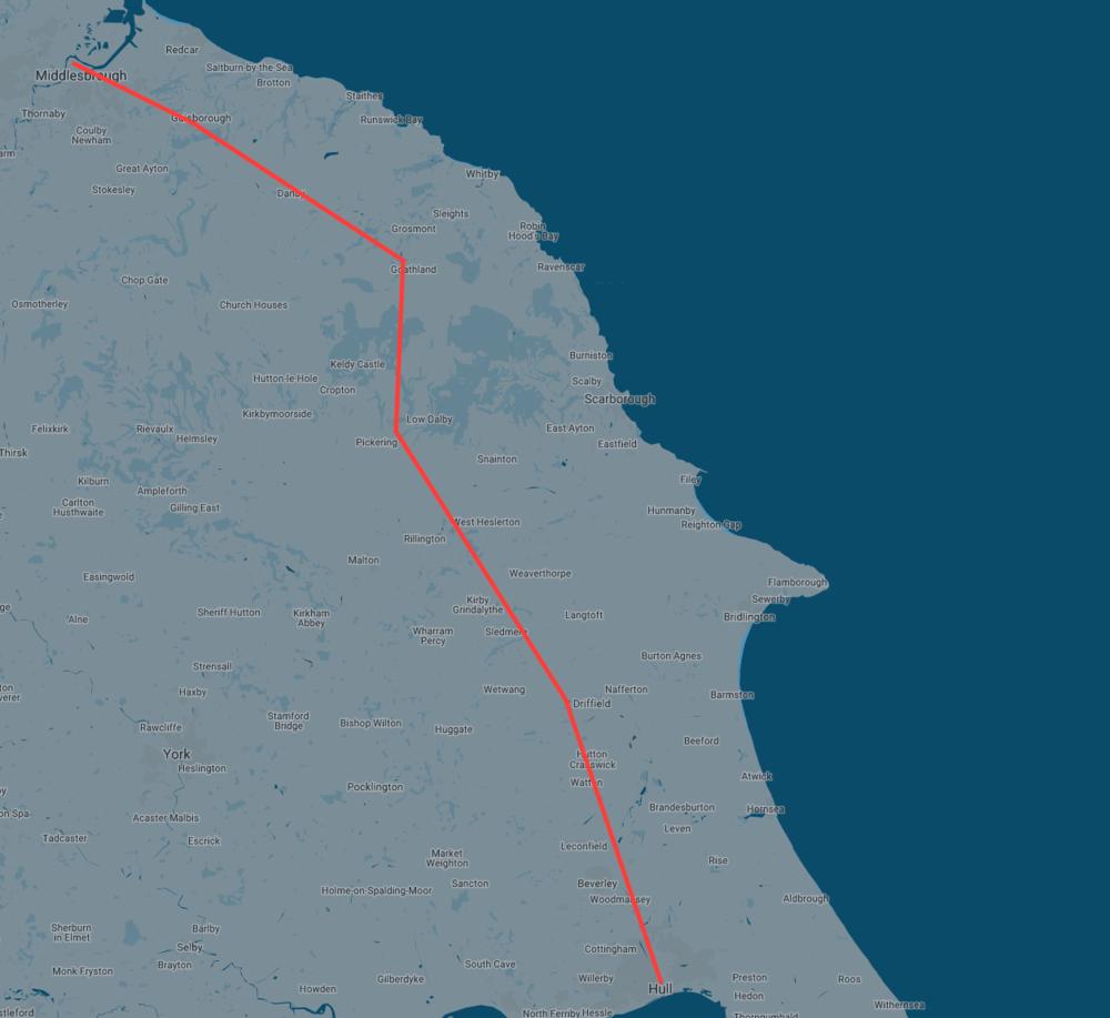
The North Water second journey: Hull to Driffield and Gorton – through Wold’s northern scarp to Pickering – Goathland and Glaisdale – Glaisdale to Guisborough and on to Middlesbrough.
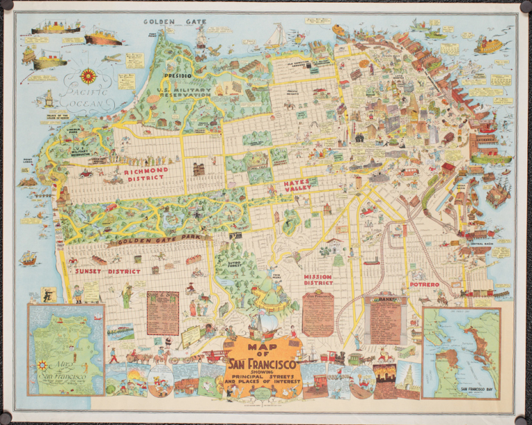
Finally, this late 18th century estuary chart of the Humber includes a town plan of Hull.