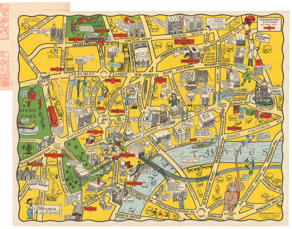
A Tube map unlike any other: telling the story of London’s famed transit system.
Historical Map of the Underground Railways
Out of stock
Description
This rare thematic plan tells the story of London’s underground transit system with the clarity and high standards of design we have come to associate with tube maps. It constitutes a remarkable reference, giving age and backstory to each line and notating many of the openings for each stop. We see the system in all of its complexity, an astounding accomplishment that began as early as the 1860s and continues to blossom and expand for the century to come.
This absorbing image, formed from the actual geography rather than Beck’s standardized conceptual map of the tube system, brings this fantastic infrastructure to a new life.
Cartographer(s):
Condition Description
Very good. Marginal wear.
References