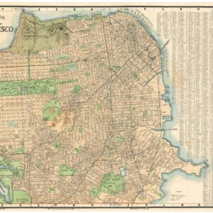
A 1940 pictorial map of San Francisco that captures the zeitgeist of Herb Caen’s “Baghdad-by-the-Bay.”
Merry-Maker’s Map of San Francisco
Out of stock
Description
In his 1940 Merry-Maker’s Map, illustrator Milt Schenkofsky successfully captures, with mischievous wit and characteristic charm, an exciting moment of change in the history of San Francisco. This was Herb Caen’s San Francisco, the “Baghdad-by-the-Bay,” a rapidly-evolving city connected to the outside world by its new bridges and the rise of the airplane like never before.
The end of the 1930s and beginning of the 1940s was a time of great celebration in San Francisco. The completion of the Golden Gate and Bay Bridges meant that Marin and the East Bay, once rural summer communities, were now just a commute away. To mark the affair, the city organized a World’s Fair, and constructed Treasure Island for its venue. It was a time of great optimism, being before the attack on Pearl Harbor would shock America and bring her into World War II.
The map is above all intended for nighttime carousers, serving as a guide for tourists and sailors looking for a good time. It portrays a wide open town, in which anything one might desire is available. The subtitle of the map is: “A Pixelated Pilot for Guys and Gals in Search of the Three Dees,” that is to say: dinner, dancing, and drink. It shows night clubs, saloons, fine restaurants, and other entertainment venues, with the streets crowded by men in suits and hats, many of whom are ogling the cornucopia of showgirls illustrated throughout the city.
The remarkable aspect that sets the Merry-Maker’s Map apart from other maps of San Francisco is that the rough edges of the city are on full display. A young man in Chinatown smokes opium and dreams of playing dice games. Across Market St., another steals a keg of beer from a truck, the delivery man distracted by the seductions of a showgirl. Gambling parlors and speakeasies are shown.
The overall tone is humorous, but the map serves as an important documentation of nightlife venues at a fascinating time in history for the city. One example on the map is the Music Box on O’Farrell St. At the time, it was owned by Sally Rand, the famous burlesque dancer and actress, most noted for her ostrich feather fan dance and balloon bubble dance. Sally Rand’s girls put on a show in the theater, which continued in her private club upstairs. The Music Box is now the Great American Music Hall.
Increasingly rare and difficult to find.
Cartographer(s):
Milt Schenkofsky was a cartoonist and illustrator apparently based in the San Francisco Bay area and active during the 1930s and 1940s.
Condition Description
Good. Couple splits along fold lines. Crimping in corners and edge wear. Handwriting in various places.
References

![5-sheet set showing San Francisco’s post-1906 earthquake water supply [SF’s first fireboat!]](https://neatlinemaps.com/wp-content/uploads/2022/03/NL-01375-sheet-4_thumbnail-scaled-300x300.jpg)
![5-sheet set showing San Francisco's post-1906 earthquake water supply [SF's first fireboat!]](https://neatlinemaps.com/wp-content/uploads/2022/03/NL-01375-sheet-4_thumbnail-scaled.jpg)