A fascinating post-Civil War map of Texas.
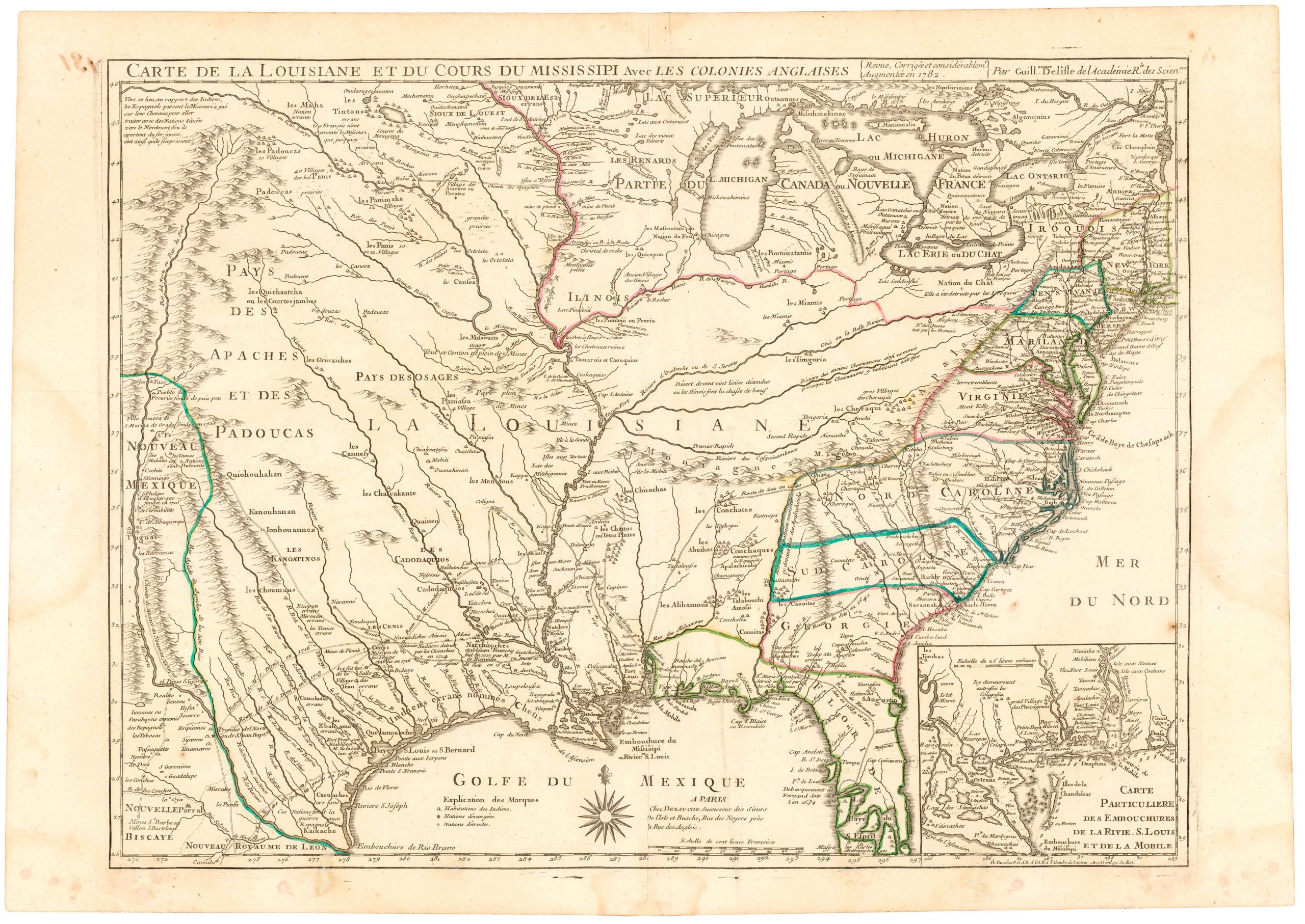
County Map of Texas.
Out of stock
Description
This is Samuel Augustus Mitchell’s 1867 map of Texas with part of western New Mexico and a large inset of Galveston Bay. It is a highly detailed map, which employs an attractive color-coding system to delineate counties and territories. Texas, of course, has more counties than any other state, a deliberate design by early state planners in order to allow for hyper-localized governance.
The map was printed before the Texas Constitution of 1876, and much of West Texas has yet to be incorporated into the county system; thus we see Young Territory and Bexar Territory, along with early configurations of El Paso and Presidio Counties.
Early railroad lines are also depicted.
Cartographer(s):
Samuel Augustus Mitchell Jr. inherited one of the most commercially successful cartographic publishing houses in nineteenth-century America. His father, Mitchell Sr., had built the Philadelphia firm into a dominant force in American popular cartography from the 1830s onward, producing the school atlases, travel guides, and reference maps that furnished the geographical education of generations of American readers. When Mitchell Sr. retired in 1860, the younger Mitchell assumed control and continued to publish under the family name, maintaining the firm’s defining approach: clear, accessible cartography produced efficiently and sold cheaply enough to reach a broad middle-class market.
Under Mitchell Jr., the firm navigated the rapid changes that followed the Civil War, expanding coverage of the trans-Mississippi West as railroad growth and public education drove demand for updated maps. The Mitchell name remained synonymous with everyday American reference cartography well into the final decades of the century, though by the 1880s increasing competition and consolidation in the map trade were eroding the firm’s once-dominant position. The maps produced under his stewardship are today among the most commonly encountered examples of Victorian-era American cartography — their ubiquity a testament to the commercial machine his father built and he sustained.
Condition Description
Good example with minor staining and the number "60" written in manuscript in the lower right margin.
References


![[Untitled Sectional County Map of Colorado]](https://neatlinemaps.com/wp-content/uploads/2026/05/NL-02489_thumbnail-300x300.jpg)