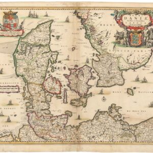
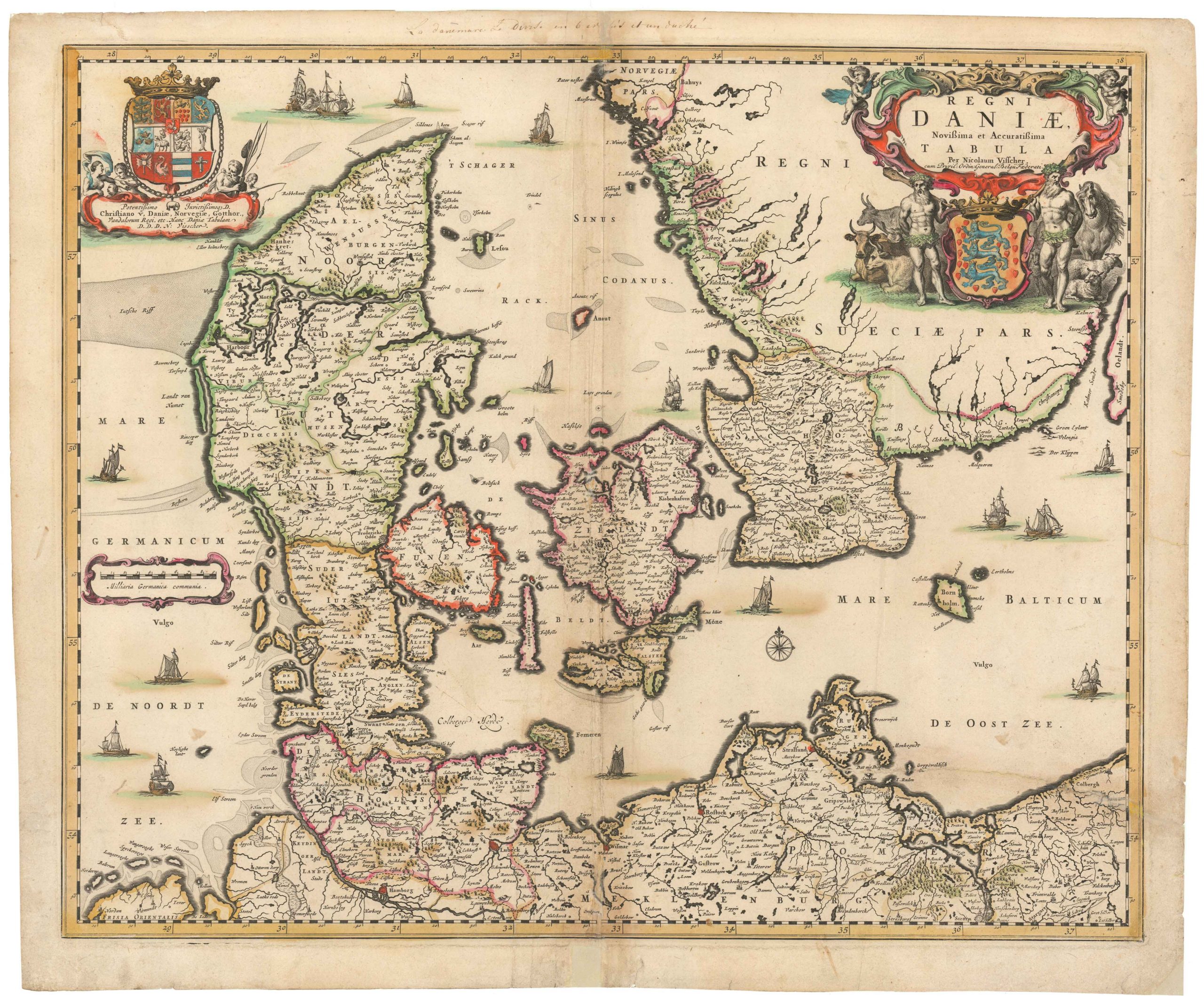
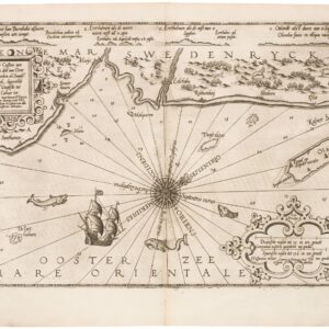
Attractive mid-17th century map of Scandinavia.
Suecia, Dania, et Norvegia, Regna Europae Septentrionalia
Out of stock
Description
Well-regarded map of the kingdoms of Sweden, Denmark and Norway, attributed to Anders Bure (1571-1646), a Swedish cartographer and mathematician. Bure, also known as Andreas Bureus, is best known for his 6-sheet map of Scandinavia and for serving as the first director of the Swedish land survey.
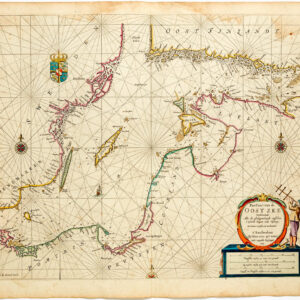
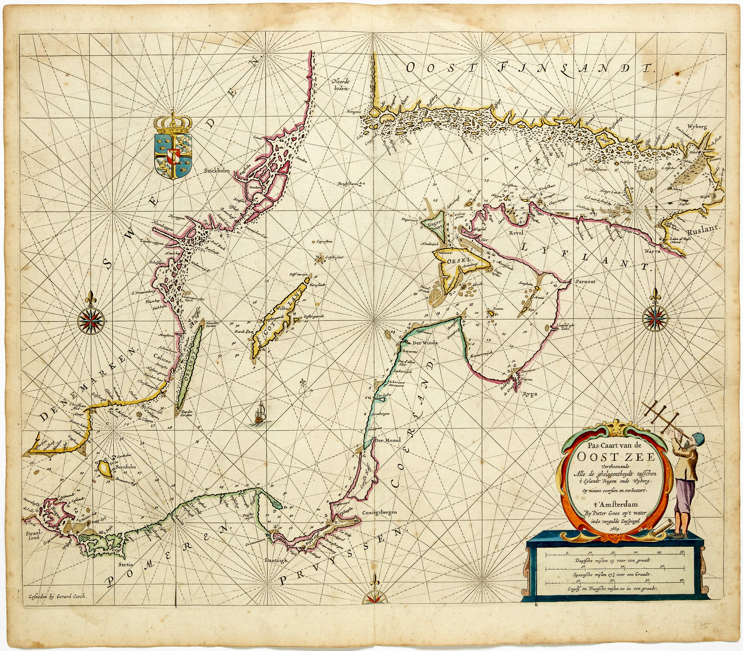
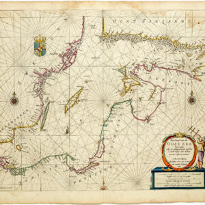
The Kingdom of Sweden is shown at its largest extent, containing present day Finland and the Baltic states. The map is filled with details of towns, political boundaries, rivers, and topography.
The coats of arms of the three kingdoms are featured within the title cartouche.
Latin text on verso.
Cartographer(s):
Willem Janszoon Blaeu (1571-1638) was one of the most important Dutch geographers and mapmakers of the 17th century. He was born the son of a herring merchant but traded fishmongering for studies in mathematics and astronomy. Blaeu’s first important breakthrough was winning an apprenticeship with the famous Danish astronomer Tycho Brahe. Working at Brahe’s Uranienborg observatory on the island of Hven, Blaeu learned various disciplines and technical skills. These included mathematics, astronomy, instrument-making, and more esoteric disciplines such as alchemy. Returning to his native Holland, Blaeu established a publishing business in Amsterdam. He sold instruments and globes, printed maps, and his own editions of some of the great philosophical works of contemporary intellectuals like Descartes and Hugo Grotius. Achieving notoriety as a cartographic pioneer, Blaeu was appointed Chief Hydrographer to the powerful Dutch East India Company, a position he held until he died in 1638.
When Willem died, his sons Cornelis (1610-1648) and Joan (1596-1673) took over the business. Joan had originally trained as a lawyer but never took up the practice, preferring to work on maps with his father. After Willem’s death, Joan continued publishing his father’s and his own maps. He also assumed his father’s position as a hydrographer for the Dutch East India Company. Towards the end of his life, Joan would dramatically expand his father’s Atlas Novus (1635), turning it into his own masterpiece, the Atlas Maior (1662-72).
When Willem died, his two sons Cornelis (1610-1648) and Joan (1596-1673) took over the business. Joan had originally trained as a lawyer, but never took up practice, preferring to work on maps with his father. After Willem’s death, Joan continued to publish both his father’s and his own maps. He also assumed his father’s position as hydrographer for the Dutch East India Company. Towards the end of his life, Joan would dramatically expand his father’s Atlas Novus (1635), turning it into his own masterpiece, the Atlas Maior (1662-72).
Condition Description
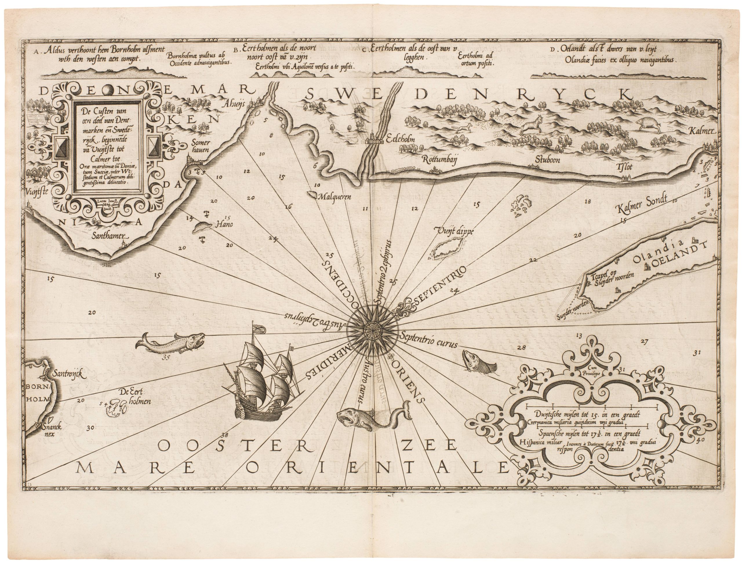
Slight toning and dust-soiling to the map, a bit of rubbing and wear along centerfold.
References