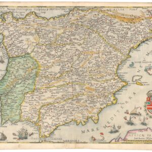
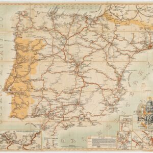
Attractive mid-17th century map of Portugal
Portugallia et Algarbia quae olim Lusitania
Out of stock
Description
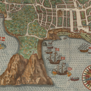
Interesting and attractive map of Portugal with west at the top, four sailing ships on the ocean along with a large figure of Neptune riding a sea monster, holding a trident and shield.
There are two coats-of-arms and two compass roses, and a large pictorial title cartouche featuring two men in what looks to be Ottoman dress using navigational instruments.
Verso Text: German
Cartographer(s):
Johannes Janssonius (1588 – 1664; born Jan Janszoon, also Jan Jansson) was a Dutch cartographer and publisher who lived and worked in Amsterdam in the 17th century. Janssonius was born in Arnhem, the son of Jan Janszoon the Elder, a publisher and bookseller. In 1612 he married Elisabeth de Hondt, the daughter of Jodocus Hondius. He produced his first maps in 1616 of France and Italy.
In the 1630s, Janssonius formed a partnership with his brother-in-law Henricus Hondius; they published atlases as Mercator/Hondius/Janssonius. Under the leadership of Janssonius, the Hondius Atlas was steadily enlarged. After Janssonius’s death, the publishing company was continued by his son-in-law, Johannes van Waesbergen. The London bookseller Moses Pitt attempted publication of the Atlas Major in English but ran out of resources after the fourth volume in 1683.
Condition Description
Text on verso slightly visible through the map; expert repairs in right margin and along centerfold, paper a little thin in places; very good.
References