Map
Showing all 19 results
-
River Pei-Ho From Gulf of Pe-Chili to Pekin
Admiralty Chart of the Hai River with manuscript additions suggesting use in the field during the Second Opium War.
Cartographer(s): Office of the British Admiralty HydrographicPlace/Date: London / 1857$2,200 Add to cart -
Europe [in Arabic]
Arabic-language WWII Rarity: a Lebanese map of Europe with Molotov–Ribbentrop Pact & Maginot Line.
Place/Date: Beirut / ca. 1939$1,700 Add to cart -
Occidentalior Tractus Indiarum Orientalium à Promontorio Bonae Spei ad C. Comorin
Stunning Renard sea chart of the Indian Ocean, with East Africa, Arabia, and southern India, from the Atlas de la Navigation.
Cartographer(s): Louis RenardPlace/Date: Amsterdam / 1715$1,400 Add to cart -
Carte des Découverts des Russes dans la Mer Orientale, et en Amerique Pour Servir à L’essai, Sur le commerce de Russie.
Between Bering & Cook: 1777 Croisey Map of Russian Discoveries in Alaska and the Bering Strait.
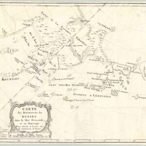
Cartographer(s): P. CroiseyPlace/Date: Paris / 1777$1,700 Add to cart -
Rand McNally Defense Map of the United States
Fascinating World War II era map of U.S. military bases and vital raw materials.
Cartographer(s): Rand, McNally & Co.Place/Date: Chicago / ca. 1941$650 Add to cart -
Map of the Spring Valley Water Works compiled from actual surveys
Bringing water from Calaveras Reservoir to Crystal Springs – Spring Valley Water Works pipe line map.
Cartographer(s): Rare Maps by Hermann SchüsslerPlace/Date: San Francisco / 1876$500 Add to cart -
General Map of the Surveys for the San Francisco Water Supply made under the direction of the Board of Supervisors…
Large, impressive San Francisco water supply system map.
Place/Date: San Francisco / 1875$600 Add to cart -
Terrae Yemen maxima Pars seu Imperii Imami, Principatus Kaukebân nec non ditionum Haschid u Bekil, Nehhm, Chaulan, Aleu Arisch et Aden Tabula
Original Copenhagen edition of Niebuhr’s map of Yemen, from the first scientific mission to Arabia.
Cartographer(s): Carsten NiebuhrPlace/Date: Copenhagen / 1771$900 Add to cart -
Map of the Great Salt Lake And Adjacent Country in the Territory Of Utah. Surveyed in 1849 and 1850…
“Scientific cartography of the Territory of Utah may be said to date from the appearance of this map.” – Wheat
Place/Date: New York / 1852$850 Add to cart -
L’Afrique Par le Sieur Du Val, Geographe Ord. du Roy
A separately-issued rarity of Africa by Pierre Duval.
Cartographer(s): Pierre du ValPlace/Date: Paris / ca. 1660$2,800 Add to cart -
1916 Election Precincts 28th Assembly District and Part of the 4th Congressional District City and County of San Francisco
1916 voting map of the Richmond District, with Sea Cliff, Lake St, and Presidio Terrace.
Cartographer(s): City and County of San FranciscoPlace/Date: San Francisco / 1916$475 Add to cart -
Map Of The State Of California. Compiled from the most recent surveys and explorations…
1860 map of California with a large bird’s-eye-view of post Gold Rush San Francisco.
Cartographer(s): VincentPlace/Date: Paris / 1860$3,800 Add to cart -
General Map of the Spring Valley Water Works Hermann F.A. Schussler Chief Engineer. 1899
A famous engineer’s plan for supplying water to San Francisco at the turn of the century.
Cartographer(s): Rare Maps by Hermann SchüsslerPlace/Date: San Francisco / 1889$700 Add to cart -
Les Isles Philippines Molucques et de la Sonde
Fine 1654 French map centered on the Philippines, and with Singapore.
Place/Date: Paris / 1654$875 Add to cart -
Constantinopoli
Incredible c. 1570 Duchetti Lafreri-school view of Constantinople.
Cartographer(s):Place/Date: Rome / ca. 1570$4,800 Add to cart -
Carte d’étude pour le tracé et le profil du canal de Nicaragua par M. Thomé de Gamond, ingénieur civil, précédée de documents publiés sur cette question par Félix Belly
Rare – the first serious and detailed published proposal for an interoceanic canal across Nicaragua, with a magnificent, chromolithographed map.
Place/Date: Paris / 1858$2,600 Add to cart -
Metsker’s map of Marin County California
Before the Richmond-San Rafael Bridge: a detailed post-WWII map of Marin County in attractive colors.
Cartographer(s): Charles F. MetskerPlace/Date: Tacoma / 1948$475 Add to cart -
Delineatio Nova Et Vera Partis Australis Novi Mexici
Scherer’s detailed map of Lower California and adjacent mainland, based on correspondence with Father Kino.
Cartographer(s): Heinrich SchererPlace/Date: Munich / 1703$975 Add to cart -
Carte des Trois Arabies. Tiree en Partie de l’Arabe de Nubie, en Partie de Divers autres Autheurs…
A particularly beautiful example of Sanson’s influential map of the “3 Arabias.”
Cartographer(s): Nicolas SansonPlace/Date: Paris / 1654$1,200 Add to cart
Archived
-
MapEasy’s Guidemap to San Francisco. A Location Map and Guidebook in one!
City travel on the eve of the world wide web: a detailed two-sided tourist map of San Francisco.
Cartographer(s): MapEasyPlace/Date: Amagansett, NY / 1993Read more -
Neueste Post-u. Eisenbahn Karte der Vereinigten Staaten von Nord-America.
Rare German pocket map with inset showing California gold fields and unusual boundaries.
Cartographer(s): Sigmund BeyerleinPlace/Date: Nürnberg / 1856Read more -
Map of Manila and Vicinity.
Map of Manila belonging to a commander of the anti-guerilla ‘Ilocano Scouts’!
Cartographer(s): AnonymousPlace/Date: Manila (?) / January 1905Read more -
Etats-Unis De L’Amerique Septentrionale Avec Les Isles Royale, De Terre Neuve, De St. Jean, L’Acadie &c.
State names that never were: post-Independence map of the U.S. with Jefferson’s 10 proposed states and early Michigan.
Place/Date: Paris / ca. 1785Read more -
Ganz neu aufgenommener und einzig richtiger Plander Hauptstadt Prag in Böhmen
The jewel of Bohemia: a rare town plan of Prague on the eve of Jüttner.
Cartographer(s): Franz HaasPlace/Date: Prague / ca. 1810Read more -
Nova Descriptio Geographica Tattariae Magnae Tam Orientalis Quam Occidentalis In Particularibus Et Generalibus Territoriis Una Cum Delineatione Totius Imperii Russici Imprimis Siberiae Accurate Ostensa.
A special issue of Strahlenberg’s masterpiece map of Imperial Russia and Siberia.
Place/Date: Paris / 1730Read more -
Ierusalem, et suburbia eius, sicut tempore Christi floruit…
Illustrating the last days of Jesus in Jerusalem: a magnificent 1588 plan of the city in the Second Temple Period.
Cartographer(s): Georg Braun & Franz HogenbergPlace/Date: Cologne / 1588Read more -
The “Graphic” Map of South-Central Africa Shewing the British and German Possessions
Interesting Victorian-era map of European colonies in sub-equatorial Africa.
Cartographer(s): The GraphicPlace/Date: London / 1890Read more -
“Vincere!”
The persuasive iconography of conflict: a double WWII theater of war Italian propaganda map.
Place/Date: Rome / 1943Read more -
A Map of the Marked Historical Sites of California. Compiled from the official registrations of the California State Department of Natural Resources
Large-format pictorial map of California documenting the state’s historical sites.
Place/Date: Not listed / 1952Read more -
Map of San Francisco, Points of Interest, A Birdseye View of the City by the Golden Gate
Excellent 1952 pictorial bird’s-eye-view of San Francisco.
Cartographer(s): Don BloodgoodPlace/Date: San Francisco / 1952Read more -
Cartes Blondel Planisphère Politique et Grandes Routes Aériennes
Tracking the expanding sector of post-war commercial aviation.
Cartographer(s): Blondel La RougeryPlace/Date: Paris / 1948Read more -
Souvenir Map of San Francisco Chinatown
Fine pictorial map of San Francisco Chinatown by a Chinese-American artist.
Place/Date: San Jose / ca. 1967Read more -
India int. Gangem merid., India ext. Gangem, Sinarum situs.
Locating Ptolemy on a contemporary map: 19th century map of India and Southeast Asia with classical references.
Cartographer(s): Christian Gottlieb ReichardPlace/Date: Nuremberg / 1827Read more -
Carte Générale des États-Unis, des Haut et Bas-Canada, de la Nouvelle Ecosse, du Nouveau Brunswick, de Terre-Neuve, etc.
Partie de la République du Texas – French map of the United States updated to include the Republic of Texas and the city of Austin.
Place/Date: Paris / 1843Read more -
Carte du Théatre de la Guerre actuel entre les Anglais et les Trieze Colonies Unies de l’Amerique Septentrionale dressée par J. B. Eliot Ingénieurs des Etats Unis 1778.
First map to name the United States and a contemporaneous illustration of the American Revolutionary War.
Cartographer(s): Louis-Joseph MondharePlace/Date: Paris / 1778Read more -
[Pridnestrovian Moldavian Republic]
The map of Transnistria you never knew you needed, a.k.a. the only map of Transnistria you’ll ever need.
Cartographer(s): UnknownPlace/Date: Transnistria / ca. 2010Read more -
Carte de l’Île de Madagascar d’après les documents les plus récents
Rare broadside detailing operations of the Franco-Hova War, with a map of Madagascar.
Cartographer(s): Lèon HayardPlace/Date: Paris / 1894Read more -
Map showing Territorial Growth of the City of Seattle to accompany the Annual Report of the City Engineer.
Superb color-printed map of Seattle focusing on the expansion of the city in the last quarter of the 19th century.
Cartographer(s): Albro GardnerPlace/Date: Seattle / December 1891Read more -
Map Showing The Rides of Paul Revere, Wm. Dawes and Dr. Prescott April 18-19, 1775
“The British are coming!” — Delightful pictorial map of the most famous horse ride in American history.
Place/Date: Boston / 1929Read more -
Main Logic Board Schematic (Apple II)
Original Apple II logic board schematic.
Cartographer(s): Apple Computer, Inc.Place/Date: Cupertino / ca. 1977Read more -
China. As seen from the direction of Guam.
Richard Edes Harrison bird’s-eye-view of China detailing its dramatic wartime inland shift.
Cartographer(s): Richard Edes HarrisonPlace/Date: New York / 1941Read more -
L’Amerique, Meridionale et Septentrionale Dressee selon les Dernieres Relations et Suivant les Nouvelles Decouvertes…
Finely-engraved small map of the Western Hemisphere featuring a prominent Island of California and three elaborate cartouches.
Cartographer(s): Nicholas de FerPlace/Date: Paris / 1700Read more -
The Best Little Whorehouses in Nevada
An uncommon map for a cultural underworld that was a tourist focus for drivers passing through the state.
Cartographer(s): AnonymousPlace/Date: Not listed / 1989Read more -
Sunkist Map of California
Scarce pictorial map of California highlighting one of the state’s great industries.
Cartographer(s): Cal RambeauPlace/Date: Los Angeles / 1940Read more -
Silicon Valley
A tongue-in-cheek map that is rooted in the work of Saul Steinberg’s famous “View of the World from 9th Avenue.”
Cartographer(s): Kirby ScudderPlace/Date: San Francisco / 1986Read more -
Seno de California, y su costa oriental nuevamente descubierta, y registrada desde el Cabo de las Virgenas, hasta su termino, que es el Rio Colorado ano 1747…
Consag’s seminal map of California, which conclusively ended the classic cartographic myth that California was an island.
Cartographer(s): Fernando ConsagPlace/Date: Madrid / 1757Read more -
A Pictorial Map of Palo Alto and the San Francisco Peninsula
1950s pictographic map and promotional pamphlet for Palo Alto, CA, the “University City.”
Cartographer(s): Palo Alto Chamber of CommercePlace/Date: Palo Alto / ca. 1950Read more -
Tourist Map of Kenya
Pictorial map of Kenya published in Nairobi shortly after independence.
Cartographer(s): Survey of KenyaPlace/Date: Nairobi / 1968Read more -
Sketch of the Route of Capt. Warner’s Exploring Party in the Sacramento Valley and Sierra Nevada. During the Months of August, September, and October, 1849
Map of the Sacramento Valley detailing an important California route and the demise of Captain William Warner.
Cartographer(s): R.S. WilliamsonPlace/Date: Washington, D.C. / 1850Read more -
A New Map Of The Kingdom of Poland with its Dismembered Provinces and the Kingdm. Of Prussia
A fine overview of the history of Poland’s boundaries in the second half of the 18th century.
Cartographer(s): Laurie & WhittlePlace/Date: London / 1794Read more -
Myths, Maps, and Men. Merrill Lynch Salutes the Year of the Moon
Iconic double hemisphere pictorial map of the moon — among the most desired Moon Landing commemorations ever created.
Cartographer(s): Michael RamusPlace/Date: New York / ca. 1969Read more -
1906 Britton & Rey’s Map of Greater San Francisco Showing Burned District
Unrecorded map of the destruction in San Francisco, published soon after the earthquake and fire.
Cartographer(s): Britton & ReyPlace/Date: San Francisco / 1906Read more -
Sana’a: Nortech Surveys (Yemen)
A large, separately-issued map of Sanaʽa, capital of the newly reunited Republic of Yemen.
Cartographer(s): The Survey AuthorityPlace/Date: Sana'a / 1992Read more -
The Kingdom of Saudi Arabia
Excellent map of the Arabian Peninsula with prominent Trans-Arabian Pipeline and desert watering points.
Cartographer(s): Arabian American Oil CompanyPlace/Date: Dhahran, Saudi Arabia / ca. 1973Read more -
Latest Pictorial Road Map of Delhi & New Delhi with the Boundary of N.D.M.C and CANTT. Showing existing petrol pump, cinema, newly set up colonies and gen information.
Large and colorful 1968 pictorial map of Delhi.
Cartographer(s): Ashoka PublicationsPlace/Date: Delhi / 1968Read more -
Lands In and Near San Rafael Marin County Cal. Owned by John W. Mackay and Jas. L. Flood. Formerly known as the Coleman Tract
A rarity of Marin County: 19th century San Rafael silver baron map.
Cartographer(s): Britton & ReyPlace/Date: San Francisco / ca. 1888Read more -
San Francisco Entrance
Attractive chart of the Bay Area with detailed mapping of San Francisco, the East Bay, and Marin County.
Cartographer(s): Office of the Coast SurveyPlace/Date: Washington, D.C. / 1940Read more -
Skeleton Map of the Union Pacific Railway
Decorative promotional railroad map of the Union Pacific Railway, with a topographic profile.
Place/Date: Buffalo, NY / 1886Read more -
State of California
The finest mid-19th century atlas map of the state of California.
Place/Date: Edinburgh / 1857Read more -
Map Showing Indian Reservations Within the Limits of the United States, Compiled Under the Direction of Hon. D.M. Browning. Commissioner of Indian Affairs, 1893
Map of Native American tribes and reservation land at the end of the 19th century.
Place/Date: Washington, D.C. / 1893Read more -
Map of the avenue leading to Golden Gate Park showing the proposed plan of improvement, together with that of the entrance to the park
Golden Gate Park takes shape: 1872 map of the Panhandle by William Hammond Hall.
Place/Date: San Francisco / 1872Read more -
Bancroft’s New Map of Central California Compiled by Wm. Henry Knight…
Handsome, separately-Issued California map with Virginia City and Comstock mining regions.
Place/Date: San Francisco / 1871Read more -
Map of San Francisco showing its uneven topography and the present and proposed main conduits reservoirs and pumping plants of the Spring Valley Water Co.
Mapping San Francisco’s famous hills – an unrecorded Spring Valley Water Co. topography map.
Cartographer(s): The Union Litho. Co.Place/Date: San Francisco / 1908Read more -
Map showing sources and lines of Water Supply proposed for the City of San Francisco 1877
Sustaining a growing city – detailed proposal map for supplying water to San Francisco.
Cartographer(s): Britton & ReyPlace/Date: San Francisco / 1877Read more -
Map of San Francisco, Showing the location of the different Distributing Reservoirs of The Spring Valley Water Works And the Districts supplied by each.
Where different San Francisco neighborhoods get their water – Spring Valley Water Works reservoir distribution map.
Cartographer(s): Britton & ReyPlace/Date: San Francisco / 1877Read more -
The United States and its new possessions: Puerto Rico, Cuba, Hawaii, Philippine Islands and Alaska, with general maps of Europe, Asia, Africa and Pan America
Rare document of the Age of Imperialism — post-Spanish-American War map of the United States.
Cartographer(s): National Publishing Co.Place/Date: Boston / 1899Read more -
Portugallia et Algarbia quae olim Lusitania
Attractive mid-17th century map of Portugal
Cartographer(s): Jan JanssoniusPlace/Date: Amsterdam / ca. 1645Read more -
Diefert Situs Orbis Hydrographorum Ab Eo Quem Ptolomeus Posuit…
16th century woodcut world map with mythical kings and beasts.
Cartographer(s): Laurent FriesPlace/Date: Vienne / 1541Read more -
[Title on Cover] America
Wonderful 1936 pictorial map of the United States.
Cartographer(s): Poole Bros.Place/Date: Chicago / 1936Read more -
Le Plan des Cinemas a Paris [and verso] Europe Movie Map
Two splendid pictorial maps in one – cinema locations in Paris and famous film locations in Europe
Cartographer(s): Yuki Miyazaki (Illustration); Eiga Houko (Publisher)Place/Date: Tokyo / ca. 1970Read more -
Mapa de America: Razas, Indumentaria, Banderas, Escudos Y Producciónes
Pictorial Interwar North & South America
Place/Date: Barcelona / ca. 1927Read more -
Karte von Palätina oder dem heiligen Lande nach ältern und den neuesten besten Quellen entworfen zum Studium der heiligen Schrift und zum Gebrauche für Schulen eingerichtet von Dr. Carl Beiling Director, Mitglied m . gel. Gesellschaften
Gorgeous and rare large-format map of the Holy Land with a plan of Jerusalem.
Cartographer(s): Carl BeilingPlace/Date: Munich / 1843Read more -
Map of the City of San Francisco with its additions, Showing Two of the Routes for the Introduction of Water by the Mountain Lake Water Company. As Surveyed By Henry S. Dexter C. E. December 1851
Extremely rare 1851 map illustrating San Francisco’s first water project.
Place/Date: New York / 1851Read more -
Tripoli citta di Barbaria
Rare Lafreri bird’s-eye-view of Tripoli depicting the expedition of King Philip II that never made it
Cartographer(s): Antonio LafreriPlace/Date: Rome / ca. 1559Read more -
View of Great Salt Lake City
Important early view of Salt Lake City, Utah.
Place/Date: Walla Walla (Washington Territory) / 1867Read more -
Map of the Battle Field of Gettysburg. July 1st, 2nd, 3rd
Bachelder’s authoritative three-part map of the Gettysburg battlefield.
Cartographer(s): John Badger BachelderPlace/Date: Boston / 1876Read more -
Totius Africae tabula, & descriptio universalis, etiam ultra Ptolemaei limites extensa.
Exceptional example of one of the earliest maps to focus on the entire continent of Africa
Cartographer(s): Sebastian MünsterPlace/Date: Basel / ca. 1554Read more -
La Nuova Francia
Extremely rare first edition of the first map devoted to New England.
Place/Date: Venice / 1556Read more -
Guide Map of Jerusalem Ancient and New
Pictorial map of Jerusalem with both ancient and modern sites
Cartographer(s): H. M. King & S. SpyridonPlace/Date: Jerusalem / ca. 1930Read more -
Colombia Prima or South America Drawn from the Large Map in Eight Sheets by Louis Stanislas D’Arcy Delarochette
Lovely mid-19th century map of South America.
Cartographer(s): James WyldPlace/Date: London / ca. 1854Read more -
Map Of San Francisco Showing The Water Service Of Spring Valley Water Works. Distributing Reservoirs, Districts Supplied By Each And Location Of Principal Distributing Mains, Contour Lines, Showing Elevation Above Water & Fire Department And Fire Patrol Buildings.
Important pre-1906 earthquake water system map of San Francisco
Cartographer(s): Britton & ReyPlace/Date: San Francisco / 1894Read more -
North Pacific
Striking sea chart of the northern Pacific Ocean with large inset of Hawaii and Pearl Harbor.
Cartographer(s): James Imray & SonPlace/Date: London / 1873Read more -
Lettres Edifiantes Et Curieuses, Ecrites Des Missions Estrangeres, par quelques Missionnaires de la Compagnie de Jesus. V. Recueil
First printed appearance of Father Kino’s influential map, along with Piccolo’s text on California missions.
Cartographer(s): Father Eusebio F. KinoPlace/Date: Paris / 1705Read more -
Marvelous Marin, Home of Muir Woods National Monument
Nice pictorial promotional map of Marin County.
Cartographer(s): Marin Tourism BureauPlace/Date: San Rafael / ca. 1960Read more -
Recettes des tramways de Paris des bateaux-omnibus et du chemin de ceinture et mouvements des voyageurs dans les gares de paris en 1880.
Gorgeous statistical graphic plan of Paris depicting passenger movements in the year 1880
Cartographer(s): Ministere des Travaux Publics; Imp. MonrocqPlace/Date: Paris / 1882Read more -
A General Map of the Post Roads of Europe wherein all the post stages with their distances are particularly expressed.
Rare first edition of Rocque’s spectacular map of the post roads of Europe in original colors
Cartographer(s): John RocquePlace/Date: London / 1758Read more -
Mappa geographiae naturalis sive tabella synoptica / inventa et adornata à Matth. Seuttero. S. Caes. Maj. geogr. Aug.
Unusual and fascinating look at mapmaking in the 18th century
Cartographer(s): Matthäus SeutterPlace/Date: Augsburg / 1730Read more -
Discovering California Through Books
Delightful literary-themed map of California
Cartographer(s): Schenkofsky-HeckingPlace/Date: Not listed / 1961Read more -
Ansight von San Francisco 1877.
1877 bird’s-eye-view of San Francisco with advertisements for German businesses.
Cartographer(s): Philo Jacoby's "California State Almanac"Place/Date: San Francisco / 1877Read more -
Brevis, Exactaq. Totius Novi Orbis, et Peruviae Regionis Descriptio, Recens Edita
Exciting map of the Americas filled with place names along the coastlines, an uncommon feature for this region in the mid-16th century
Cartographer(s): Jean BellèrePlace/Date: Antwerp / 1567Read more -
A Map of Canada and the North Part of Louisiana with the Adjacent Countrys
Remarkable 1762 coast-to-coast map of Canada, Upper Midwest & Plains.
Cartographer(s): Thomas JefferysPlace/Date: London / 1762Read more -
Carte Nouvelle du Mexique du Texas et d’une Partie des Etats Limitrophes
Brué’s landmark map of the West with the Republic of Texas — first use of ‘Texas’ in the title
Cartographer(s): Adrien-Hubert BruéPlace/Date: Paris / 1840Read more -
Map of Jordan. Holy Land
Pre-Six-Day War map of Jordan including Jerusalem, with vignettes of important monuments.
Cartographer(s): Tourism Bureau of the Hashemite Kingdom of JordanPlace/Date: Amman / 1961Read more -
Pictorial map of the United Arab Republic
1969 map of the short-lived United Arab Republic with pictorial vignettes.
Cartographer(s): K. Kamel; Ministry of Tourism in EgyptPlace/Date: Cairo / 1969Read more -
South America West Coast Sheet XIV Peru. Independencia Bay to Begueta Bay…
Chart surveyed by the H.M.S. Beagle (Darwin’s ship) with sextant pencil notations showing it was used at sea.
Cartographer(s): British AdmiraltyPlace/Date: London / 1840Read more -
Faust’s Map of the City and County of San Francisco, California
Gorgeous pre-1906 earthquake map of San Francisco.
Place/Date: San Francisco / 1900Read more -
A Map and History of Peiping; formerly known as Peking; capital of provinces, princedoms and kingdoms since 1121 B.C.; in 1264 A.D. the capital of the Mongol Empire of Kublai Khan; made the capital of the Ming Empire through the Ming and Ching Dynasties…
Iconic 1936 pictorial map of Beijing.
Cartographer(s): Frank DornPlace/Date: Tientsin-Peiping / 1936Read more -
A New & Accurate Map of the North Pole, with all the Countries hitherto Discovered…
Fine map of the North Pole and surrounding hemisphere on a polar projection.
Cartographer(s): Emanuel BowenPlace/Date: London / 1746Read more -
A New & Accurate Map of Persia with the adjacent Countries. Drawn from the most approved Modern Maps, &c.
Map of the Persian Empire, with parts of the Ottoman Empire
Cartographer(s): Emanuel BowenPlace/Date: London / 1747Read more -
San Francisco Water System
Fascinating 1995 pictorial poster map of the San Francisco water system
Cartographer(s): San Francisco Water WorksPlace/Date: San Francisco / 1995Read more -
A Map of Mackenzie’s Track from Fort Chipewyan to the Pacific Ocean in 1793
Mackenzie becomes the first European to reach the Pacific by land, 1793
Cartographer(s): Alexander MackenziePlace/Date: London / 1801Read more -
San Francisco Quadrangle (Topography)
Extensively detailed map of San Francisco and the East Bay
Cartographer(s): U.S. Geological SurveyPlace/Date: Washington, D.C. / 1913Read more -
General Map of the Panama Canal
Rare relief map booklet of the Panama Canal Zone
Cartographer(s): William M. Baxter, Jr.Place/Date: Boston / ca. 1915Read more -
Map of Beverly Hills California
1937 map of Beverly Hills – “Center of the Next Million”
Cartographer(s): Beverly Hills Chamber of Commerce and Beverly Hills Realty BoardPlace/Date: Los Angeles / 1937Read more -
Pony Express Route April 3, 1860 – October 24, 1861
Cool pictorial commemoration of the Pony Express centennial
Place/Date: New York / 1961Read more -
A New and Accurate Map of Chili, Terra Magellanica, Terra del Fuego &c. Laid down according to the latest improvements and regulated by astron.l observat.ns.
Hand-colored 1747 Bowen map with insets of Santiago and Tierra del Fuego
Cartographer(s): Emanuel BowenPlace/Date: London / 1747Read more -
Map of Upper California by the U.S. Ex. Ex. and Best Authorities
1841 pre-Fremont map of the West
Cartographer(s): Charles WilkesPlace/Date: Washington, D.C. / 1841Read more -
Map of the City & County of San Francisco
Fascinating 1927 wall map of San Francisco with new additions, including Golden Gate Heights and St. Mary’s Park.
Cartographer(s): H. A. CandrianPlace/Date: San Francisco / 1927Read more -
The California Herald
Important document of the California Gold Rush
Cartographer(s): James Gordon BennettPlace/Date: New York / 1Read more -
Les Isles Philippines Molucques et de la Sonde
1654 French map of the Philippines in original outline color
Place/Date: Paris / 1654Read more -
Aegyptus Antiqua
Stunning full color example of Ortelius’s two-sheet map of Egypt.
Cartographer(s): Abraham OrteliusPlace/Date: Antwerp / 1584Read more -
Rollandet’s Map of the City of Denver Colorado — Fourth Edition– February 1st, 1889
Rare 1889 map of Denver with vignettes of important buildings
Cartographer(s): Edward RollandetPlace/Date: Denver / 1889Read more -
A Map of America, between Latitudes 40 and 70 North, and Longitudes 45 and 180 West, Exhibiting Mackenzie’s Track from Montreal to Fort Chipewyan & from thence onto the North Sea in 1789, & to the West Pacific Ocean in 1793
Before Lewis & Clark: map of Mackenzie’s expedition across North America
Cartographer(s): Alexander MackenziePlace/Date: London / 1801Read more -
Gli Stati Uniti dell’America Delineati sulle ultime Osservazioni…
Cassini’s multi-sheet map of Colonial North America in original black and white
Cartographer(s): Giovanni Maria CassiniPlace/Date: Rome / 1797Read more -
Carte des Isles Philippines, Celebes et Moluques. Carte des Isles Philippines… 1re. Feuille Carte des Isles Philippines… 2e. Feuille.
Complete set of three maps of the Philippines from Bellin’s Le Petit Atlas Maritime
Cartographer(s): Jacques Nicolas BellinPlace/Date: Paris / 1764Read more -
Haec est nobilis florens illa Neapolis, Campaniae civitas…
Lovely hand-colored Renaissance view of Naples
Cartographer(s): Georg Braun & Franz HogenbergPlace/Date: Colonge / 1580Read more -
Partie de la Nouvelle France…
The “first printed information…on the geography of the region to the north and west of Lake Superior” (Kershaw)
Cartographer(s): Alexis Hubert JaillotPlace/Date: Paris / 1695Read more -
Nieuwe kaart van Arabia…
Detailed Tirion map of Arabia in excellent colors.
Cartographer(s): Isaak TirionPlace/Date: Amsterdam / ca. 1740Read more -
Nieuwe Gelijk Gradige of Platte Zekaart Van Het Noorder deel van Europa Vertoonende de Geheele Groenlandse En Moskovise Scheepvaard Waer in Elk de Miswijsinge Van het Compas selver moet Verbeeteren (repeated in French)
Spectacular and rare 1709 Van Keulen chart of the North Atlantic with erupting Hekla
Cartographer(s): Johannes & Gerard Van KeulenPlace/Date: Amsterdam / 1709Read more -
W. Rose’s Revised Chart of the Comstock Mines and Sutro Tunnel, State of Nevada
Map of the Comstock Mines and Sutro Tunnel – A remarkable image from the Nevada Silver Rush
Cartographer(s): W. RosePlace/Date: San Francisco / 1878Read more -
Deliniantur in hac Tabula, Orae Maritimae Abexiae, Freti Mecani; al Maris Rubri; Arabiae, Ormi, Persiae, Supra Sindam usq, Fluminis Indi, Cambriae India & Malabaris, Insulae, Ceylon
1596 Navigational chart of the Indian Ocean in spectacular full color.
Cartographer(s): Jan Huygen van LinschotenPlace/Date: Amsterdam / 1596Read more -
Plan du Golfe de Palerme et des Environs…
Detailed 1826 chart of Palermo with coastal views.
Cartographer(s): Adm. William Henry SmythPlace/Date: Paris / 1826Read more -
Point Reyes Quadrangle (19 x 15 mintues map)
1969 topographic map of West Marin
Cartographer(s): U.S. Geological SurveyPlace/Date: Washington, D.C. / 1969Read more -
Guide Map, the City and County of San Francisco
1915 map of San Francisco with a plan of the Panama Pacific International Exposition
Cartographer(s): W. Bashford SmithPlace/Date: San Francisco / 1915Read more -
Map of San Francisco, Points of Interest, A Birdseye View of the City by the Golden Gate
Rare 1952 pictorial map of San Francisco
Cartographer(s): Don BloodgoodPlace/Date: San Francisco / 1952Read more -
Islandia
1609 Ortelius extraordinary map of Iceland with Spanish text on verso
Cartographer(s): Abraham OrteliusPlace/Date: Antwerp / 1609Read more -
Carte du Canal des Iles Philippines Par lequel passe le Galion de Manille, et les Isles voisins de ce canal
Lovely mid-18th century Anson chart of the Philippines
Cartographer(s): George AnsonPlace/Date: Paris / ca. 1750Read more -
Chart of the World on Mercator’s Projection
Excellent 1871 world map with extensive detail, original Edward Stanford case
Cartographer(s): Hermann BerghausPlace/Date: Gotha / 1871Read more -
South Pacific
1869 Imray sea chart stretching from Papua New Guinea and eastern Australia to western South America
Cartographer(s): James Imray & SonPlace/Date: London / 1869Read more -
Ischia quae olim Aenaria
1590 old color Ortelius Island of Ischia
Cartographer(s): Abraham OrteliusPlace/Date: Antwerp / 1590Read more -
Railroad map of the United States, showing the through lines of communication from the Atlantic to the Pacific, together with the various steamship lines along the seaboard. Copyright 1886 by Wm. M. Bradley & Bro.
Detailed 19th century map of U.S. rail and steamship lines
Cartographer(s): Samuel Augustus Mitchell Jr.Place/Date: Philadelphia / 1886Read more -
Regiones Sub Polo Arctico
1644 W. Blaeu signature map of the Arctic
Cartographer(s): Willem BlaeuPlace/Date: Amsterdam / 1644Read more -
Tantum Distamus Ap Invicem
1703 Scherer map of the Pacific with California and Japan in mirror and California as an island
Cartographer(s): Heinrich SchererPlace/Date: Munich / 1703Read more -
Map of Western Palestine from surveys conducted for The Committee of the Palestine Exploration Fund. By Lieuts. C. R. Conder and H. H. Kitchener, R. E. Reduced from the one inch map in twenty six sheets. Special Edition Illustrating The Divisions of The Natural Drainage And the Mountain Ranges…
Large 1882 Special Edition of Kitchener & Conder’s famous Map of Western Palestine.
Cartographer(s): Claude R. Conder & Horatio KitchenerPlace/Date: London / 1882Read more -
City and County of San Francisco compiled from official surveys and sectioned in accordance with U.S. surveys
Rare 1861 first edition of Wackenreuder’s famous map of San Francisco.
Place/Date: San Francisco / 1861Read more -
A Pictorial Map of North America
Signed Ernest Dudley Chase 1945 pictorial map of North America
Cartographer(s): Ernest Chase DudleyPlace/Date: Winchester / 1945Read more -
Primae Partis Asiae accurata delineatio…
Rare 1593 de Jode map of the Black and Caspian Seas, with the eastern Mediterranean and a prominent Cyprus
Cartographer(s): Gerard & Cornelis de JodePlace/Date: Antwerp / 1593Read more -
Grondvlakte van Nieuw Orleans, de Hoofdstad van Louisiana [with] De Uitloop vande Rivier Missisippi [and] De Oostelyke ingang van de Missisippi met een Plan van het Fort
1740 plan of New Orleans and the Mississippi River Delta
Cartographer(s): Isaak TirionPlace/Date: Amsterdam / 1740Read more -
Road Map to Iran
Folding tourist map of Iran with photographic vignettes
Cartographer(s): Aziz HatamiPlace/Date: Tehran / ca. 1972Read more -
Hierosolymia, Clarissima totius Orientis civitas…
1582 town-plan of Jerusalem
Cartographer(s): Georg Braun & Franz HogenbergPlace/Date: Colonge / 1582Read more -
Sketch map of Italy with the Lines of Communication by Road, Rail, Sea, and Air
Interesting 1953 pictorial map of Italy
Cartographer(s): SalomonePlace/Date: Rome / 1953Read more -
Bird’s-eye-view of the Panama Canal
Bird’s-eye-view and map of the Panama Canal issued the first year after its opening
Cartographer(s): I.L. Maduro Jr.Place/Date: Panama / 1915Read more -
Nouvelle Carte Générale des Provinces Asiatiques de l’Empire Ottoman (sans l’Arabie) dressée par Henri Kiepert, Berlin 1883. Chemins De Fer d’après l’état de 1909.
Colossal 1909 map of the Ottoman Empire composed during the ‘New Great Game’and the lead-up to World War I
Cartographer(s): Heinrich KiepertPlace/Date: Berlin / 1909Read more -
Carte Touristique de la ville de Rio de Janeiro. La Capitale des Etats Unis du Brasil
1940 c. art-deco pictorial map of Rio de Janeiro
Cartographer(s): YpirngaPlace/Date: São Paulo / ca. 1940Read more -
Correct Map of the Railway & Steamship lines operated by the Southern Pacific Company…
A seemingly unrecorded special edition of the Southern Pacific Railway’s large-format promotional map, prepared especially for German-speaking immigrants, with a large side map of Texas
Cartographer(s): Poole Bros.Place/Date: Chicago / ca. 1885Read more -
Totius Europae Littora Novissime Edita. Pascaert Vertoonende alle de See-Custen van Europa
Splendid 1745 portolan-style sea chart based on De Wit
Cartographer(s): Reiner & Joshua OttensPlace/Date: Amsterdam / 1745Read more -
Additamentum IV. Theatri Orbis Terrarum
1590 Ortelius including Islandia, Maris Pacifici, and many more.
Cartographer(s): Abraham OrteliusPlace/Date: Antwerp / 1590Read more -
Carte du Duché de Bourgogne, Comtés et Pays adjacents dressée par Ordre de M.M.
1782 Gauthey wall map of Burgundy (Bourgogne) wine region in France.
Cartographer(s): Emiland Marie GautheyPlace/Date: Bourgogne / 1782Read more -
Report upon the San Francisco and Ocean Shore Railroad Company, California
1881 map of proposed San Francisco and Ocean Shore Railroad
Cartographer(s): E. Wells Sackett & RankinPlace/Date: New York / 1881Read more -
Indiae Orientalis, Insularumque Adiacentium Typus
1590 Ortelius map of Southeast Asia in original colors
Cartographer(s): Abraham OrteliusPlace/Date: Antwerp / 1590Read more -
Zee Custe van Sweeden Otrent de Westerwijk en Tgatt vann Stockholm Beginnende va Kalmar Tot sen Wigsteen en Rookoe Gelegen bijnnen Tgatt va Stockholm / Coste Marine de Suede a l’entour de Westerwijck & bouchede Stockholm…
Scarce sea chart of part of Sweden
Cartographer(s): Lucas Janszoon WaghenaerPlace/Date: Antwerp / 1584Read more -
Beschreibung des heiligen Landes Canaan
Decorative late 16th century woodcut map of the Holy Land
Cartographer(s): Heinrich BüntingPlace/Date: Leipzig / ca. 1590Read more -
Preliminary Chart of Entrance to San Francisco Bay California
Gold Rush era sea chart of San Francisco Bay
Cartographer(s): Office of the Coast SurveyPlace/Date: Washington, D.C. / 1856Read more -
A Pictorial Map of Palo Alto and the San Francisco Peninsula
Superb 1940s pictorial map with Stanford University
Cartographer(s): Palo Alto Chamber of CommercePlace/Date: Palo Alto / ca. 1940Read more -
Map of the University of California Sponsored by the California Club in Commemoration of the Golden Gate International Exposition
Splendid 1930s pictorial map of the University of California system
Cartographer(s): S. Lachman, LIPABAPlace/Date: San Francisco / 1939Read more -
Map of San Francisco, California
Late 19th century map of San Francisco with missing Marina street names
Cartographer(s): Matthews, Northrup & Co.Place/Date: New York / 1891Read more -
America Septentrionalis a Domino d’Anville in Galliis edita nunc in Anglia Coloniis in Interiorem Virginiam…
1777 Revolutionary War issue of Homann’s map of the United States
Cartographer(s): Homann HeirsPlace/Date: Nuremberg / 1777Read more -
Map of the lines of the Northwestern Pacific Railroad Company RMH
Attractive mid-1920s Northwestern Pacific Railroad map
Cartographer(s): Northwestern Pacific RailroadPlace/Date: San Francisco / ca. 1925Read more -
Carte De L’Egypte De La Nubie De L’Abissinie
Original Delisle example of this highly-detailed 1708 map of Egypt and Arabia.
Cartographer(s): The De L'Isle familyPlace/Date: Paris / 1708Read more -
Sicilia
Lovely 1594 map of Sicily with inset of King Phillip II
Cartographer(s): Matthias QuadPlace/Date: Colonge / 1594Read more -
Marin County California
Vivid c. 1954 Thomas Bros. map of Marin County
Place/Date: Oakland / ca. 1954Read more -
24 Miles round London
24 Miles round London with original color & case
Cartographer(s): George Frederick CruchleyPlace/Date: London / ca. 1839Read more -
Ride the roads to romance along the Golden Coast and thru the sunshine empire of Southern California
Roads to Romance pictorial map of Southern California
Cartographer(s): Roads to Romance AssociationPlace/Date: Los Angeles / 1952Read more -
Florence. Florence Ville d’Italie, capitale de Toscane…
Scarce and lovely mid-18th century bird’s-eye-view of Florence.
Cartographer(s): Jacques ChereauPlace/Date: Paris / ca. 1750Read more -
Il Texas, la ferrovia Nuova York-Texas-Messicana. Il Texas e la colonizzazione italiana della costa del Texas.
Rare Texas railroad pamphlet promoting Italian emmigration
Cartographer(s): Henman & SonsPlace/Date: London / 1881Read more -
Map of Santa Clara County showing topography, geography, post offices, school houses, county roads, etc. Compiled for the San Jose Board of Trade
Map of Santa Clara County with Bay Area inset
Cartographer(s): H.X. Van de CasteelePlace/Date: San Jose / 1887Read more -
Plano del Puerto Cabello en la Costa de Tierra Firme… [on sheet with] Plano de la Ensenada de Barcelona en la Costa de Tierra Firme… [on sheet with] Plano del fondeadero de la Guayra en la Provincia de Caracas…
Scarce 1818 chart of three Caribbean ports from the expedition of Fidalgo.
Place/Date: Madrid / 1818Read more -
Tab. II. Europae, Hispaniam ac Lusitaniam Complectens
Attractive mid-18th century map of the Iberian Peninsula
Cartographer(s): Gerard MercatorPlace/Date: Amsterdam / ca. 1730Read more -
Map of Sacramento, Sacramento County, California
Uncommon map of Sacramento
Cartographer(s): Raymond J. SquiresPlace/Date: Sacramento / 1909Read more -
Contour Map of the Lake Merced properties showing improvements
Rare 1917 Spring Valley Water Company contour map of area around Lake Merced
Cartographer(s): Spring Valley Water CompanyPlace/Date: San Francisco / 1917Read more -
Map of the Exterior Boundary of the Proposed Inverness-Municipal Water District, Inverness, Marin County, California
1948 town plan and property map of Inverness.
Cartographer(s): J. C. OglesbyPlace/Date: Not listed / 1948Read more -
Plat Showing Subdivision and Survey of Lots 2 and 3 in the Block L and M 25th and 26th Streets in the City of Sacramento, Cal. Sept. 7th 1892 C.M. Phinney, Surveyor
1892 manuscript plat of Sacramento blocks with official seal
Cartographer(s): C. M . PhinneyPlace/Date: Sacramento / 1892Read more -
Carte de la Californie Suivant I. la Carte Manuscrite de l’Amerique de Mathieu Neron Pecci…
Vaugondy’s essential 1772 presentation of California variants
Cartographer(s): Didier Robert de VaugondyPlace/Date: Paris / 1772Read more -
No. 3 Map of North America Engraved to Illustrate Mitchell’s School and Family Geography
Early edition of Mitchell & Young’s North America with Independent Texas
Place/Date: Philadelphia / 1839Read more -
Terra Sancta, sive Promissionis, olim Palestina Recens Delineata, et in Lucem Edita
1680 De Wit map of the Holy Land with Jerusalem
Cartographer(s): Frederick de WitPlace/Date: Amsterdam / 1680Read more -
Colton’s California and Nevada
1873 Colton California and Nevada with extended San Bernadino County
Cartographer(s): George Woolworth Colton and Charles B. ColtonPlace/Date: New York / 1873Read more -
[Title on Verso] Tabula Septima Asiae Complectitur Margianam, Bactrianam, Sogdianam, Sacas, & Scythiam, Intra Imaum Montem
1541 Ptolemaic map of Central Asia
Cartographer(s): Laurent FriesPlace/Date: Vienne / 1545Read more -
Carte de la Nouvelle France, ou se voit le Cours des Grandes Rivieres de S. Laurens & de Mississipi Aujour d’hui S. Louis, aux Environs des Quelles se Trouvent les Etats, Pais, Nations, Peuples &c…
Chatelain’s map of French possessions in the U.S. in full color
Cartographer(s): Henri Abraham ChatelainPlace/Date: Amsterdam / 1719Read more -
H. Benzos Scheep-togt uit Italie over Spanje na de Westindize Eylanden, en Kusten van’t Zuider America
1707 exploration map set in a decorative border
Cartographer(s): Pieter van der AaPlace/Date: Leiden / 1707Read more -
[Title on Verso] Tabula Duodecima Asiae Continet Taprobanam Insulam
1541 woodcut Ptolemaic map of Sri Lanka
Cartographer(s): Laurent FriesPlace/Date: Vienne / 1545Read more -
Golfe Arabique ou Mer Rouge…
18th century French chart of the Red Sea.
Cartographer(s): Jean Baptiste Bourguignon d'AnvillePlace/Date: Paris / 1765Read more -
[Title on Verso] Tabula IIII Aphricae
1535 Ptolemaic Africa with Prester John
Cartographer(s): Laurent FriesPlace/Date: Lyon / 1535Read more -
No. 15 Map of Oregon and Upper California
1846 school atlas map of Oregon and Upper California
Cartographer(s): Samuel Augustus MitchellPlace/Date: Philadelphia / 1846Read more -
Delineatio Syracusarum Antiquarium Quadriurbium
Rare 1725 bird’s-eye-view of ancient Syracuse, Sicily
Cartographer(s): Pieter van der AaPlace/Date: Amsterdam / ca. 1725Read more -
Le Plan de Paris, ses Faubourgs et ses Environs / Platte Grond van Parys, zyn Voorburgen en Omleggende Plaatse
Stunning hand-colored 1730 map of Paris
Place/Date: Amsterdam / ca. 1730Read more -
The British Governments in Nth. America Laid Down Agreeable to the Proclamation of Octr. 7. 1763
Map of boundaries following the French and Indian War, with Bermuda inset
Cartographer(s): John GibsonPlace/Date: London / 1763Read more -
Britannischen Insula
1570 woodcut Ptolemaic map of the British Isles
Cartographer(s): Sebastian MünsterPlace/Date: Basel / 1570Read more -
Legionis, Biscaiae et Guipiscoae Typus
Old color 1630 Mercator & Hondius map of the Basque region
Place/Date: Amsterdam / 1630Read more -
Maris Pacifici
Stunning 1595 example of Ortelius’ landmark map of the Pacific Ocean.
Cartographer(s): Abraham OrteliusPlace/Date: Antwerp / 1595Read more -
Plano de la Ciudad de Santiago de Chile
Nineteenth century town plan of Santiago, Chile.
Cartographer(s): Carlos BrandtPlace/Date: Santiago / ca. 1878Read more -
Ins. Ceilan que incolis Tenarisin dictur
Mercator & Hondius’s striking 1609 map of Ceylon
Place/Date: Amsterdam / 1609Read more -
Peru, Chili and La Plata
Thomson’s detailed 1821 map of Peru, Chile, and Argentina
Cartographer(s): John ThompsonPlace/Date: Edinburgh / 1821Read more -
Seu Graecia Universa Autore J. Laurenbergio
1680 map of Greece with an elaborate cartouche and fine detail
Cartographer(s): Nicolas VisscherPlace/Date: Amsterdam / 1680Read more -
Carte de la Manche
1710 sea chart of the English Channel including Dunkirk and Mont Saint Michel
Place/Date: Amsterdam / 1710Read more -
Italia mit dreien fürnemsten Inseln / Corsika / Sardinia und Sicilia
1600 Münster woodblock map of Italy from Sicily to the Alps
Cartographer(s): Sebastian MünsterPlace/Date: Basel / 1600Read more -
Madagascar
French pictorial map of Madagascar
Cartographer(s): JylbertPlace/Date: Paris / 1943Read more