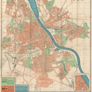
Sightseeing and occupying: a tourist map of Occupied Paris issued to German Soldiers during WWII.
Pariser Plan: das Geschichtliche und Kunsthistorische Paris
Out of stock
Description
Even in the long historical association between warfare and cartography, this map stands out. It is a tourist map of Paris, distributed by the city’s Axis military governor during World War II. Published in October 1940, the map was designed for German troops on leave during the occupation.
Authors Tim Bryars and Tom Harper feature the map in their book, A History of the Twentieth Century in 100 Maps, suggesting that while no sites associated with the occupation are marked, the Germanic Gothic script of the title and key are “a sufficient statement of control.” The sites are depicted pictorially and numbered to correspond with the key. One of the most interesting monuments is a memorial to a French military victory over Prussia. Bryars and Harper note the sense of pride that must have been felt by German troops visiting this monument, now from a position of triumph: “The defeats of the past had been expunged by the decisive victory in the present.”
Rather than a map related to a specific military action, this is a war map of a different type. Its benign appearance masks the background of its genesis. During the Occupation, the French Government moved to Vichy, and Germany’s Third Reich flag flew over all the French government buildings. During the autumn of 1940, as this map was being published, Paris was beginning to see the first crackdowns on its citizens, including anti-Semitic edicts and roundups of French communists.
Why is this map so rare?
With only one institutional holding listed on OCLC Worldcat and no other offerings on the market, this map appears to be quite rare. If you think about it, this scarcity makes sense: as German control of Paris broke down ahead of the Allied landing at Normandy, German troops had bigger things to worry about than saving a tourist map. And any Parisian who found the map was more likely to destroy it than keep it.
Thus, we are lucky to have found this small piece of the story of World War II.
Cartographer(s):
Condition Description
Very good.
References
OCLC Number: 809144810 -- only one institutional record found, at the Sächsische Landesbibliothek - Staats- und Universitätsbibliothek Dresden. Bryars & Harper, A History of the Twentieth Century in 100 Maps, University of Chicago Press, 2014. SLATE (https://slate.com/human-interest/2015/02/history-of-the-occupation-of-paris-map-issued-to-german-soldiers-on-leave.html)


![[Persuasive Cartography] Ubootswirkung im Mittelmeer.](https://neatlinemaps.com/wp-content/uploads/2024/05/NL-01997_thumbnail-300x300.jpg)
