The End of the Great Game.
Carl Flemmings generalkarten No. 44 – Afghanistan und seine Nachbarländer.
Out of stock
Description
An interesting large-format German folding map of Afghanistan, published c. 1910 by the map publishing house of Carl Flemming. It provides thorough information on the topography, infrastructure, and landscapes of Afghanistan and nearby territories.
Judging by their borders, one would think these were independent and fully sovereign states, but in reality they were all under some degree of either British or Russian control, with exceptions in remote desert or mountainous regions and the portions of ‘Chinese East Turkestan’ at right.
Even the Afghans, who had dealt the British a stinging defeat in the First Anglo-Afghan War (1839-1842), had to accept British influence and control of their foreign affairs following the Second Anglo-Afghan War (1878-1880). Although the Russians and British had vied for influence in the region for several decades, by the time this map was made the ‘Great Game’ of imperial competition had mostly run its course.
Cartographer(s):
Carl Flemming was a German map publisher active in the late 19th and early 20th centuries.
Condition Description
Some wear on attached cover.
References
Related products
-
-
Add to cart
- Asia, Pictorial maps
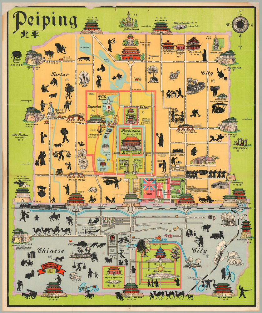
Peiping
- $1,250
-
-
-