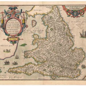
A Set of Four: Münster’s maps of Sicily and Sardinia, and views of Naples and Cagliari.
Beschreibung de Inseln und desz gantzen Künigreichs Sicilie / Sardinia Insula / Calaris die Hauptstatt in Sardinia / Neapolis.
$500
1 in stock
Description
This set consists of four single-page maps from Sebastian Münster’s Cosmographia Universalis. Presented together, they represent some of the earliest modern maps dedicated to the islands of Sicily and Sardinia and city views of Naples and Cagliari. All four maps originate from the same edition and volume, published in 1567 by Heinrich Petri in Basel. These maps reflect Münster’s unique style, blending geographical accuracy with aesthetic elements characteristic of 16th-century cartography.
Sicily
This woodblock map of the Kingdom of Sicily is an evocative early depiction of the island. Drawn in Münster’s distinctive style, it skillfully combines geographical accuracy with artistic embellishments. The map captures Sicily, extending from Calabria and the southern tip of Italy in the north to the coast of North Africa, including Carthage and Sousse, in the south.
Sicily’s topography is well represented, with its mountain ranges depicted in vignette form. Mount Etna, the island’s most famous volcano, is prominently illustrated in an active state. Key cities, including Palermo, Agrigento, Syracuse, and Catania, are labeled, while four rivers flowing from the mountains to the sea highlight Sicily’s fertility and agricultural productivity.
One of the most striking visual elements is the large vignette of a ship at the bottom. This maritime scene underscores Sicily’s role as a naval hub in the Mediterranean.
Naples
Münster’s Neapolis offers a bird’s-eye view of one of Europe’s most influential cities at the time. Seen from the Bay of Naples, the city’s fortifications, churches, and bustling port illustrate its status as a major economic and cultural center. During the 16th century, Naples was under Spanish rule, and its urban expansion reflected both medieval and Renaissance influences.
The map highlights the city’s strategic coastal location, its fortresses, and natural barriers that shaped its defensive structure. Naples was one of the largest cities in Europe at the time, and this map provides an early visual representation of its urban grandeur.
Sardinia
Münster’s map of Sardinia is one of the earliest detailed cartographic depictions of the island, solidifying his reputation as a pioneer of 16th-century mapmaking. This hand-colored woodcut focuses on Sardinia, while also depicting the southern part of Corsica, including the notable town of Bonifacio.
The map vividly conveys the island’s rugged terrain, using vignette illustrations of mountains, rivers, and towns. Major cities such as Cagliari, Oristano, Bosa, Alghero, and Sassari are represented pictorially as clusters of buildings. On the northwestern coast, Castru Aragonen (modern Castelsardo) is prominently labeled, underscoring its historical importance as a Genoese fortress later controlled by the Crown of Aragon.
The title banner on the map, a hallmark of Münster’s cartographic style, enhances both its visual appeal and readability.
Cagliari
Münster’s Cagliari offers a rare and detailed 16th-century city plan of Sardinia’s capital. Enclosed within its fortified walls, the city’s layout is meticulously illustrated, emphasizing architectural and defensive structures.
This map belongs to an early category of city maps, with a lettered key identifying important buildings corresponding to descriptions in the main text. Wide streets, ancient buildings, and the city’s port are clearly depicted. The harbor, a vital hub for trade and maritime activity, is animated with two anchored ships. Beyond the city walls, open fields and parish churches provide insight into the surrounding landscape.
Publication information
These maps originate from Sebastian Münster’s Cosmographia Universalis, first published in 1544 and reissued multiple times until 1628. The maps of Sicily, Naples, Sardinia, and Cagliari were first introduced around 1550 and remained a fixture in all subsequent editions.
The Cosmographia succeeded Münster’s earlier Geographia. Unlike the Latin-only Geographia, the Cosmographia was printed in German, Latin, French, and Italian, broadening its accessibility across Europe.
Cartographer(s):
Sebastian Münster (1488-1552) was a cosmographer and professor of Hebrew who taught at Tübingen, Heidelberg, and Basel. He settled in Basel in 1529 and died there, of the plague, in 1552. Münster was a networking specialist and stood at the center of a large network of scholars from whom he obtained geographic descriptions, maps, and directions.
As a young man, Münster joined the Franciscan order, in which he became a priest. He studied geography at Tübingen, graduating in 1518. Shortly thereafter, he moved to Basel for the first time, where he published a Hebrew grammar, one of the first books in Hebrew published in Germany. In 1521, Münster moved to Heidelberg, where he continued to publish Hebrew texts and the first German books in Aramaic. After converting to Protestantism in 1529, he took over the chair of Hebrew at Basel, where he published his main Hebrew work, a two-volume Old Testament with a Latin translation.
Münster published his first known map, a map of Germany, in 1525. Three years later, he released a treatise on sundials. But it would not be until 1540 that he published his first cartographic tour de force: the Geographia universalis vetus et nova, an updated edition of Ptolemy’s Geography. In addition to the Ptolemaic maps, Münster added 21 modern maps. Among Münster’s innovations was the inclusion of map for each continent, a concept that would influence Abraham Ortelius and other early atlas makers in the decades to come. The Geographia was reprinted in 1542, 1545, and 1552.
Münster’s masterpiece was nevertheless his Cosmographia universalis. First published in 1544, the book was reissued in at least 35 editions by 1628. It was the first German-language description of the world and contained 471 woodcuts and 26 maps over six volumes. The Cosmographia was widely used in the sixteenth and seventeenth centuries and many of its maps were adopted and modified over time, making Münster an influential cornerstone of geographical thought for generations.
Condition Description
Hand color. Visible repairs, as seen on the image. Overall nice.
References
Related products
-
-
Add to cart


- Europe, Italy
A Topographical Map of the Republick of Genoua, Taken from the Celebrated Map by Chaffrion…1764 / To the Right Honourable James Steward Mackenzie, Lord Privy Seal of Scotland, One of His Majesty’s most Honourable Privy Council, and Late His Majesty’s Envoy Extraordinary and Plenipoteniary to the King Of Sardina. This Map is most Humbly Inscribed…
- $4,400
-
-
-

![Delimitation de la Zone Occupee [German Occupation of France]](https://neatlinemaps.com/wp-content/uploads/2019/12/NL-00782-scaled-300x300.jpg)
![Delimitation de la Zone Occupee [German Occupation of France]](https://neatlinemaps.com/wp-content/uploads/2019/12/NL-00782-scaled.jpg)