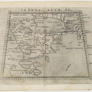
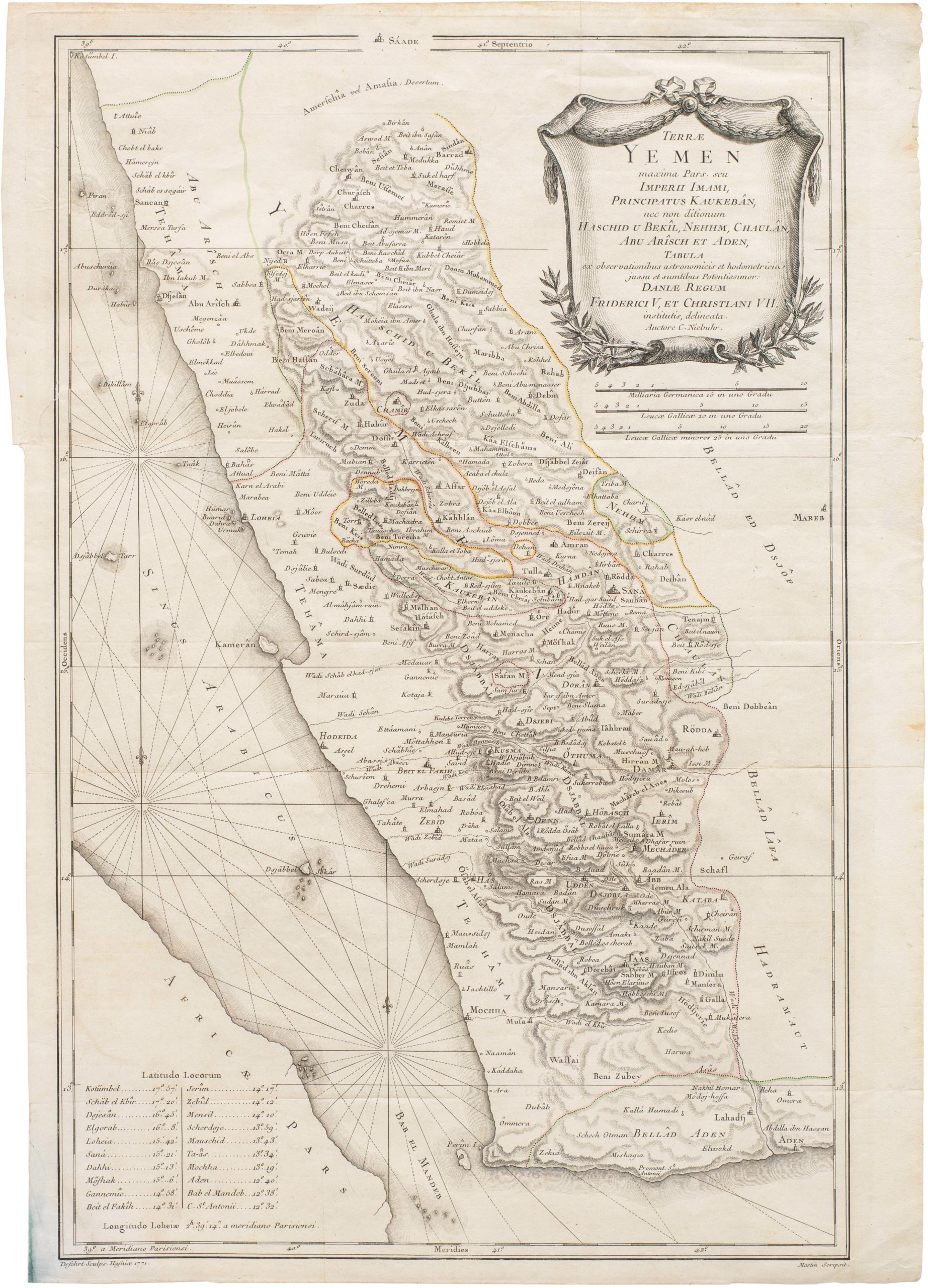
Beautiful 1535 Ptolemaic woodcut map of Arabia.
Tabula VI Asiae [Arabia]
Out of stock
Description
Hand colored example of the sixth map in Laurent Fries’s edition of the Geographia of Claudius Ptolemy, comprising the Arabian Peninsula bordered by Red Sea (labeled the ‘Arab Sea’), Persian Gulf, and Indian Ocean. Detail is also given for part of the Persian coast, labeled Carmania, the ancient designation for the Achaemenid/Sassanid province corresponding roughly to modern-day Kermaan province in Iran.
The Arabian Peninsula covers more than 1 million square miles and is comprised of the modern states of Saudi Arabia, Bahrain, Kuwait, Oman, Qatar, the United Arab Emirates, and Yemen. It is one of the largest regions in the world with no navigable rivers, a circumstance that made exploring and mapping its interior a difficult endeavor. The first map of the Arabian peninsula to be printed in Europe was in the 1477 edition of Ptolemy. Tibbetts notes that, like other early Greeks, Ptolemy exaggerated the length of Eurasia to the east. The distance between the Red Sea and Persia was too big and thus Arabia was stretched to fill the gap, especially because Ptolemy knew the entrance to the Red Sea was very narrow; thus he had to make the shape fit.
By Ptolemy’s time, Greek sailors had sailed around the Arabian coast and were familiar with port towns. However, its interior remains largely unmapped until the 20th century. The northern part of the peninsula tended to be mapped more accurately because it was closer to populated lands and more frequently traveled, but the interior of Ptolemaic maps are almost completely fanciful, including the mountain ranges, river systems, and lakes. The cartographic errors are probably a mix of depicting stories told to sailors about what lies inland and the desire to fill space common in pre-18th century cartography.
The map image is bordered by degree blocks, with notes in the margins. The Tropic of Cancer runs across the map in roughly the correct position. Towns are plotted in red dots, with names in black; regions are designated in black Gothic script. Both mountain ranges and coast lines are shaded to add depth to the topography.
Verso Text: Latin with woodcut ornamental pillars.
Cartographer(s):
Laurent/Lorenz Fries (ca. 1485-1532) was born in Alsace circa 1490 and studied medicine and mathematics at a number of European universities. He was trained as a physician but was also keenly interested in cartography and medical publications. From 1518-19 Fries is mainly based in Strasbourg, where he was commissioned to compile the first edition of Waldseemüller’s atlas after his death in 1520.
Condition Description
A bit of darkening along centerfold, light stain in the Indian Ocean; very good, an attractive map.
References
Tibbetts, G. R. Arabia in Early Maps. Ney York, NY: Oleander Maps, 1978.