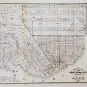
Large and attractive 1938 Thomas Brothers map of San Francisco.
Thomas Bros Map of the City and County of San Francisco.
Out of stock
Description
This is a c. 1938 Thomas Bros. large-format indexed map of San Francisco, California, published soon after the completion of the Golden Gate Bridge. The combination of lovely hand watercolor and its large format gives the map an impressive presence that would look great on display in any home.
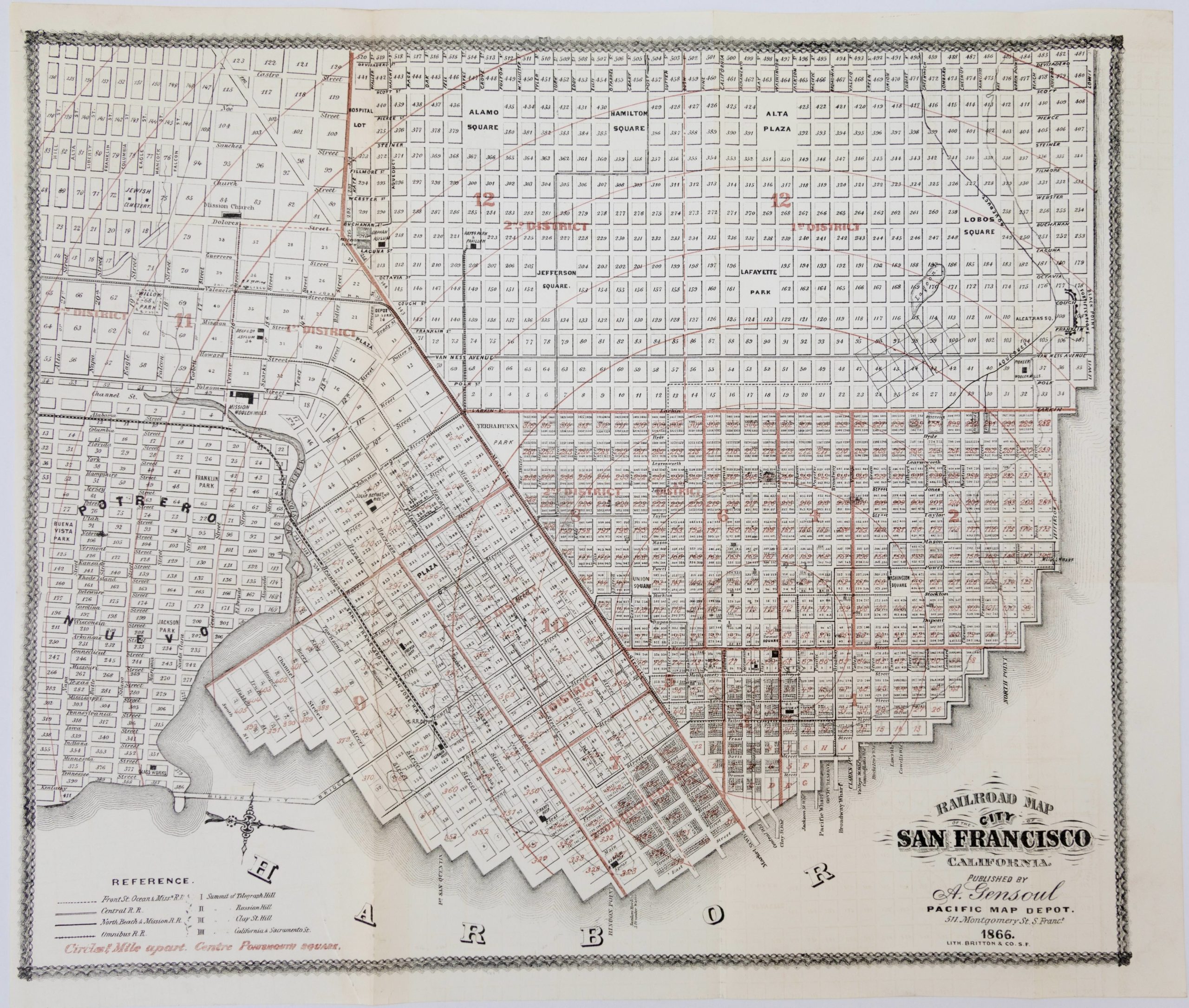
The completion of the Golden Gate and San Francisco-Oakland Bay Bridges signaled an important transformation in which the city achieved something akin to its modern configuration. In the preceding decades, large tracts of land in the southern and western parts of the city were considered for and put to various uses, but mostly ended up as housing for the city’s growing population. An exception is (John) McLaren Park, only behind Golden Gate Park and the Presidio in terms of size and the largest managed by the city, which was dedicated as parkland in the late 1920s after many years of debate and indecision as to the proper use of the lands therein. In fact, the continued uncertainty over the park’s use is evident here, with ghosted in (and eventually never-built) residential streets covering most of the park’s land. In contrast, the area south of Sloat Blvd. near Lake Merced, seen as greenspace here, would eventually be dedicated to housing, associated development, and San Francisco State University.
The map is filled with fascinating details related to the history of San Francisco. We see, for example, Laurel Hill and Calvary Cemeteries on Lone Mountain, this being before all burials were transferred south to the town of Colma. The area today is taken up by housing and the campus of the University of San Francisco (here as ‘S.F. College’), and all that remains of the former cemeteries is the Columbarium, a mausoleum on Lorraine Ct. just north of Rossi Park. Further west, Sutro Baths, Sutro Heights, and Fort Miley in Lincoln Park are all shown. On the opposite side of the city, Dogpatch and Bayview are depicted as the wide-open industrial and military zones – much of this industrial infrastructure would be dedicated to the war effort soon afterwards. The ‘S.F. Baseball Club’ at 16th St. between Bryant and Potrero was a stadium opened in 1931 as the home of the Pacific League San Francisco Seals and the short-lived Mission Reds. When the Giants moved to San Francisco in 1958, the stadium briefly served as their home field while Candlestick Park was being built.
This map was produced by the local map publishing firm Thomas Bros. It is undated, but is consistent with a date in the late 1930s. The OCLC notes one example of a map with this exact title (an ampersand instead of the word ‘and’ written out) and dimensions, held by the Newberry Library dated to c. 1940.
Cartographer(s):
Thomas Bros. Maps, the publishers of the Thomas Guide, previously known as Popular Street Atlas, Street Guide, and Popular Atlas, was started in Oakland, California, in 1915 by cartographer George Coupland Thomas and his two brothers, who were business partners. Early publications were detailed block maps, bird eye view of communities, road & highway maps, and what would be generally referred as generalized tourist maps.
Condition Description
Very good. Backed on archival tissue for stability.
References