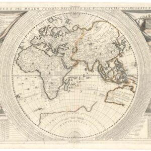
16th century woodcut world map with unexplained Australian landmass.
Die Eigentliche und Warhafftige Gestalt der Erden und des Meers. Cosmographia Universalis
Out of stock
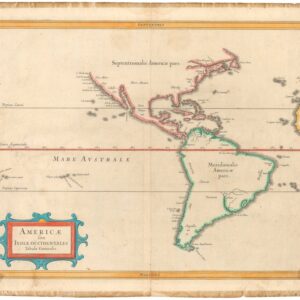
Description
Woodcut world map with several notable features. Most interestingly, in the right hand corner the mapmaker has shown a landmass labeled India Meridionalis, which is remarkably similar to the west coast of Australia and in the correct relative position. The history behind the European discovery of Australia is shrouded in doubt, and this map may be part of the story, perhaps and indication of earlier than accepted Portuguese knowledge of the island continent.
In Europe one can detect a hint of Bunting’s famous depiction of the continent as a queen. Africa presents a clear conception of a Ptolemaic Nile, along with the Mountains of the Moon. In the left hand corner we see an emerging America.
Cartographer(s):
Henrich Bünting was a Protestant theologian and teacher from Hannover who is most renowned for his influential work on Biblical geography. His Itinerarium Sacrae Scripturae, first published in 1581, became very popular due to its comprehensive summary of Biblical geography through travel narratives and commentary. The book contained Bünting’s own unique woodcut maps, including imaginative representations of the continents as a Clover Leaf, Europe personified as a crowned woman, and Asia depicted as the winged horse Pegasus.
With over sixty editions published between 1581 and 1757, Heinrich Bünting’s Itinerarium Sacrae Scripturae remains a significant contribution to the history of Biblical geography.
Condition Description
Standard paper toning and show-through from the verso, frayed edges.
References
Shirley, Rodney W. The Mapping of the World: Early Printed World Maps, 1472-1700. London: Holland Press, 1983, #142.